Nýidalur Huts and Campground in Vatnajökull National Park

Campground · Vatnajökull National Park

Nýidalur Huts and Campground

A basic highland base for the central crossing and Vonarskarð trail.

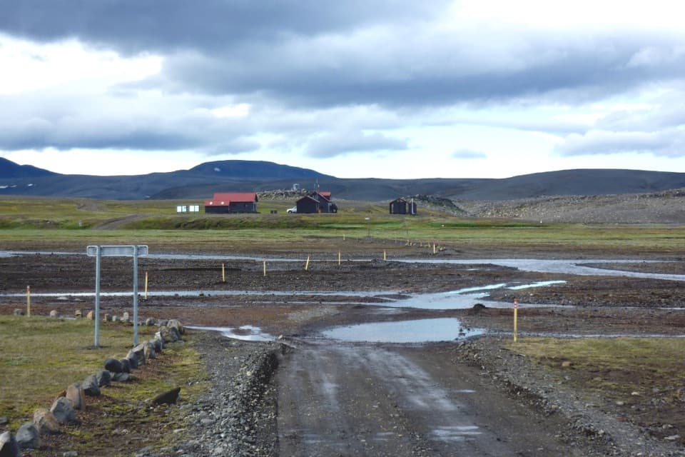
Photo: Gummao, CC BY-SA 3.0, via Wikimedia Commons; unchanged source photograph

Type
Campground
Nearest trail
0.8 km
Audio stories
3 nearby
  • Lodging
  • Restrooms

Hear the audio tour

Nýidalur: A Highland Break
Download Parkwolf on the App StoreGet Parkwolf on Google Play

4.7 from 8,600+ ratings

Overview

About Nýidalur Huts and Campground

Why stop

  • An easy valley loop and a much longer highland hike start from the same base.

Heads up

  • The campground is exposed, and strong winds are common.

Map

Where it is

Loading the Vatnajökull map
Full map
CampgroundNýidalur Huts and Campground64.73505, -18.07294
Keep this map with you offline in the Parkwolf app

Plan your stop

Before you go

Getting there and staying

F26 is a highland road for 4x4 vehicles, and it opens only when snow and road conditions allow. The huts are usually open from early July into early September, but the dates shift with the road opening. In winter the huts are locked unless arranged ahead, and travel here is for experienced, properly equipped highland travelers. Check road status before setting out; an open hut season does not guarantee that every route or river crossing is passable.

The campground is close to a separate building with toilets and showers. Showers are paid. The huts have bunk rooms, sleeping lofts and equipped kitchens, but check what indoor facilities are included if you are camping; visitors have reported that campground stays did not automatically include use of the hut common areas. The camping area is exposed, and visitors repeatedly mention strong wind, so this is a tough place to rely on a tent in unsettled weather.

A park ranger sits on a dash-mounted phone, talking, as Parkwolf’s Tour Guide plays “Army Cutworm Moths: A Grizzly Bear Buffet” on Grand Loop Road below Dunraven Pass in Yellowstone
Parkwolf Tour GuideThe highest, rockiest slopes around here are a summer buffet for grizzly bears.

Vatnajökull Tour Guide

Your drive to Nýidalur Huts and Campground, narrated.

Parkwolf is a GPS audio tour guide for Vatnajökull National Park. As you drive, it chimes in with what’s ahead: hidden gems, upcoming stops, history, geology, and wildlife, right through your car’s speakers.

Recorded for this place

Nýidalur: A Highland Break
0:00 / 0:31
“You're coming up on Nýidalur, a pair of mountain huts and a campground beside the Sprengisandur crossing.”

Plays as you drive up to Nýidalur Huts and Campground in the Parkwolf Vatnajökull Tour Guide.

More stories near here in the app

  • Snow Sculpted by the Wind
  • Where the Rivers Part Ways
  • Tómasarhagi: The Háhyrna Summit Hike
  • The Plant That Changes the Ground
  • 298 audio storiesacross Vatnajökull’s roads, triggered by GPS as you drive
  • Wildlife heatmapsfor Grey Seal, Harbor Seal, Caribou, and 13 more
  • Works offlinemaps, 92 trails, 75 places, and audio download before you lose signal
  • CarPlay readysimple controls built for the drive
★★★★★
“Fantastic app with many points of information… It’s great to just turn on while you’re driving and it gives you an audio tour of the national Park. We love it!!!!”
JMJamesApp Store review
Download Parkwolf on the App StoreGet Parkwolf on Google Play

4.7 from 8,600+ ratings

Guide

More about Nýidalur Huts and Campground

A highland base on SprengisandurNýidalur is a pair of mountain huts and an adjacent campground at the mouth of Nýidalur valley,…

Nýidalur is a pair of mountain huts and an adjacent campground at the mouth of Nýidalur valley, about 830 metres above sea level beside Sprengisandsleið (F26). It is a useful overnight stop on the long central-highlands crossing, and a good base if you want to walk beyond the road. Expect a remote mountain stop with simple facilities, not a full-service campground.

A short loop or a demanding dayThe easy Nýidalur circle is about 3 kilometres and takes around an hour, crossing alpine…

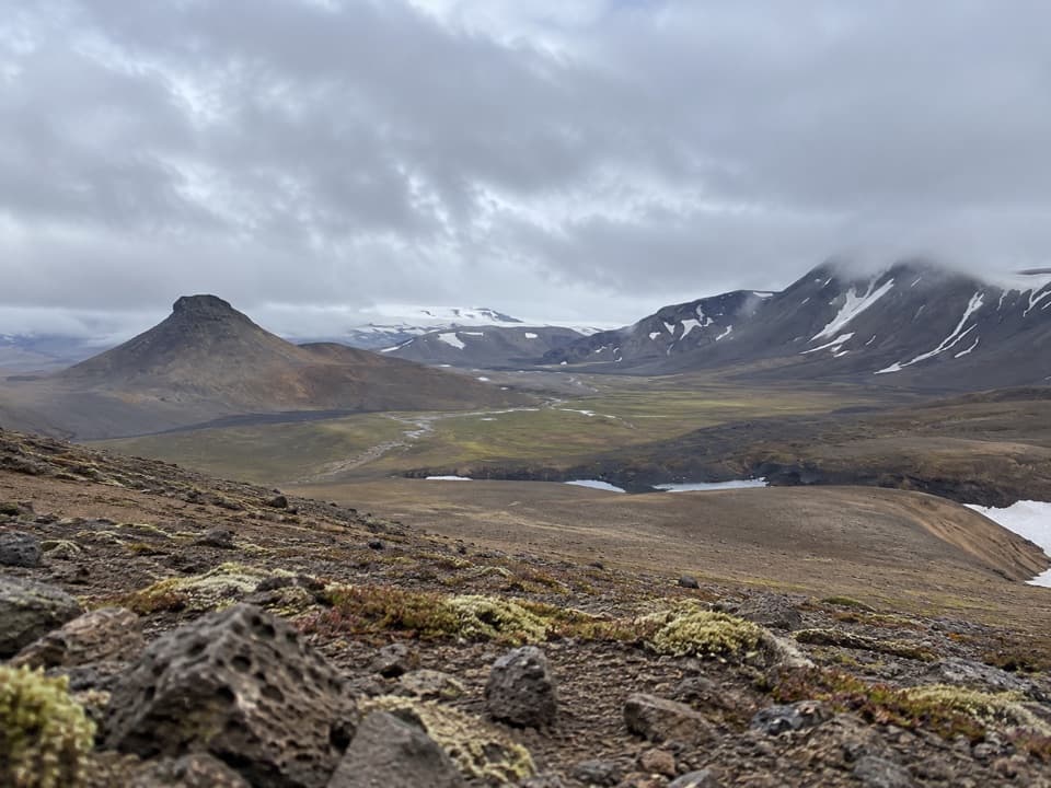
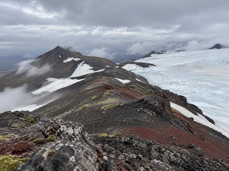
The easy Nýidalur circle is about 3 kilometres and takes around an hour, crossing alpine vegetation near the huts. For a much bigger outing, the challenging route toward Vonarskarð is about 26 kilometres and takes 6 to 10 hours. It follows Mjóháls ridge, where the view opens back over Nýidalur toward Tungnafellsjökull, then continues toward Hverahlíð's geothermal area. Choose the short loop for a quick taste of the valley; the longer route is a serious full-day hike.

A stop on the old highland crossingThe first hut was built here in 1967 on the route across Sprengisandur.

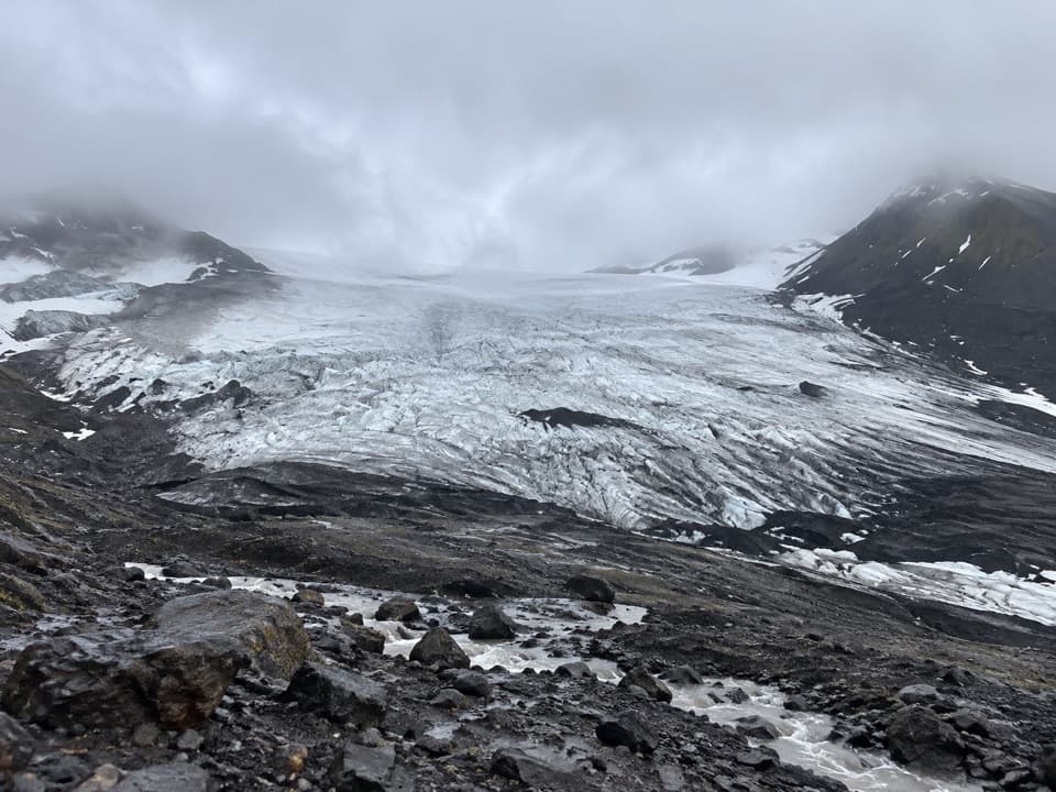
The first hut was built here in 1967 on the route across Sprengisandur. Nýidalur sits where the road reaches the mouth of the valley, with a greener patch of alpine vegetation contrasting with the broad, spare highland terrain. The huts look toward nearby Tungnafellsjökull, while the longer Vonarskarð route reaches the valley views from above.

Wildlife

Wildlife in Vatnajökull

All Vatnajökull wildlife maps

Sighting maps show where each species has been reported across Vatnajökull. Wildlife moves, so no sighting is guaranteed.

Parkwolf’s Vatnajökull ranking

Top sights in Vatnajökull

All 75 places
  1. 1Jökulsárlón Glacier LagoonSight
  2. 2DettifossSight
  3. 3Fellsfjara (Diamond Beach)Beach
  4. 4SvartifossSight
  5. 5Ásbyrgi Canyon and BotnstjörnSight
  6. 6Fjallsárlón Glacier LagoonSight

Take Parkwolf to Vatnajökull.

The audio tour guide for the drive, plus offline maps, trails, and wildlife heatmaps for when the signal drops.

4.7 from 8,600+ ratings

Download Parkwolf on the App StoreGet Parkwolf on Google Play