Highland Ridge Overlook in Wind Cave National Park

#6 of 10 sights in Wind Cave

Scenic pullout · Wind Cave National Park

Highland Ridge Overlook

See the red valley and hogback that ring the Black Hills.

Photo: National Park Service
Type
Scenic pullout
Nearest trail
1.2 mi
Audio stories
7 nearby
  • Parking
  • Pullout
  • Scenic viewpoint

Hear the audio tour

Highland Ridge Overlook

Overview

About Highland Ridge Overlook

Why stop

  • A distinctive geology view from the last stop on the park’s driving tour.

Heads up

  • Reaching it means four miles on loose gravel NPS 5.

Map

Where it is

Loading the Wind Cave map
Full map
Scenic pulloutHighland Ridge Overlook43.61205, -103.40175
Keep this map with you offline in the Parkwolf app

Plan your stop

Before you go

1 active Wind Cave alert

  • ClosureNatural Entrance Tour Route closed for winterThe Natural Entrance Tour Route is closed for the season beginning October 1, 2026, because of the park’s annual winter seasonal closure. - The closure lasts through the winter season.Official details
Wind Cave alerts
A park ranger sits on a dash-mounted phone, talking, as Parkwolf’s Tour Guide plays “Army Cutworm Moths: A Grizzly Bear Buffet” on Grand Loop Road below Dunraven Pass in Yellowstone
Parkwolf Tour GuideThe highest, rockiest slopes around here are a summer buffet for grizzly bears.

Wind Cave Tour Guide

Your drive to Highland Ridge Overlook, narrated.

Parkwolf is a GPS audio tour guide for Wind Cave National Park. As you drive, it chimes in with what’s ahead: hidden gems, upcoming stops, history, geology, and wildlife, right through your car’s speakers.

Recorded for this place

Highland Ridge Overlook
0:00 / 0:30
“Highland Ridge Overlook is coming up, with a view down into Red Valley and across to the ridge that marks the outer edge of the Black Hills. This is a good short stop for making sense of the landscape.”

Plays as you drive up to Highland Ridge Overlook in the Parkwolf Wind Cave Tour Guide.

More stories near here in the app

  • A Place of Emergence
  • Highland Creek Trail
  • The Prairie’s Night Hunter
  • Boland Ridge
  • 28 audio storiesacross Wind Cave’s roads, triggered by GPS as you drive
  • Wildlife heatmapsfor Bison, Elk, Pronghorn, and 13 more
  • Works offlinemaps, 11 trails, 14 places, and audio download before you lose signal
  • CarPlay readysimple controls built for the drive
★★★★★
“Fantastic app with many points of information… It’s great to just turn on while you’re driving and it gives you an audio tour of the national Park. We love it!!!!”
JMJamesApp Store review
Download Parkwolf on the App StoreGet Parkwolf on Google Play

4.7 from 8,600+ ratings

Guide

More about Highland Ridge Overlook

A quick geology stopHighland Ridge Overlook is a roadside viewpoint at the last stop of Wind Cave’s geology driving…

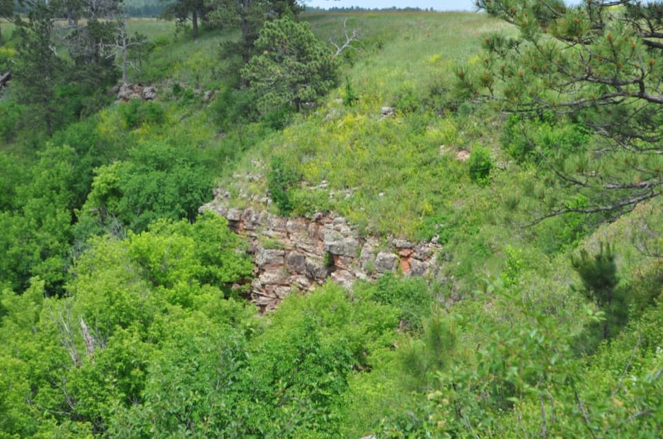
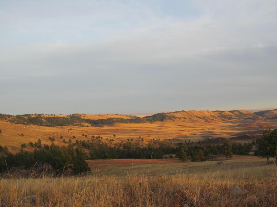
Highland Ridge Overlook is a roadside viewpoint at the last stop of Wind Cave’s geology driving tour. It looks down into Red Valley and across to the hogback ridge on the Black Hills’ outer edge. It’s a short stop, but a good one if you want the layers behind the landscape to click. For a photo, keep the pale grass and scattered pines in the foreground with the red valley beyond.

Find the pulloutFrom the previous tour stop, continue 4.

From the previous tour stop, continue 4.4 miles north on SD 87, then turn onto gravel NPS 5 just before Custer State Park. Drive four miles to a lone pine on the right; the gravel parking area is on the left. That’s 8.4 miles from Stop 6. NPS 5 and NPS 6 aren’t maintained in winter, and heavy snow can close park roads, so check conditions before heading out. The full 20-mile tour takes about 60 to 90 minutes. There’s no fuel for sale in the park, so start with enough for the drive. The loose gravel on NPS 5 can make access difficult for wheelchair users.

Why the valley is redThe low, red land is the Spearfish Formation: fine-grained shale and siltstone colored by iron…

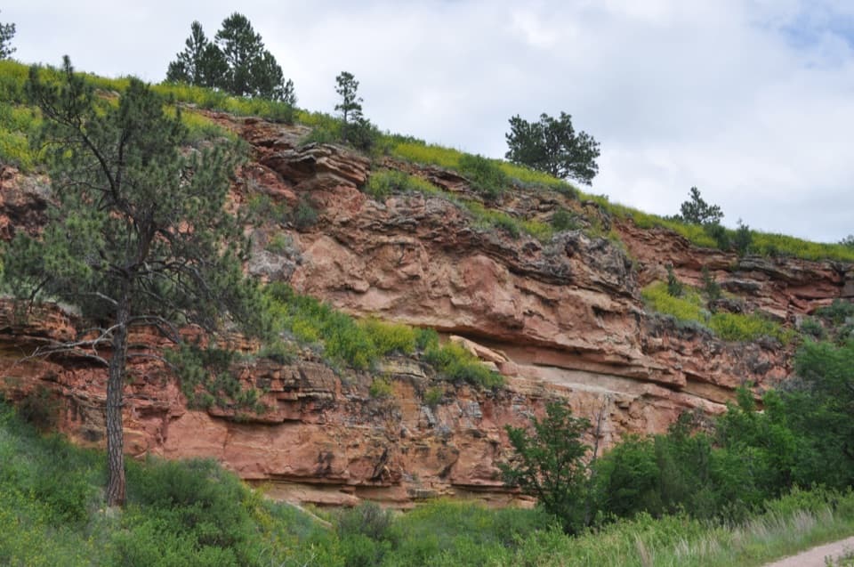
The low, red land is the Spearfish Formation: fine-grained shale and siltstone colored by iron oxide. Those rocks erode readily in the Black Hills’ semi-arid climate, which is why they form a valley. Beyond it, iron-rich sandstone and claystone of the Inyan Kara Group make the more resistant hogback that marks the Hills’ outer rim.

The Great RaceLakota and Cheyenne oral traditions also connect the wider Red Valley landscape to the Great…

Lakota and Cheyenne oral traditions also connect the wider Red Valley landscape to the Great Race, a story of a race between two-legged and four-legged beings. A magpie riding a bison crosses the finish first, and the exhausted animals’ blood stains the track red. That’s a cultural story tied to the landscape, alongside the geological explanation visible from this stop.

Wildlife

Wildlife in Wind Cave

All Wind Cave wildlife maps

Sighting maps show where each species has been reported across Wind Cave. Wildlife moves, so no sighting is guaranteed.

Parkwolf’s Wind Cave ranking

Top sights in Wind Cave

All 14 places
  1. 1Wind CaveSight
  2. 2Wind Cave Natural EntranceSight
  3. 3Rankin Ridge Fire TowerSight
  4. 4Beaver Creek BridgeSight
  5. 5Pigtail BridgeSight
  6. 7Ancient FoundationsSight

Take Parkwolf to Wind Cave.

The audio tour guide for the drive, plus offline maps, trails, and wildlife heatmaps for when the signal drops.

4.7 from 8,600+ ratings

Download Parkwolf on the App StoreGet Parkwolf on Google Play