Kuskulana Bridge

Historic one-lane trestle over a dizzying glacial river canyon
Kuskulana Bridge, Wrangell-St. Elias National Park
InsideWrangell-St. Elias National Park

Overview

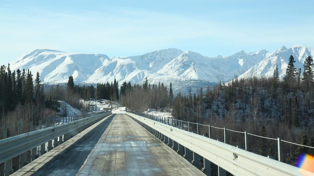
Kuskulana Bridge is the classic white‑knuckle highlight along the McCarthy Road—a single‑lane, steel trestle perched about 238 feet above the silty Kuskulana River. Built in 1910 for the CRNW railroad to Kennecott, it’s a compact stop with big drama and an easy way to feel the scale of this landscape without a long hike. Mile 17.2–17.3 is your mark.

What You’ll See

Walk out from the pullouts and look straight down into a narrow, sheer‑walled canyon carved into hard metamorphic bedrock. The river’s coffee‑colored flow isn’t dirty; it’s glacial “rock flour” washing off Mt. Blackburn’s ice. Interpretive panels explain the bridge’s history and the region’s glacier‑fed rivers.

On‑Site Logistics

It’s one lane—yield to oncoming traffic and don’t stop on the span. Park in the gravel pullouts on either side and then wander out for the view. A designated wayside just east of the bridge has vault toilets and signage, making this a natural stretch‑your‑legs stop on the drive.

Getting There & Road Reality

The McCarthy Road runs from Chitina about 60 miles to the Kennicott River footbridge. It’s unpaved, narrow, and can be potholed or washboarded. Fuel up before you go, bring a full‑size spare and jack, and expect limited cell service. Take it slow and respect private land along the way.

Photography

The safest, widest perspectives come from the signed pullouts and the east‑end wayside. Early and late light adds texture to the canyon walls; a polarizer helps tame glare off the silty water.

Best Time to Visit

This is a roadside stop with no set hours, but daylight is obviously better for views. To avoid pauses for oncoming cars, aim for before mid‑morning or after early evening; mid‑day can see more vehicles, especially mid‑week afternoons and late Saturday mornings in summer. Shoulder seasons are typically quieter.


A Bit of History & Geology

Engineers anchored the trestle into the inner gorge’s bedrock rather than the loose glacial gravels near the surface—one big reason it has endured more than a century of harsh conditions.

Nearby Along McCarthy Road

If you’re exploring farther, the Gilahina Trestle (mile 29) makes a fascinating companion stop, and the Crystalline Hills area (mile 34.8) is a known spot to glass distant slopes for bright‑white Dall sheep. End‑of‑road logistics funnel to parking at the Kennicott River footbridge for access to McCarthy and Kennecott.

Pros

  • Dramatic 238-foot drop into a glacial river canyon
  • Quick, worthwhile stop with pullouts, vault toilets, and interpretive panels
  • Historic 1910 railroad engineering landmark

Cons

  • One-lane span; you can’t stop on the bridge for photos
  • Access is via a rough, remote road with very limited services

Tips

  • Park in the gravel pullouts on either side—don’t stop on the span.
  • Use the east‑end wayside for restrooms and interpretive panels.
  • For photos, come early or late; a polarizer reduces glare on the silty river.
  • Fuel up and bring a full‑size spare—services and cell coverage are scarce.
  • Allow about 2 hours each way for the McCarthy Road drive and go slow.
The Parkwolf tour guide sitting on a phone mounted in a car

Parkwolf Tour Guide

Like a tour guide in your car.

Save the places you found around Wrangell-St. Elias, then let Parkwolf guide the drive between them.Download Parkwolf on the App Store