Parking
Eagle Pass Trailhead (6K1) is a remote foot-access point with no road or parking access. Reach the pass by a longer backcountry approach from the east.

Yellowstone National Park, WY · MT · ID
A steep first mile, then a long descent to the Thorofare.
Overview
Map & elevation
Plan your hike

The highest, rockiest slopes around here are a summer buffet for grizzly bears.
Yellowstone Tour Guide
Parkwolf is a GPS audio tour guide for Yellowstone National Park. As you drive, it chimes in with what’s ahead: hidden gems, upcoming stops, history, geology, and wildlife, right through your car’s speakers.
See the Yellowstone audio tour“First time driving through a national park. We used the Yellowstone tour on grand loop Road and it’s just like having a tour guide in your car with you.”


Trail guide
Eagle Pass–Mountain Creek Trail is a 10.2-mile one-way route from Eagle Pass to the Thorofare Trail along the Upper Yellowstone River. It loses about 1,600 feet. The first mile drops steeply; after that, the descent eases through open, fire-sculpted country. Allow about six hours for this leg. Eagle Pass is not road-accessible, and the route finishes at a backcountry junction, so plan it as part of a longer wilderness itinerary rather than a roadside day hike. The eastern approach described from US 20 adds a separate 14.9 miles to Eagle Pass.
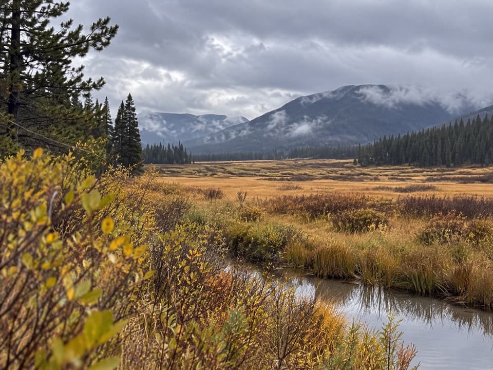
Eagle Pass opens onto high-country views toward Eagle Peak and the Trident. The trail drops roughly 650 feet in its first mile to Howell Creek, crosses it, then crosses again around mile two as the grade eases. It continues past Howell Fork Patrol Cabin at about mile 3.5; the Dike Creek Trail branches toward Teton Wilderness shortly after, so stay on the Mountain Creek route for the Thorofare. Much of this open slope still shows the 1988 fires.
Around mile 5.2, campsite 6D6 sits below the turret-shaped breccia pillar of Turret Mountain. The route continues to campsite 6D5 near mile 7.8, below the Howell and Mountain Creek confluence. Mountain Creek Triangle Trail branches around mile 9.2; the Thorofare Trail junction comes at 10.2 miles. At Eagle Pass, a low composition that keeps rocky ground beneath the peak shows how the trail starts high above the creek country.
This route has no road access at its start. A backcountry permit is required for any overnight stay, and camping is limited to the site assigned to your itinerary. Pets are not allowed on park trails or in the backcountry. Late June through September is the usual backpacking season; snowmelt can keep streams high well into July, and snow can return to high elevations in September. Check current backcountry conditions before you go, and carry what you need for a remote, one-way trip.
Wildlife
 713 sightingsGrizzly BearMost seen around 6 AMSighting map
 743 sightingsWolfMost seen around 6 AMSighting map
 5,273 sightingsBisonMost seen around 7 AMSighting map
 3,258 sightingsElkMost seen around 7 PMSighting map
 397 sightingsMooseMost seen around 7 PMSighting map
 1,494 sightingsBlack BearMost seen around 7 PMSighting map
Sighting maps show where each species has been reported across Yellowstone. Wildlife moves, so no sighting is guaranteed.
Keep exploring
Parkwolf’s Yellowstone ranking

The audio tour guide for the drive, plus offline maps, trails, and wildlife heatmaps for when the signal drops.