
Place · 0 mi away
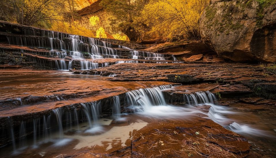
Archangel Falls (also called Archangel Cascades) is a broad, stepped series of shallow waterfalls where Left Fork of North Creek sheets over hard sandstone. It’s one of the marquee stops on the “bottom‑up” hike toward the Subway in Zion’s Kolob Terrace section—beautiful in any flow and especially rewarding for photographers.
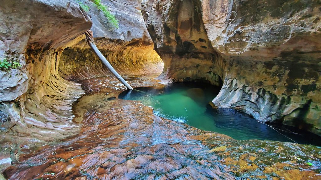
You’ll descend steeply from the rim to the creek (about a 500–600 ft drop), then make slow upstream progress by alternating banks, boulder‑hopping, and wading. The route at river level is unmarked and often faint, with frequent crossings and occasional backtracking. After the canyon narrows, the cascades appear just below the bend that leads into the lower Subway and its clear pools. Going farther inside quickly meets deeper pools and a small waterfall/obstacle that typically turns around bottom‑up hikers without canyoneering gear. Expect roughly 8–9+ miles round trip and 6–9 hours depending on conditions and route‑finding.
A day‑use permit is required for the Subway whether you hike bottom‑up to Archangel Falls or do the technical top‑down canyoneering route. Permits are issued through the park’s backcountry system. This is a day‑use area (no overnight camping), and paid guided trips are not permitted. Some visitors find permits easier to obtain in late fall shoulder periods.
Start early—heat builds even in spring, and summer can be oppressive along the creek. Water levels vary; algae and moss on slickrock can be treacherous, so step carefully. This drainage is subject to flash flooding; avoid storm forecasts and assess conditions conservatively. The exit back to the rim is steep, and many hikers miss the turn—note landmarks on the way in and consider dropping a GPS pin.
Archangel Falls is a classic long‑exposure scene. Soft light (early/late or overcast) minimizes glare on wet rock and brings out color. A tripod or ND filter helps smooth the flow; changing your perspective—especially getting low near the lip of the steps—can transform the shot. Stay off fragile, mossy patches to protect both the site and your footing.
The cascades showcase Zion’s erosional story—flood‑scoured sandstone shaped into terraces that lead to the Subway’s tubular slot. Along the approach, hikers sometimes notice dinosaur tracks on rock slabs, a reminder of the area’s deep geologic past.
There are no services along the hike—plan to be fully self‑sufficient with water, food, and waste. Expect only basic toilets at the trailhead and no running water; fill up before you go. The Kolob Terrace/Left Fork trailhead is reached by personal vehicle; park shuttles do not service this area.
For hiking comfort and photos, aim for shoulder seasons and an early start. Early morning light works best on wet slickrock, and cooler temperatures make the river travel and exit climb more pleasant. Overcast days are excellent for photography. In high summer, begin before dawn to beat heat; in late fall, permits may be easier to secure.
Place · 0 mi away
Place · 0.6 mi away
Place · 1.1 mi away
Place · 2.4 mi away
Easy · 2.5 mi away
Moderate · 2.5 mi away
Challenging · 2.9 mi away
Moderate · 4 mi away

Parkwolf Tour Guide
