
Place · 0.6 mi away
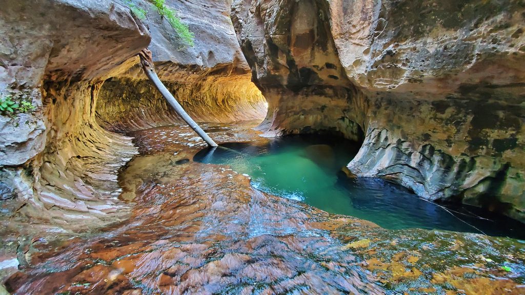
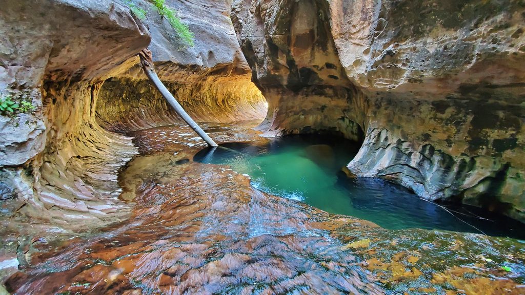
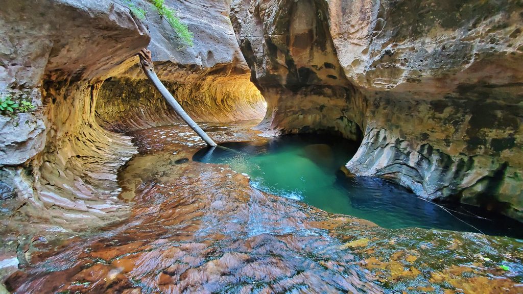
This is the famous “Subway” section of the Left Fork of North Creek—an otherworldly tubular slot with fern-draped walls, green pools, and constant cascades. It’s rugged, wet, and unforgettable. You can reach it via a strenuous bottom-up hike or tackle a technical top-down canyoneering traverse. Either way, permits are mandatory year-round.
Permits are required for both routes, with limited quotas. Apply through a Seasonal Lottery well in advance; if you miss out, try the Daily Lottery two days before your target date. The trip is day-use only (no camping), group size is capped at 12, and formally guided trips aren’t authorized in wilderness. The reservation holder must pick up the permit in person at the Zion Canyon Visitor Center Wilderness Desk; bring vehicle info and allow time at the desk. Fees include a nonrefundable application fee and a per-person charge when you pick up the permit.
Bottom-up trips start from the signed Left Fork Trailhead on Kolob Terrace Road. Expect a steep ~400-foot descent to the creek at the start—and an equally stiff climb back out at the end. Mark a GPS waypoint for the exit; people miss it every season. Dark basalt on the rim is a helpful landmark above the orange sandstone. Plan for limited to no services at the trailhead: arrive early for parking, bring all the water you need, and pack out your trash.
For photos, softer light works best: mid-morning or mid-afternoon in summer and mid-day in autumn to keep the pools bright but shaded. Fall color in the canyon usually peaks in late October to early November. Start early (especially on weekends) for parking, cooler temps, and fewer people.
You’ll descend from a cap of black basalt into the Kayenta Formation with massive Navajo Sandstone looming above. The Subway’s smooth, fluted walls and potholes are sculpted by persistent flow and sediment over millennia.
If you’re up for an all-day, wet, hands-on adventure, the Subway is one of the park’s singular experiences. Permits can be competitive and the route is no joke—but for prepared hikers and canyoneers, it’s absolutely worth the effort.
Place · 0.6 mi away
Place · 0.6 mi away
Place · 1.4 mi away
Place · 1.8 mi away
Challenging · 2.3 mi away
Easy · 2.6 mi away
Moderate · 2.6 mi away
Moderate · 3.8 mi away

Parkwolf Tour Guide
