High Falls and Natural Waterslide in Algonquin Provincial Park

#7 of 28 sights in Algonquin

Sight · Algonquin Provincial Park

High Falls and Natural Waterslide

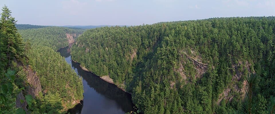
A smooth granite chute links a chain of Barron River pools.

Photo: Wikimedia Commons
Type
Sight
Nearest trail
3.5 km
  • Trailhead
  • Parking

Hear the audio tour

High Falls Trail Access

Overview

About High Falls and Natural Waterslide

Why stop

  • Distinctive natural chute with connected river pools
  • The downstream waterfall adds a second feature to find

Heads up

  • Long approach with uneven, sometimes muddy footing and insects

Map

Where it is

Loading the Algonquin map
Full map
SightHigh Falls and Natural Waterslide45.85835, -77.69296
Keep this map with you offline in the Parkwolf app

Plan your stop

Before you go

4 active Algonquin alerts

  • ClosureProvoking Falls Bridge ClosedThe Provoking Falls bridge on the Highland Backpacking Trail is closed because of safety concerns; the bridge has been removed. - Use the posted reroute, which adds 2.5 km.Official details
  • CautionLow Water on Backcountry Canoe RoutesOntario Parks currently lists low-water alerts for six backcountry canoe-route sections: - Varley Lake from Carl Wilson Lake - Latour Creek north of Rosebary Lake - Carcajou Creek north towards…Official details

See all 4 alerts
A park ranger sits on a dash-mounted phone, talking, as Parkwolf’s Tour Guide plays “Army Cutworm Moths: A Grizzly Bear Buffet” on Grand Loop Road below Dunraven Pass in Yellowstone
Parkwolf Tour GuideThe highest, rockiest slopes around here are a summer buffet for grizzly bears.

Algonquin Tour Guide

Your drive to High Falls and Natural Waterslide, narrated.

Parkwolf is a GPS audio tour guide for Algonquin Provincial Park. As you drive, it chimes in with what’s ahead: hidden gems, upcoming stops, history, geology, and wildlife, right through your car’s speakers.

See the Algonquin audio tour

Recorded for this place

High Falls Trail Access
0:00 / 0:25
“You're approaching the trail access for High Falls and the natural waterslide. The unsigned route is roughly nine kilometres out and back, so allow at least half a day for the walk and river stop.”

Plays as you drive up to High Falls and Natural Waterslide in the Parkwolf Algonquin Tour Guide.

More stories near here in the app

  • When a Pond Becomes a Meadow
  • A Turtle’s Shell Through Winter
  • A Drumroll Made of Air
  • Achray and the Jack Pine Site
  • 107 audio storiesacross Algonquin’s roads, triggered by GPS as you drive
  • Wildlife heatmapsfor Moose, Eastern Wolf, Black Bear, and 13 more
  • Works offlinemaps, 39 trails, 66 places, and audio download before you lose signal
  • CarPlay readysimple controls built for the drive
★★★★★
“Fantastic app with many points of information… It’s great to just turn on while you’re driving and it gives you an audio tour of the national Park. We love it!!!!”
JMJamesApp Store review
Download Parkwolf on the App StoreGet Parkwolf on Google Play

4.7 from 8,600+ ratings

Guide

More about High Falls and Natural Waterslide

The slide and the fallsHigh Falls and Natural Waterslide are two features on the Barron River between Stratton Lake…

High Falls and Natural Waterslide are two features on the Barron River between Stratton Lake and High Falls Lake in eastern Algonquin. The natural waterslide is a smooth rock chute connecting pools; High Falls drops over ledges about 100 m downstream. The waterfall is separate from the slide and easy to miss from the swim area. Keep this for a longer river outing, not a quick roadside stop.

Make time for the approachA common road approach starts on a short dirt spur off Barron Canyon Road, about 13 km beyond…

A common road approach starts on a short dirt spur off Barron Canyon Road, about 13 km beyond Sand Lake Gate. The direct hike is commonly described as roughly 4.5 km each way, though visitor estimates run closer to 5 km. It is an out-and-back through mixed forest, with muddy or flooded stretches and biting insects reported along the way. Some canoe approaches reach Stratton Lake; rough ground separates it from High Falls Lake, so there is no direct paddle between the two.

Water levels change the experienceThe slide is an 8–10 ft rock chute, and its flow changes with season and recent rain.

The slide is an 8–10 ft rock chute, and its flow changes with season and recent rain. High water can turn the chute forceful; don't assume the natural slide is safe to ride or that the pools are safe for swimming. Treat this as moving river water and judge conditions before entering.

Go looking for High FallsThe waterfall is about 100 m downstream from the slide, and it is not obvious from the slide…

The waterfall is about 100 m downstream from the slide, and it is not obvious from the slide area or High Falls Lake. Allow time to seek it out as a separate feature. Visitors often value the slide and pools most, so set expectations for a smaller follow-on waterfall rather than a second swimming spot.

Frame the rock and waterWater-polished granite forms the chute and broad ledges around the pools.

Water-polished granite forms the chute and broad ledges around the pools. For a photo, include the rock slope and both the water's entry and exit where you can; that shows the shape of the slide better than a tight crop of white water.

Come self-sufficientNo restroom was identified at the falls, and no food or potable-water source was confirmed…

No restroom was identified at the falls, and no food or potable-water source was confirmed there. Bring what you need for the walk and time by the river; don't count on facilities at the attraction.

Wildlife

Wildlife in Algonquin

All Algonquin wildlife maps

Sighting maps show where each species has been reported across Algonquin. Wildlife moves, so no sighting is guaranteed.

Parkwolf’s Algonquin ranking

Top sights in Algonquin

All 66 places
  1. 1Barron Canyon LookoutSight
  2. 2Algonquin Logging MuseumSight
  3. 3Lake Opeongo Access Point and Opeongo StoreSight
  4. 4Canoe Lake Access Point and Portage StoreSight
  5. 5Booth's Rock LookoutSight
  6. 6LookoutSight

Take Parkwolf to Algonquin.

The audio tour guide for the drive, plus offline maps, trails, and wildlife heatmaps for when the signal drops.

4.7 from 8,600+ ratings

Download Parkwolf on the App StoreGet Parkwolf on Google Play