Emory Peak in Big Bend National Park

#10 of 45 sights in Big Bend

Sight · Big Bend National Park

Emory Peak

A 10.5-mile round trip earns a 360-degree summit panorama.

Photo: Wikimedia Commons
Type
Sight
Nearest trail
1.6 mi
Audio stories
1 nearby
  • Scenic viewpoint

Hear the audio tour

Chisos Basin and Window View

Overview

About Emory Peak

Why stop

  • A full panorama from the park’s highest point.

Heads up

  • A strenuous hike ends with an exposed summit scramble.

Map

Where it is

Loading the Big Bend map
Full map
SightEmory Peak29.24590, -103.30510
Keep this map with you offline in the Parkwolf app

Plan your stop

Before you go

2 active Big Bend alerts

  • ClosureWeather-related road closuresDo not use these closed roads; NPS lists the closures as in effect until further notice.Official details
  • InfoBoquillas Crossing schedule changeBoquillas Crossing is open Friday through Monday, 9:00 a.m.–4:00 p.m.; NPS says it will not change to winter hours at this time. Check current park conditions before planning a crossing.Official details

Big Bend alerts
A park ranger sits on a dash-mounted phone, talking, as Parkwolf’s Tour Guide plays “Army Cutworm Moths: A Grizzly Bear Buffet” on Grand Loop Road below Dunraven Pass in Yellowstone
Parkwolf Tour GuideThe highest, rockiest slopes around here are a summer buffet for grizzly bears.

Big Bend Tour Guide

Your drive to Emory Peak, narrated.

Parkwolf is a GPS audio tour guide for Big Bend National Park. As you drive, it chimes in with what’s ahead: hidden gems, upcoming stops, history, geology, and wildlife, right through your car’s speakers.

See the Big Bend audio tour

Recorded for this place

Chisos Basin and Window View
0:00 / 0:33
“You're coming up on Chisos Basin, a mountain-ringed bowl with a gap called the Window opening toward the desert.”

Plays as you drive up to Emory Peak in the Parkwolf Big Bend Tour Guide.

More stories near here in the app

  • Chisos Basin Campground and Amphitheater
  • Lost Mine Trail
  • Tree Zone Exhibit
  • How Corners Become Curves
  • 110 audio storiesacross Big Bend’s roads, triggered by GPS as you drive
  • Wildlife heatmapsfor Black Bear, Collared Peccary, White-tailed Deer, and 13 more
  • Works offlinemaps, 45 trails, 64 places, and audio download before you lose signal
  • CarPlay readysimple controls built for the drive
★★★★★
“Fantastic app with many points of information… It’s great to just turn on while you’re driving and it gives you an audio tour of the national Park. We love it!!!!”
JMJamesApp Store review
Download Parkwolf on the App StoreGet Parkwolf on Google Play

4.7 from 8,600+ ratings

Guide

More about Emory Peak

Big Bend’s high point takes a full dayEmory Peak is the highest summit in Big Bend National Park, a rocky crown above the forested…

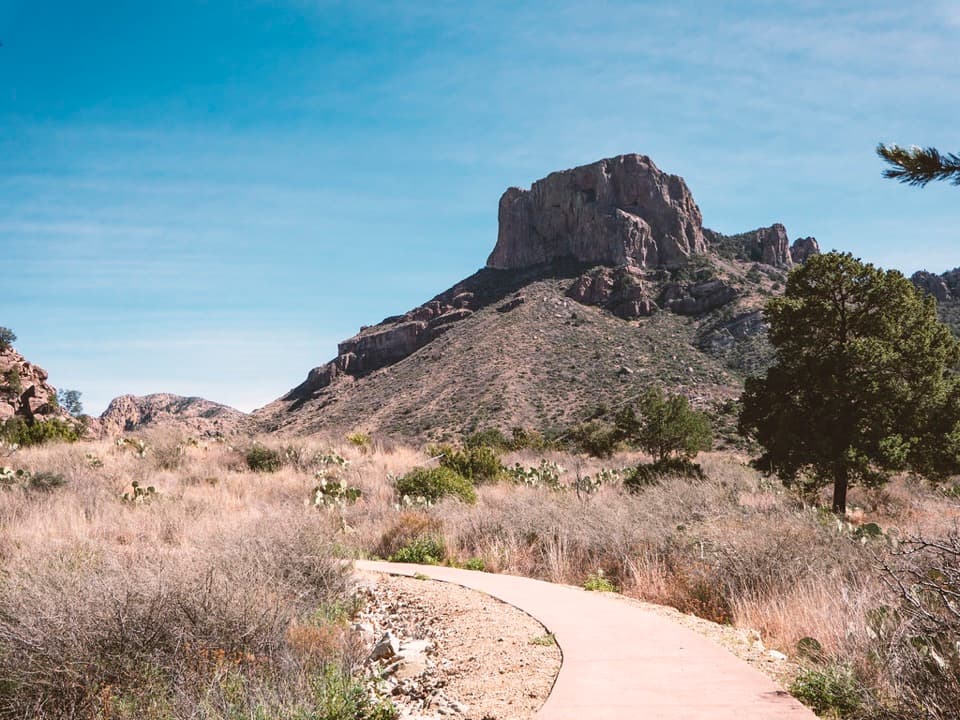
Emory Peak is the highest summit in Big Bend National Park, a rocky crown above the forested Chisos Mountains. The usual approach is a 10.5-mile round trip with about 2,500 feet of climbing. It’s strenuous and takes most of a day; I’d make it the main event, not a quick add-on. The payoff is a 360-degree panorama from the top.

Climb from the BasinFrom the standard trailhead near the Chisos Basin parking lot, the Pinnacles Trail climbs…

From the standard trailhead near the Chisos Basin parking lot, the Pinnacles Trail climbs through forest for 3.8 miles to the Emory Peak junction. The peak trail continues another 1.4 miles to the summit. The park estimates six to eight hours for the full hike. There’s no water along the trails, and the park advises carrying one liter per person for each planned hiking hour. Pets aren’t allowed on park trails or in the backcountry.

The exposed last stepThe final quarter-mile climbs steeply over rock.

The final quarter-mile climbs steeply over rock. The last 25 feet are an exposed scramble up solid rock, with no rope, rail or built handholds. If that kind of exposure isn’t for you, stop before the summit block. Don’t attempt the last mile when thunderstorms threaten, especially in July, August or September.

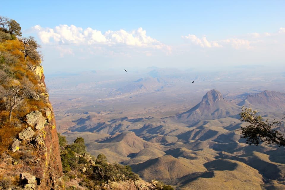
The view from the topThe summit opens to a full circle of Chisos ridges, wooded slopes and desert beyond.

The summit opens to a full circle of Chisos ridges, wooded slopes and desert beyond. For a photo that captures the scale, frame the near ridges and basin together in a wide view; a close crop of one peak misses what makes the outlook special.

Why there’s radio gear up hereThe antenna and equipment on the summit are part of Big Bend’s two-way radio system.

The antenna and equipment on the summit are part of Big Bend’s two-way radio system. They’re working park infrastructure at the high point, alongside the broad mountain view.

A skyline shaped by magmaThe Chisos Mountains formed through volcanic activity about 38 million years ago.

The Chisos Mountains formed through volcanic activity about 38 million years ago. Eruptions laid down ash and lava, while magma also pushed into older rock underground. Erosion later exposed the more resistant rhyolite that makes many of the peaks.

A name from the boundary surveyThe peak is named for William H. Emory, who led the U.S.

The peak is named for William H. Emory, who led the U.S.–Mexico boundary survey after the Mexican War. In 1852, surveyor M. T. W. Chandler, appointed by Emory to work in the Big Bend area, gave the summit its name.

Trees on stony groundShallow, rocky soils near the summit support Douglas fir, aspen, Arizona cypress, maple,…

Shallow, rocky soils near the summit support Douglas fir, aspen, Arizona cypress, maple, ponderosa pine and madrone. It’s a high-country mix above the surrounding desert, and part of what makes the Chisos feel like a different world from the lower park.

Wildlife

Wildlife in Big Bend

All Big Bend wildlife maps

Sighting maps show where each species has been reported across Big Bend. Wildlife moves, so no sighting is guaranteed.

Keep exploring

Near Emory Peak

See it all on the map

Trails nearby

More stops nearby

Parkwolf’s Big Bend ranking

Top sights in Big Bend

All 64 places
  1. 1Santa Elena CanyonSight
  2. 2Sotol VistaSight
  3. 3Fossil Discovery ExhibitSight
  4. 4Window ViewSight
  5. 5Boquillas CanyonSight
  6. 6Langford Hot SpringsSight

Take Parkwolf to Big Bend.

The audio tour guide for the drive, plus offline maps, trails, and wildlife heatmaps for when the signal drops.

4.7 from 8,600+ ratings

Download Parkwolf on the App StoreGet Parkwolf on Google Play