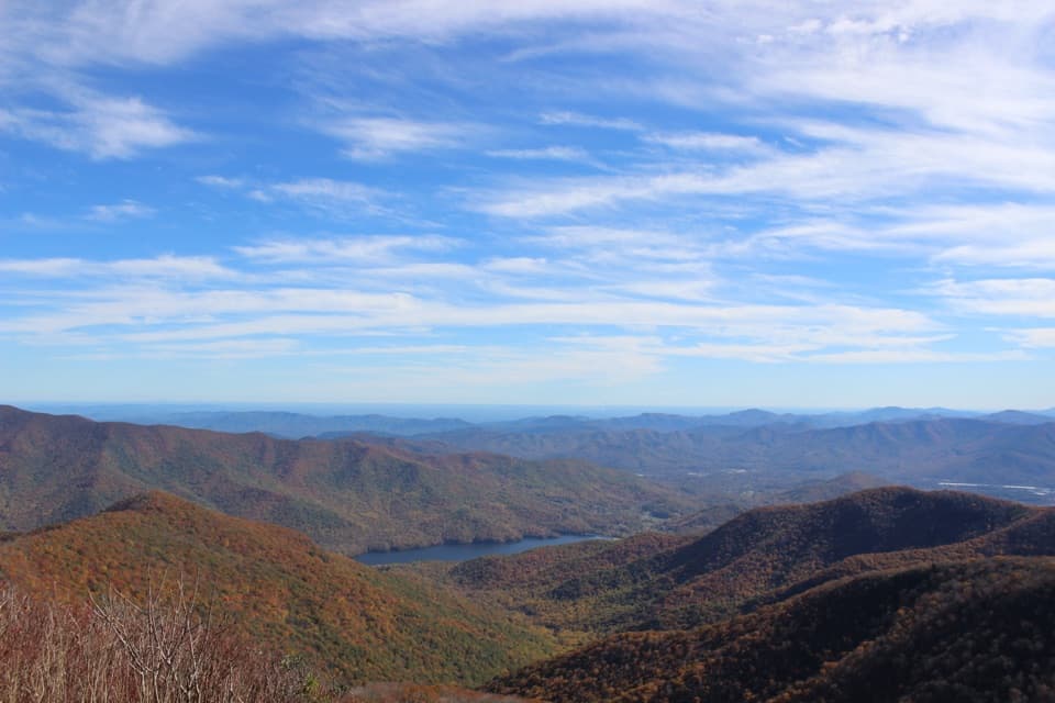
Fork Ridge Overlook in Blue Ridge Parkway

Scenic pullout · Blue Ridge Parkway

Fork Ridge Overlook

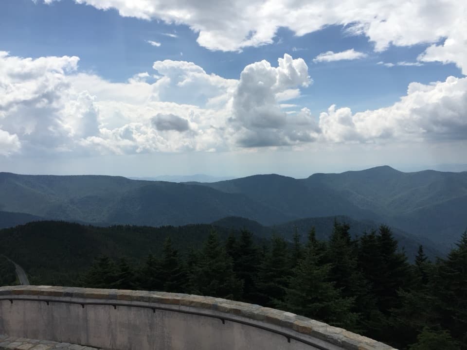
A paved roadside stop for a long look over layered ridges.

Photo: NPS Photo / Alexa Saxton Bush

Type
Scenic pullout
Nearest trail
1.3 mi
Audio stories
5 nearby
  • Parking
  • Pullout
  • Scenic viewpoint
  • Trailhead

Hear the audio tour

The Tree Behind Sourwood Honey
Download Parkwolf on the App StoreGet Parkwolf on Google Play

4.7 from 8,600+ ratings

Overview

About Fork Ridge Overlook

Why stop

  • The Mountains-to-Sea Trail starts across the Parkway.

Heads up

  • Trees interrupt part of the view from some angles.
The overlook also looks onto land that was once at risk of subdivision. The Conservation Trust for North Carolina, with private landowners and philanthropists, protected 81 acres beside the Parkway. That parcel now joins a larger protected stretch across the Plott Balsam Range toward Waterrock Knob. If you take a photo, include some of the grassy opening below the ridges to give the layered view a foreground.
Parkwolf’s verdictA view worth protecting

Map

Where it is

Loading the Blue Ridge Parkway map
Full map
Scenic pulloutFork Ridge Overlook35.45944, -83.11723
Keep this map with you offline in the Parkwolf app

Plan your stop

Before you go

7 active Blue Ridge Parkway alerts

  • ClosureHurricane Helene closures and hazards in North CarolinaMentions North Carolina, referenced in this guideDo not enter closed Parkway sections, trails, facilities, or adjacent NPS lands in North Carolina; recreation is prohibited in the closed NC Highway 80–Mount Mitchell section. - The MP 344.2–355.Official details
  • ClosureWeather closures near Craggy Gardens and southern ParkwayWeather closures block Parkway sections near Craggy Gardens and south of Beech Gap, as well as Mount Mitchell State Park and Heintooga Spur Road; do not enter closed roads. - MP 355.3–375.Official details

See all 7 alerts
A park ranger sits on a dash-mounted phone, talking, as Parkwolf’s Tour Guide plays “Army Cutworm Moths: A Grizzly Bear Buffet” on Grand Loop Road below Dunraven Pass in Yellowstone
Parkwolf Tour GuideThe highest, rockiest slopes around here are a summer buffet for grizzly bears.

Blue Ridge Parkway Tour Guide

Your drive to Fork Ridge Overlook, narrated.

Parkwolf is a GPS audio tour guide for Blue Ridge Parkway. As you drive, it chimes in with what’s ahead: hidden gems, upcoming stops, history, geology, and wildlife, right through your car’s speakers.

See the Blue Ridge Parkway audio tour

Recorded for this area

The Tree Behind Sourwood Honey
0:00 / 0:27
“If you see sourwood honey in a mountain shop, the name refers to a tree. Bees gather nectar from its little white flowers, which hang in long clusters at the branch tips.”

Plays on the road 0.1 mi from Fork Ridge Overlook in the Parkwolf Blue Ridge Parkway Tour Guide.

More stories near here in the app

  • Woodfin Cascades and Mount Lyn Lowry
  • Waterrock Knob: Views Without the Climb
  • Cranberry Ridge and Woolyback: Choose Your View
  • A Hummingbird's Overnight Slowdown
  • 298 audio storiesacross Blue Ridge Parkway’s roads, triggered by GPS as you drive
  • Wildlife heatmapsfor Black Bear, Elk, White-tailed Deer, and 13 more
  • Works offlinemaps, 145 trails, 251 places, and audio download before you lose signal
  • CarPlay readysimple controls built for the drive
★★★★★
“…We knew we wanted to drive the Blue Ridge Parkway. The narration was impeccably timed. The facts and info provided were meaningful. Without it, the trip would not have been near as awesome.”
Ashl GApp Store review
Download Parkwolf on the App StoreGet Parkwolf on Google Play

4.7 from 8,600+ ratings

Guide

More about Fork Ridge Overlook

A quick roadside overlookFork Ridge is a paved pull-off at Milepost 449, with a long view southwest across an open…

Fork Ridge is a paved pull-off at Milepost 449, with a long view southwest across an open grassy field to layered mountains and the valley below. You can enjoy the view without taking a hike. The overlook sign marks its elevation as 5,280 feet.

The trail starts across the ParkwayThe Mountains-to-Sea Trail is reached across the Parkway from the pull-off.

The Mountains-to-Sea Trail is reached across the Parkway from the pull-off. That makes a hike an easy extension if you want one, but the view itself is a quick stop. The crossing is the practical detail to plan for; trail conditions and the distance toward Waterrock Knob weren’t verified for this visit.

Wildlife

Wildlife in Blue Ridge Parkway

All Blue Ridge Parkway wildlife maps

Sighting maps show where each species has been reported across Blue Ridge Parkway. Wildlife moves, so no sighting is guaranteed.

Parkwolf’s Blue Ridge Parkway ranking

Top sights in Blue Ridge Parkway

All 251 places
  1. 1Mabry MillSight
  2. 2Linn Cove ViaductSight
  3. 3Linville FallsSight
  4. 4Moses H. Cone Memorial Park and Flat Top ManorSight
  5. 5Mount Mitchell SummitSight
  6. 6Craggy PinnacleSight

Take Parkwolf to Blue Ridge Parkway.

The audio tour guide for the drive, plus offline maps, trails, and wildlife heatmaps for when the signal drops.

4.7 from 8,600+ ratings

Download Parkwolf on the App StoreGet Parkwolf on Google Play