Saratoga Spring in Death Valley National Park

Sight · Death Valley National Park

Saratoga Spring

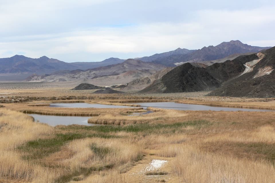
Three spring-fed ponds make a wetland in Death Valley’s dry south.

Photo: Stan Shebs, CC BY-SA 3.0, via Wikimedia Commons

Type
Sight
Nearest trail
1.9 mi
  • Parking

Overview

About Saratoga Spring

Why stop

  • A rare patch of open water and marsh in the desert.

Heads up

  • The remote dirt drive and river crossing make access conditional.

Map

Where it is

Loading the Death Valley map
Full map
SightSaratoga Spring35.68140, -116.42253
Keep this map with you offline in the Parkwolf app

Plan your stop

Before you go

4 active Death Valley alerts

  • ClosureRoad closures and hazardous conditionsSeveral park roads are closed or hazardous; follow closures and vehicle restrictions.Official details
  • ClosureSaline Valley Lower Springs closed after wildfireLower Springs pools at Saline Valley Warm Springs remain closed because the September 15 wildfire left safety hazards, including potential hazardous chemicals; do not enter the closed area.Official details

See all 4 alerts
A park ranger sits on a dash-mounted phone, talking, as Parkwolf’s Tour Guide plays “Army Cutworm Moths: A Grizzly Bear Buffet” on Grand Loop Road below Dunraven Pass in Yellowstone
Parkwolf Tour GuideThe highest, rockiest slopes around here are a summer buffet for grizzly bears.

Death Valley Tour Guide

Your drive to Saratoga Spring, narrated.

Parkwolf is a GPS audio tour guide for Death Valley National Park. As you drive, it chimes in with what’s ahead: hidden gems, upcoming stops, history, geology, and wildlife, right through your car’s speakers.

See the Death Valley audio tour
  • 228 audio storiesacross Death Valley’s roads, triggered by GPS as you drive
  • Wildlife heatmapsfor Bighorn Sheep, Desert Tortoise, Coyote, and 13 more
  • Works offlinemaps, 57 trails, 81 places, and audio download before you lose signal
  • CarPlay readysimple controls built for the drive
★★★★★
“Fantastic app with many points of information… It’s great to just turn on while you’re driving and it gives you an audio tour of the national Park. We love it!!!!”
JMJamesApp Store review
Download Parkwolf on the App StoreGet Parkwolf on Google Play

4.7 from 8,600+ ratings

Guide

More about Saratoga Spring

A spring in Death Valley’s dry southSaratoga Spring is a remote wetland of three spring-fed ponds and marsh grasses near the…

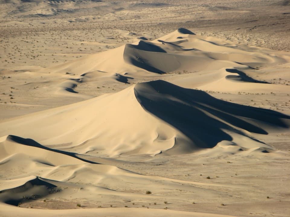
Saratoga Spring is a remote wetland of three spring-fed ponds and marsh grasses near the southern end of Death Valley. It’s a striking patch of open water in a very dry landscape, and a good stop if you’re already exploring the park’s southern end or heading for Ibex Dunes. The long, rough drive is the main reason to skip it.

The drive is the commitmentSaratoga Spring Road leaves CA-127 south of Shoshone and runs across remote desert to the ponds.

Saratoga Spring Road leaves CA-127 south of Shoshone and runs across remote desert to the ponds. Expect washboard on graded dirt; the route is rated high-clearance and crosses the Amargosa River. That crossing can be impassable when the river is flowing, so check conditions before you go. There’s no cell service or place to pick up supplies along the road, and the spring isn’t drinking water. A parking area marks the end of vehicle travel at the wilderness boundary.

Watch the wetlandThe pools and marsh support Saratoga pupfish and other small aquatic life, while waterfowl use…

The pools and marsh support Saratoga pupfish and other small aquatic life, while waterfowl use the open water and reeds. Treat it as habitat to observe rather than a swimming spot, and keep out of the pools and marsh grass.

A watering stop on the borax routeBy the 1880s, the spring was an important watering stop for the 20-mule teams hauling borax…

By the 1880s, the spring was an important watering stop for the 20-mule teams hauling borax across the desert. The name points back to Saratoga Springs in New York; the earliest written record is associated with the 1871 Wheeler Survey, though the exact naming story is uncertain.

Photograph the contrastThe best view is the wetland against its dry setting: include open water and reed beds with the…

The best view is the wetland against its dry setting: include open water and reed beds with the bare valley and mountain slopes behind them. The Panamint Range sits far to the northwest. The three pools spread across the marsh, so include more than one in the frame rather than treating it like a single overlook.

Wildlife

Wildlife in Death Valley

All Death Valley wildlife maps

Sighting maps show where each species has been reported across Death Valley. Wildlife moves, so no sighting is guaranteed.

Parkwolf’s Death Valley ranking

Top sights in Death Valley

All 81 places
  1. 1Badwater BasinSight
  2. 2Zabriskie PointSight
  3. 3Mesquite Flat Sand DunesSight
  4. 4Dantes ViewSight
  5. 5Artists PaletteSight
  6. 6Ubehebe CraterSight

Take Parkwolf to Death Valley.

The audio tour guide for the drive, plus offline maps, trails, and wildlife heatmaps for when the signal drops.

4.7 from 8,600+ ratings

Download Parkwolf on the App StoreGet Parkwolf on Google Play