Ibex Sand Dunes Walk in Death Valley National Park

Death Valley National Park, CA · NV

Ibex Sand Dunes Walk

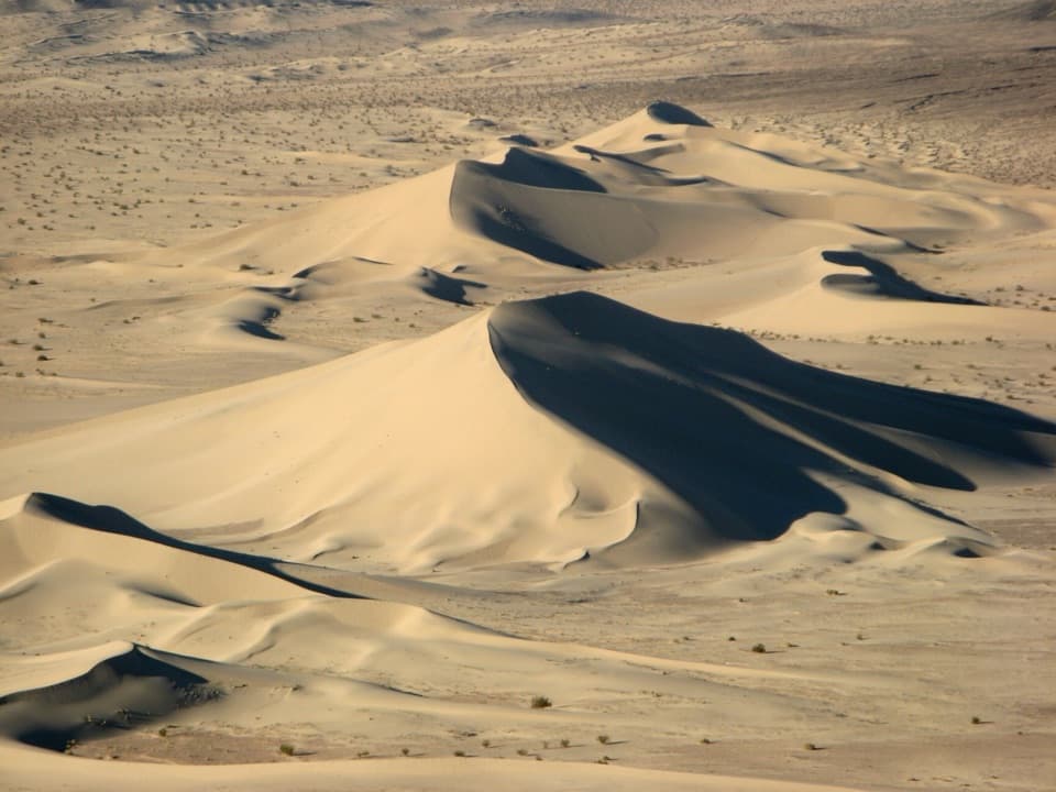
Cross open desert to a high, wind-shaped dune crest.

Photo: MostlyDeserts, CC BY-SA 3.0, via Wikimedia Commons

Length
3.1mi
Time
3hr
Elev. change
200ft
Difficulty
Moderate
  • No dogs
  • High point 459 ft
Parkwolf audio tour228 stories across Death Valley’s roads

Overview

About Ibex Sand Dunes Walk

Why go

  • A quiet dune field and a high crest with broad desert views.
  • A rare chance to walk through the park’s remote southern dune system.

Heads up

  • No maintained tread, shade, water or formal parking.
  • Loose sand and rough-road access make the short mileage slow.

Map & elevation

The route

Loading the Death Valley map
Full map
Elevation259–459 ft
TrailheadIbex Road Old Mining Road Sign35.69497, -116.39320
Keep this map with you offline in the Parkwolf app

Plan your hike

Before you go

Parking

Use a safe, legal roadside pullout by the old mining-road foot access off Ibex Road; there is no formal lot. The 3.1-mile route starts at the sign. Reaching it requires a rough, remote dirt-road approach from Saratoga Springs Road. Check current park road conditions before driving.

Safety

The route is unmarked and crosses a broad wash before leaving the old road for loose sand. Carry water and offline navigation; there is no shade or service, and heat or thunderstorms make the exposed crest hazardous. Pets are not allowed on this off-road route. Sandboarding, sledding and skiing are prohibited to protect sensitive dune habitat; motor vehicles must remain on designated roads.

4 active Death Valley alerts

  • ClosureRoad closures and hazardous conditionsSeveral park roads are closed or hazardous; follow closures and vehicle restrictions.Official details
  • ClosureSaline Valley Lower Springs closed after wildfireLower Springs pools at Saline Valley Warm Springs remain closed because the September 15 wildfire left safety hazards, including potential hazardous chemicals; do not enter the closed area.Official details
See all 4 alerts
A park ranger sits on a dash-mounted phone, talking, as Parkwolf’s Tour Guide plays “Army Cutworm Moths: A Grizzly Bear Buffet” on Grand Loop Road below Dunraven Pass in Yellowstone
Parkwolf Tour GuideThe highest, rockiest slopes around here are a summer buffet for grizzly bears.

Death Valley Tour Guide

Your drive to Ibex Sand Dunes Walk, narrated.

Parkwolf is a GPS audio tour guide for Death Valley National Park. As you drive, it chimes in with what’s ahead: hidden gems, upcoming stops, history, geology, and wildlife, right through your car’s speakers.

See the Death Valley audio tour
  • 228 audio storiesacross Death Valley’s roads, triggered by GPS as you drive
  • Wildlife heatmapsfor Bighorn Sheep, Desert Tortoise, Coyote, and 13 more
  • Works offlinemaps, 57 trails, 81 places, and audio download before you lose signal
  • CarPlay readysimple controls built for the drive
★★★★★
“Fantastic app with many points of information… It’s great to just turn on while you’re driving and it gives you an audio tour of the national Park. We love it!!!!”
JMJamesApp Store review
Download Parkwolf on the App StoreGet Parkwolf on Google Play

4.7 from 8,600+ ratings

Trail guide

Hiking Ibex Sand Dunes Walk

What this walk isIbex Sand Dunes Walk is an informal 3.

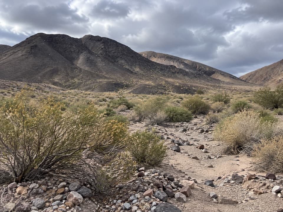
Ibex Sand Dunes Walk is an informal 3.1-mile round trip from the old mining-road foot access off Ibex Road to a high crest in the dune field. Allow about three hours for the roughly 1.5-mile line each way; open wash, cross-country navigation and soft sand slow the distance. There is no maintained hiking tread or single fixed line. This is a remote dune outing for someone comfortable following a saved route across open desert, not a signed trail with a built path.

Find the routeThe recorded version starts at the old mining-road sign, crosses a broad wash, then follows…

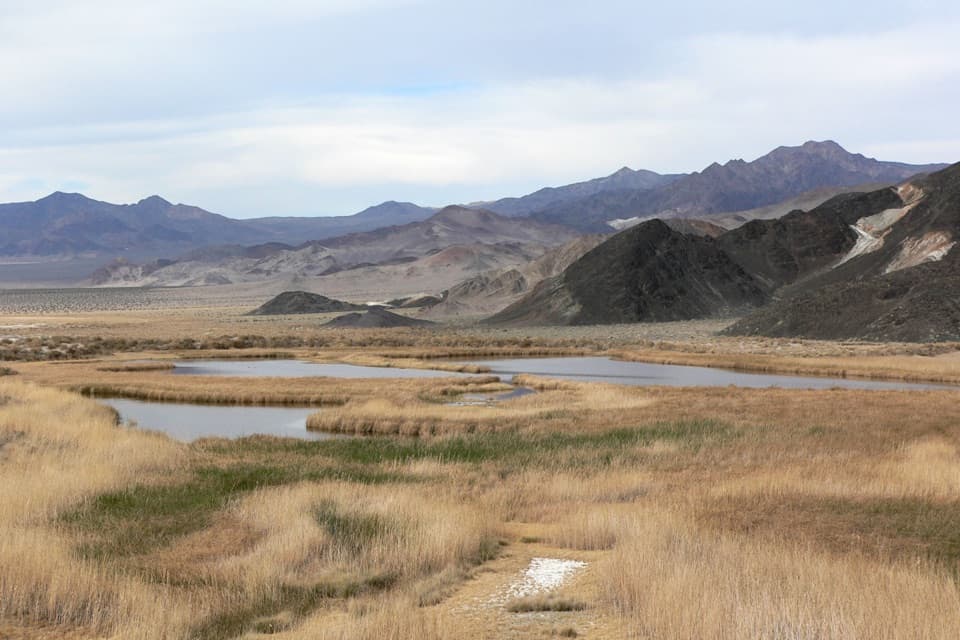
The recorded version starts at the old mining-road sign, crosses a broad wash, then follows about 0.9 mile of old road before leaving it as it bends around the south end of the dunes. From there the route crosses rocky desert and climbs sandy ridgelines to the high dune, then returns to the sign. The 3.1-mile figure starts at that sign. Parking farther back along Saratoga Springs Road adds about 1.8 miles for the road approach and return; the exact line and distance can vary with where you start and how you cross the sand. Keep an offline map or GPS track for the way back. Wind can erase footprints.

The climb and the viewThe old road is the easiest walking; the last stretch is loose sand, with a steep final push.

The old road is the easiest walking; the last stretch is loose sand, with a steep final push. Angling up a ridgeline is more manageable than heading straight up the steepest face. From the crest, the dune shapes open across the desert with rocky hills behind them. Go early or late if you can: low-angle light draws long shadows along the ridges, and the sculpted sand is the point of the view.

A protected dune habitatCanyons and washes supply the sand, wind moves it, and surrounding hills trap it here.

Canyons and washes supply the sand, wind moves it, and surrounding hills trap it here. The Mojave fringe-toed lizard lives on the Ibex dunes, and sensitive endemic plants and wildlife are part of why the dune system is protected. Sandboarding, sledding and skiing are prohibited here; motor vehicles must stay on designated roads. Keep the walk on foot and avoid disturbing plants or wildlife.

Plan for a remote, exposed outingThere is no formal trailhead lot, water, shade or service at the access.

There is no formal trailhead lot, water, shade or service at the access. The approach uses rough, remote dirt roads, so check current park road conditions before driving and be prepared to turn back if the surface is beyond your vehicle. Heat and thunderstorms are serious concerns on the exposed dunes, especially on the crest. Pets are allowed only in developed areas of the park, so leave them behind for this cross-country walk.

Wildlife

Wildlife in Death Valley

All Death Valley wildlife maps

Sighting maps show where each species has been reported across Death Valley. Wildlife moves, so no sighting is guaranteed.

Parkwolf’s Death Valley ranking

Top-rated trails in Death Valley

All 57 trails
  1. 1Badwater Salt FlatEasy · 1.9 mi
  2. 2Mosaic CanyonModerate · 4 mi
  3. 3Golden Canyon to Red CathedralModerate · 3 mi
  4. 4Telescope Peak TrailChallenging · 12.2 mi
  5. 5Golden Canyon Complete CircuitChallenging · 7.8 mi
  6. 6Gower Gulch LoopModerate · 4.3 mi

Take Parkwolf to Death Valley.

The audio tour guide for the drive, plus offline maps, trails, and wildlife heatmaps for when the signal drops.

4.7 from 8,600+ ratings

Download Parkwolf on the App StoreGet Parkwolf on Google Play