Pros & cons
PROS
- Rarely visited dunes that often stay free of footprints by midday
- Easy add‑on exploration of Ibex Springs oasis and historic talc‑mining remnants
CONS
- Rough, sandy access roads often require high‑clearance (sometimes 4WD)
- No signage or trail—navigation and self‑reliance required
No formal lot. Park well off the unpaved Ibex Springs backroad on firm ground near where you can see the dunes; high‑clearance recommended. If the track deteriorates, stop earlier and hike the extra distance.
Remote, unsigned cross‑country travel with deep sand, no shade or water, unreliable cell service, and rough access roads with washouts, off‑camber sections, and deep sand—start early and bring ample water and navigation tools.
Overview
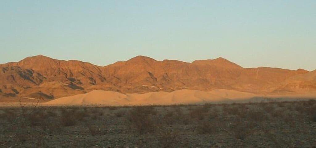
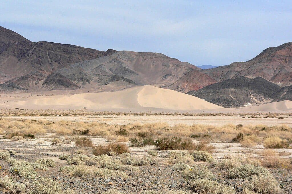
If “quiet” is your love language, Ibex Dunes will speak to you. This remote dune field sits in the far south of the park, backed by stark hills and big desert sky. There’s no official trail—just you, cross‑country walking across firm desert flats into deep, wind‑sculpted sand. Expect roughly 3.0 miles round trip, about 300–400 feet of total gain as you crest the dunes, and 1.5–3 hours depending on how far you wander.
What You’ll See
The dunes rise in graceful ridgelines with a dramatic mountain backdrop. Light and shadow at sunrise or late afternoon make the ripples pop and footprints vanish quickly—photographers, this is your spot. Nearby are the Ibex Springs oasis (palms, water, and a once‑lived‑in outpost) and relics from historic talc mining—great context if you want to add some exploring before or after your dune wander.
Trail Experience
There are no signs or maintained paths—navigation is by sight, map, or GPS. Footing starts on hard desert wash, then turns to soft, calf‑burning sand as you gain the ridgeline. It’s effortful but not technical. Plan an out‑and‑back: wander the crest as long as you like, then return the way you came.
Getting There & Parking
Access is via rough, unpaved backroads in the Ibex Springs/Saratoga Springs corridor. High‑clearance (and often 4WD) is strongly recommended due to deep sand, washouts, and off‑camber sections. There’s no formal trailhead or lot—park well off the road on firm ground where you can see the dunes; if conditions get sketchy, stop sooner and walk the extra distance.
Best Time to Hike
Late fall through early spring is prime (roughly November–March). Start at sunrise or aim for late‑day golden light for cooler temps and the best photography. Avoid summer and midday heat—there’s no shade and no water.
Tips & Essentials
- Carry ample water, sun protection, and a real navigation plan; cell service is unreliable.
- Don’t count on facilities—there are none. Pack it in, pack it out.
- Pair the dunes with a careful look at Ibex Springs and adjacent mining remnants for a fuller day.
Regulations & Reality Check
No pets on trails or in wilderness. No day‑hiking permit is required; standard park entry fees apply. Dispersed backcountry camping is generally allowed with strict rules—never on the dunes. Bottom line: this is a superb, solitude‑forward outing for prepared hikers. If you want a quick, easy dune stroll with simple access, look elsewhere.
Near Ibex Dunes
All places →All trails →
Badwater BasinVast salt flats at the continent’s lowest pointTrailhead · Restroom
Dante's ViewGrandstand view over Badwater Basin from 5,475 feetTrailhead · Parking
Mesquite Flat Sand DunesEasy-access dunes for golden-hour photos, stargazing, and sandboardingParking · Restroom
Zabriskie PointSignature badlands vista that lights up at sunriseTrailhead · Restroom
Badwater Basin Salt FlatsWalk the otherworldly salt polygons at North America’s lowest pointEasy · 1.9 mi · 33 min
Zabriskie Point Overlook TrailA quick paved stroll to Death Valley’s most photogenic badlands.Easy · 0.3 mi · 8 min
Mesquite Flat Sand DunesChoose your own dune adventure with knockout sunrise and sunset.Easy · 2.2 mi · 1.5 hr
Telescope PeakDesert-to-alpine summit day with bristlecones and massive viewsChallenging · 14 mi · 8.5 hr