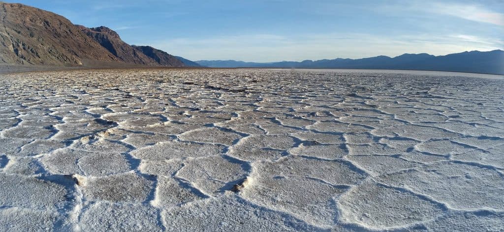
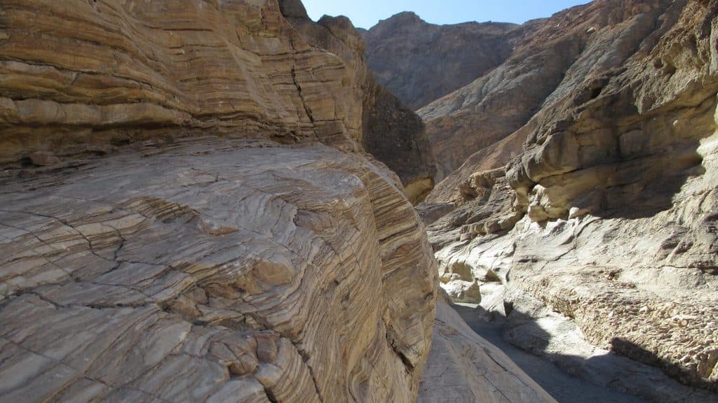
Titus Canyon Narrows in Death Valley National Park

#5 of 36 trails in Death Valley

Death Valley National Park, CA · NV

Titus Canyon Narrows

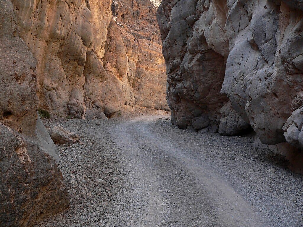
Easy desert walk into Titus Canyon’s narrowest limestone walls.

Photo: Wikimedia Commons
Length
3mi
Time
1.5hr
Elev. change
591ft
Difficulty
Easy
  • Dogs allowed
  • High point 1,568 ft

Hear the audio tour

Titus Canyon: A Backcountry Drive or Hike

Overview

About Titus Canyon Narrows

Titus Canyon Narrows is a short, scenic desert walk into the narrowest western section of Titus Canyon. Towering limestone walls and changing light make the canyon the destination; the route is a rough road and wash rather than a signed, developed trail.

Why go

  • Dramatic limestone narrows with a straightforward out-and-back route
  • Mostly level walking and strong scenery with minimal route-finding

Heads up

  • Remote desert route with no water or services
  • Rough access road and possible vehicle traffic when Titus Canyon Road is open

Map & elevation

The route

Loading the Death Valley map
Full map
Elevation978–1,568 ft
TrailheadTitus Canyon Narrows Trailhead36.82206, -117.17406
Keep this map with you offline in the Parkwolf app

Plan your hike

Before you go

Parking

Gravel parking at the Titus Canyon Narrows Trailhead (36.8220625, -117.1740625), reached by roughly 2.8 miles of bumpy gravel approach from Scotty’s Castle Road; conditions determine whether ordinary 2WD can reach it. No services are available at the trailhead.

Best time to go

Cooler seasons and early morning are preferable. Carry more water than you expect to need, avoid the canyon when rain threatens, and be prepared for severe desert heat, remote conditions, uneven footing, and delayed assistance.

Safety

Check current Death Valley road conditions before the trip: Titus Canyon Road may close for repairs, washouts, mud, storms, or flash-flood risk. Carry ample water, avoid the canyon when rain threatens, expect severe desert heat and uneven gravel footing, and watch for vehicles sharing the road when it is open.

3 active Death Valley alerts

  • ClosurePark roads closed or hazardousPlan around multiple closed roads and use extra caution on damaged routes. - Paved roads: North Highway and Beatty Cut-off are closed due to flooding and debris from the October 22 storm.Official details
  • ClosureSaline Valley Lower Springs closed after wildfireLower Springs at Saline Valley Warm Springs remains closed after the September 15 wildfire; stay out because the fire left safety hazards, including potential hazardous chemicals.Official details
See all 3 alerts
A park ranger sits on a dash-mounted phone, talking, as Parkwolf’s Tour Guide plays “Army Cutworm Moths: A Grizzly Bear Buffet” on Grand Loop Road below Dunraven Pass in Yellowstone
Parkwolf Tour GuideThe highest, rockiest slopes around here are a summer buffet for grizzly bears.

Death Valley Tour Guide

Your drive to Titus Canyon Narrows, narrated.

Parkwolf is a GPS audio tour guide for Death Valley National Park. As you drive, it chimes in with what’s ahead: hidden gems, upcoming stops, history, geology, and wildlife, right through your car’s speakers.

See the Death Valley audio tour

Recorded for this area

Titus Canyon: A Backcountry Drive or Hike
Listen
“That massive opening in the mountains ahead is the mouth of Titus Canyon, one of the park's premier backcountry adventures.”

Plays on the road 0.1 mi from the trailhead in the Parkwolf Death Valley Tour Guide.

More stories near here in the app

  • A Valley Pulled Apart
  • 130 audio storiesacross Death Valley’s roads, triggered by GPS as you drive
  • Wildlife heatmapsfor Bighorn Sheep, Desert Tortoise, Coyote, and 13 more
  • Works offlinemaps, 36 trails, 114 places, and audio download before you lose signal
  • CarPlay readysimple controls built for the drive
★★★★★
“Fantastic app with many points of information… It’s great to just turn on while you’re driving and it gives you an audio tour of the national Park. We love it!!!!”
JMJamesApp Store review
Download Parkwolf on the App StoreGet Parkwolf on Google Play

4.7 from 8,600+ ratings

Trail guide

Hiking Titus Canyon Narrows

Route and DistanceStart at the Titus Canyon Narrows Trailhead and walk east/up-canyon on Titus Canyon Road for…

Start at the Titus Canyon Narrows Trailhead and walk east/up-canyon on Titus Canyon Road for about 1.5 miles to the turnaround in the narrows, then return the same way. The 3.0-mile length is the total out-and-back distance; the stored line represents the physical corridor once, from the primary trailhead to the turnaround. The route is mostly level but uneven, with gravel, sand, and small cobbles.

What You’ll SeeThe canyon begins broad and tightens into dramatic, shaded narrows within the first quarter…

The canyon begins broad and tightens into dramatic, shaded narrows within the first quarter mile. Bighorn sheep may be seen farther up-canyon, but wildlife is never guaranteed.

Access and LogisticsThe trailhead is reached by a roughly 2.8-mile bumpy gravel approach from Scotty’s Castle Road.

The trailhead is reached by a roughly 2.8-mile bumpy gravel approach from Scotty’s Castle Road. The National Park Service describes the west end as a short two-way section that gives hikers access to the narrows; the main Titus Canyon Road is one-way from the east. When the road is open, vehicles may share the corridor. There are no services or reliable water along the route. Check current Death Valley road conditions before driving because Titus Canyon Road can close for repairs, washouts, mud, storms, or flash-flood risk.

Wildlife

Wildlife in Death Valley

All Death Valley wildlife maps

Sighting maps show where each species has been reported across Death Valley. Wildlife moves, so no sighting is guaranteed.

Parkwolf’s Death Valley ranking

Top-rated trails in Death Valley

All 36 trails
  1. 1Badwater Basin Salt FlatsEasy · 1.9 mi
  2. 2Zabriskie Point Overlook TrailEasy · 0.3 mi
  3. 3Mesquite Flat Sand DunesEasy · 2 mi
  4. 4Telescope PeakChallenging · 12.5 mi
  5. 6Mosaic CanyonModerate · 4 mi
  6. 7Artist's Palette WashEasy · 0.4 mi

Take Parkwolf to Death Valley.

The audio tour guide for the drive, plus offline maps, trails, and wildlife heatmaps for when the signal drops.

4.7 from 8,600+ ratings

Download Parkwolf on the App StoreGet Parkwolf on Google Play