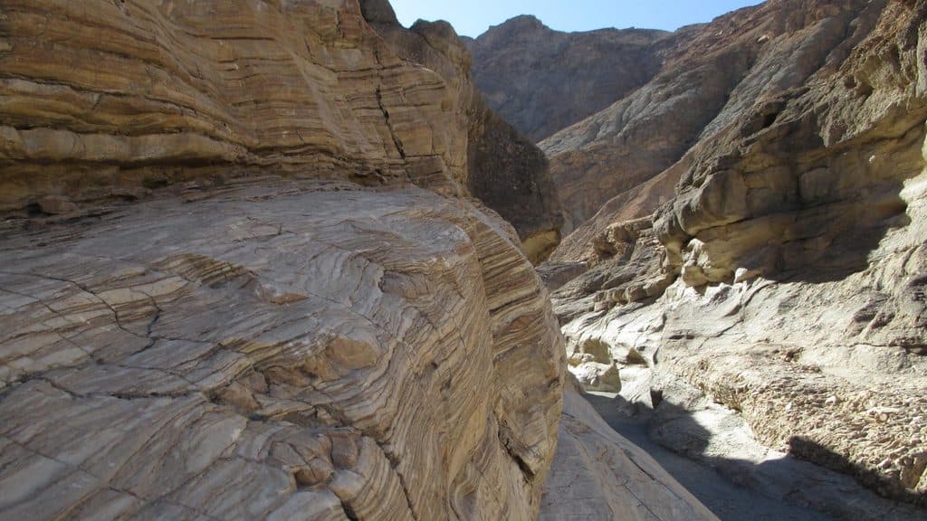
Mosaic Canyon in Death Valley National Park

#6 of 36 trails in Death Valley

Death Valley National Park, CA · NV

Mosaic Canyon

A full out-and-back through polished marble narrows, Mosaic Breccia, and dryfall terrain

Photo: National Park Service
Length
4mi
Time
2.8hr
Elev. change
1,306ft
Difficulty
Moderate
  • No dogs
  • High point 2,241 ft

Hear the audio tour

Mosaic Canyon: A Hike Through Polished Marble

Overview

About Mosaic Canyon

Mosaic Canyon is a 4-mile out-and-back into a polished marble canyon south of Stovepipe Wells. Smooth Noonday Dolomite narrows and Mosaic Canyon Breccia appear within the first 0.25 miles, while the full visitor route continues through boulder jams, bypass terrain, and successive narrows to a final 25-foot dryfall. Many visitors turn around at the first narrows, but this record represents the full NPS route to the final dryfall.

Why go

  • Polished marble narrows and Mosaic Canyon Breccia appear soon after the trailhead
  • Full route reaches successive narrows and a dramatic final dryfall
  • A choose-your-turnaround canyon walk with a rewarding short option

Heads up

  • Unmarked route includes slippery rock, boulder scrambling, and dryfalls
  • Extreme heat, limited shade, and no water or restroom at the trailhead
  • Flash-flood danger makes rain conditions unsafe; buses and large RVs are not recommended on the access road

Map & elevation

The route

Loading the Death Valley map
Full map
Elevation935–2,241 ft
TrailheadMosaic Canyon Trailhead36.57185, -117.14425
Keep this map with you offline in the Parkwolf app

Plan your hike

Before you go

Parking

Large gravel parking area at the end of the 2.3-mile unpaved Mosaic Canyon Road from Stovepipe Wells Village, across from Stovepipe Wells Campground. The road is typically passable in a sedan. Buses and large RVs are not recommended. Closest restrooms are in Stovepipe Wells Village.

Safety

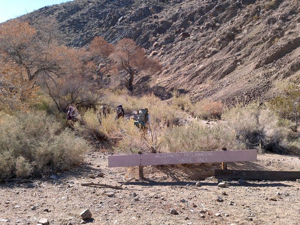
Avoid during or after rain because flash floods can fill the canyon. The route is unmarked and enters designated wilderness, with smooth slippery marble, boulder jams, a bypass around a 20-foot dryfall, light scrambling, extreme heat, limited shade, and no water at the trailhead. Do not climb the dryfalls; return by the same route and avoid ridge trails.

3 active Death Valley alerts

  • ClosurePark roads closed or hazardousPlan around multiple closed roads and use extra caution on damaged routes. - Paved roads: North Highway and Beatty Cut-off are closed due to flooding and debris from the October 22 storm.Official details
  • ClosureSaline Valley Lower Springs closed after wildfireLower Springs at Saline Valley Warm Springs remains closed after the September 15 wildfire; stay out because the fire left safety hazards, including potential hazardous chemicals.Official details
See all 3 alerts
A park ranger sits on a dash-mounted phone, talking, as Parkwolf’s Tour Guide plays “Army Cutworm Moths: A Grizzly Bear Buffet” on Grand Loop Road below Dunraven Pass in Yellowstone
Parkwolf Tour GuideThe highest, rockiest slopes around here are a summer buffet for grizzly bears.

Death Valley Tour Guide

Your drive to Mosaic Canyon, narrated.

Parkwolf is a GPS audio tour guide for Death Valley National Park. As you drive, it chimes in with what’s ahead: hidden gems, upcoming stops, history, geology, and wildlife, right through your car’s speakers.

See the Death Valley audio tour

Recorded for this trailhead

Mosaic Canyon: A Hike Through Polished Marble
Listen
“The turnoff ahead leads to Mosaic Canyon. The canyon gets its name from 'mosaic breccia,' a type of rock that looks like colorful, broken fragments have been naturally cemented together.”

Plays as you drive up to this trailhead in the Parkwolf Death Valley Tour Guide.

More stories near here in the app

  • Stovepipe Wells Village: Desert Outpost and Dune Gateway
  • Stovepipe Wells Airport: A Runway for Stargazing
  • Stovepipe Wells Campground: The Convenient Basecamp
  • Reading the Night's Story on the Dunes
  • 130 audio storiesacross Death Valley’s roads, triggered by GPS as you drive
  • Wildlife heatmapsfor Bighorn Sheep, Desert Tortoise, Coyote, and 13 more
  • Works offlinemaps, 36 trails, 114 places, and audio download before you lose signal
  • CarPlay readysimple controls built for the drive
★★★★★
“Fantastic app with many points of information… It’s great to just turn on while you’re driving and it gives you an audio tour of the national Park. We love it!!!!”
JMJamesApp Store review
Download Parkwolf on the App StoreGet Parkwolf on Google Play

4.7 from 8,600+ ratings

Trail guide

Hiking Mosaic Canyon

Route and TerrainFrom the large gravel parking area, follow the rocky wash into the canyon.

From the large gravel parking area, follow the rocky wash into the canyon. The physical corridor is stored once from the parking area to the final dryfall; the visitor distance is 4 miles out and back. The route is unmarked and includes smooth slippery rock, boulder scrambling, a boulder jam, and a bypass around a 20-foot dryfall. Climbing the dryfalls is not recommended. Backtrack by the same route and avoid ridge trails.

Logistics and SafetyThe access is a 2.

The access is a 2.3-mile unpaved Mosaic Canyon Road from Stovepipe Wells Village, typically passable in a sedan. There is no water or restroom at the trailhead; use the Stovepipe Wells village facilities first. This is designated wilderness. Avoid the canyon during or after rain because flash floods are a serious hazard. Carry ample water, use traction footwear, and expect extreme heat and limited shade.

HighlightsThe route showcases polished marble walls, Mosaic Canyon Breccia, tight narrows, and sculpted…

The route showcases polished marble walls, Mosaic Canyon Breccia, tight narrows, and sculpted chutes. The NPS rates the full route moderate to difficult and estimates 2.5 to 3 hours round trip with 1,200 feet of elevation gain. Pets are not permitted on the trail or in designated wilderness.

Wildlife

Wildlife in Death Valley

All Death Valley wildlife maps

Sighting maps show where each species has been reported across Death Valley. Wildlife moves, so no sighting is guaranteed.

Keep exploring

Near Mosaic Canyon

See it all on the map

Trails that start nearby

Places near the trailhead

Parkwolf’s Death Valley ranking

Top-rated trails in Death Valley

All 36 trails
  1. 1Badwater Basin Salt FlatsEasy · 1.9 mi
  2. 2Zabriskie Point Overlook TrailEasy · 0.3 mi
  3. 3Mesquite Flat Sand DunesEasy · 2 mi
  4. 4Telescope PeakChallenging · 12.5 mi
  5. 5Titus Canyon NarrowsEasy · 3 mi
  6. 7Artist's Palette WashEasy · 0.4 mi

Take Parkwolf to Death Valley.

The audio tour guide for the drive, plus offline maps, trails, and wildlife heatmaps for when the signal drops.

4.7 from 8,600+ ratings

Download Parkwolf on the App StoreGet Parkwolf on Google Play