
Place · 0 mi away
Easy
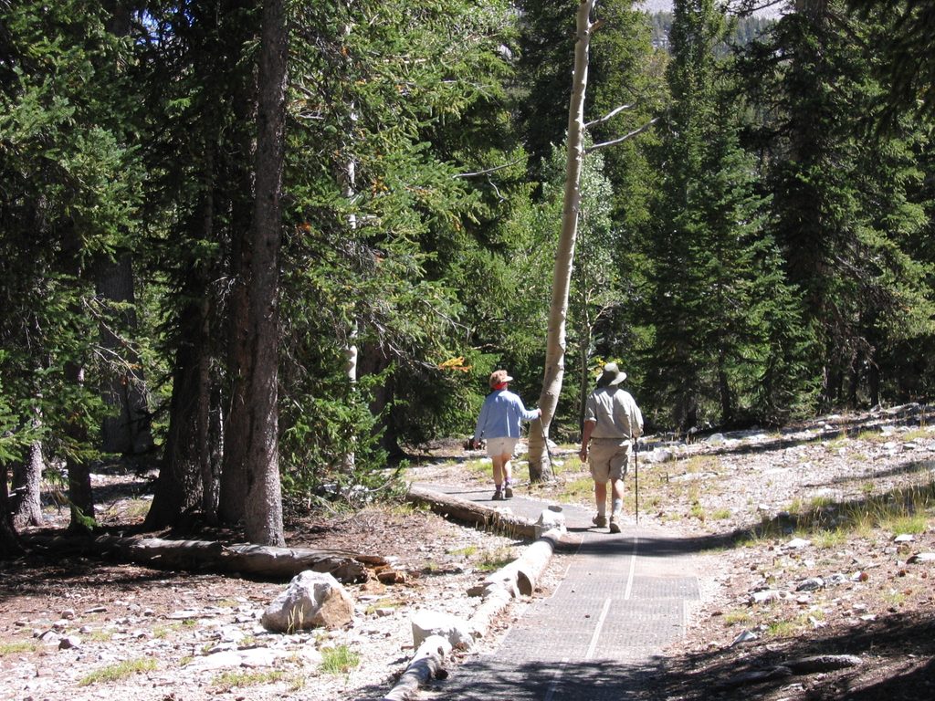
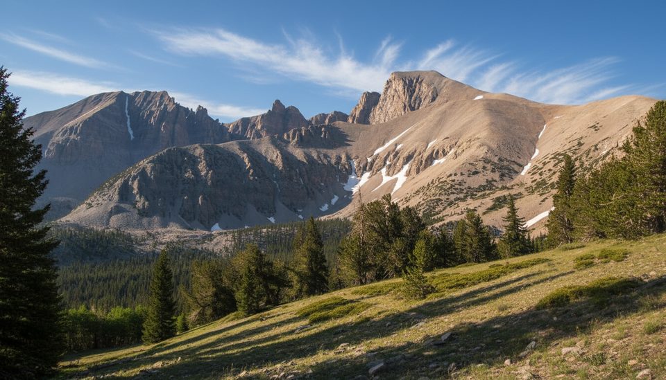
A quick, high-elevation loop with big educational value. The Sky Island Forest Trail is a short interpretive circuit (about 0.3–0.4 miles total) through a cool, conifer-cloaked “island” of forest set above the surrounding desert. It’s not a destination hike so much as a smart, scenic stop to stretch legs, learn the sky-island story, and acclimatize to altitude.
Expect a gentle walk amid Engelmann spruce and limber pine, with pockets of alpine meadow and the sound of small creeks nearby. Interpretive panels explain how this isolated forest persists, separated by distance, elevation, and time. Don’t come looking for bristlecone groves or lakes here—this loop is about the forest itself: smells of spruce, shaded light, and the feel of true high country without the effort.
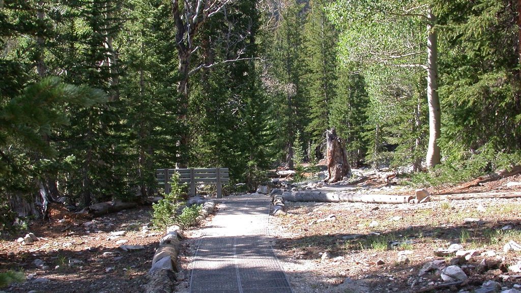
Drive the paved Wheeler Peak Scenic Drive to its end at the Bristlecone Parking area. The trailhead is directly across the road. The loop is designed to be accessible, using interlocking rubber tiles and segments of elevated boardwalk over sensitive ground. Total elevation gain is minimal (often cited around 22 feet), but you’re walking near 9,800 feet, so pace yourself if you’ve just arrived in the park.
This is one of the park’s most wheelchair-friendly trails. Surfaces include rubberized panels, boardwalk, and short natural sections, with a minimum width around 32 inches and grades generally gentle. There is a brief steeper pitch around 0.15 miles if you travel clockwise; going counter-clockwise softens that climb. A designated van-accessible parking space is at the lot, and accessible restrooms are available at the Wheeler Peak Campground entrance nearby. Note: access depends on the scenic drive being open; winter conditions can close the road.
Anytime the Wheeler Peak Scenic Drive is open and dry. Midday is great for reading signs and enjoying the forest shade; early and late can be cooler at this elevation. In shoulder seasons, always check road status and weather—closure of the drive means no access to this loop.
Park at the Bristlecone Parking lot at the end of Wheeler Peak Scenic Drive; one designated van-accessible space. Trailhead is directly across the road. Accessible restrooms at the Wheeler Peak Campground entrance nearby.
High elevation (~9,800 ft) can affect breathing; the scenic drive closes with snow/ice and bans vehicles over 24 feet past Upper Lehman Creek. A short steeper grade occurs ~0.15 miles if walking clockwise—go counter-clockwise for an easier push.
Place · 0 mi away
Place · 0.3 mi away
Place · 0.5 mi away
Place · 0.5 mi away
Easy · 0 mi away
Moderate · 0 mi away
Easy · 0 mi away
Challenging · 0.5 mi away

Parkwolf Tour Guide
