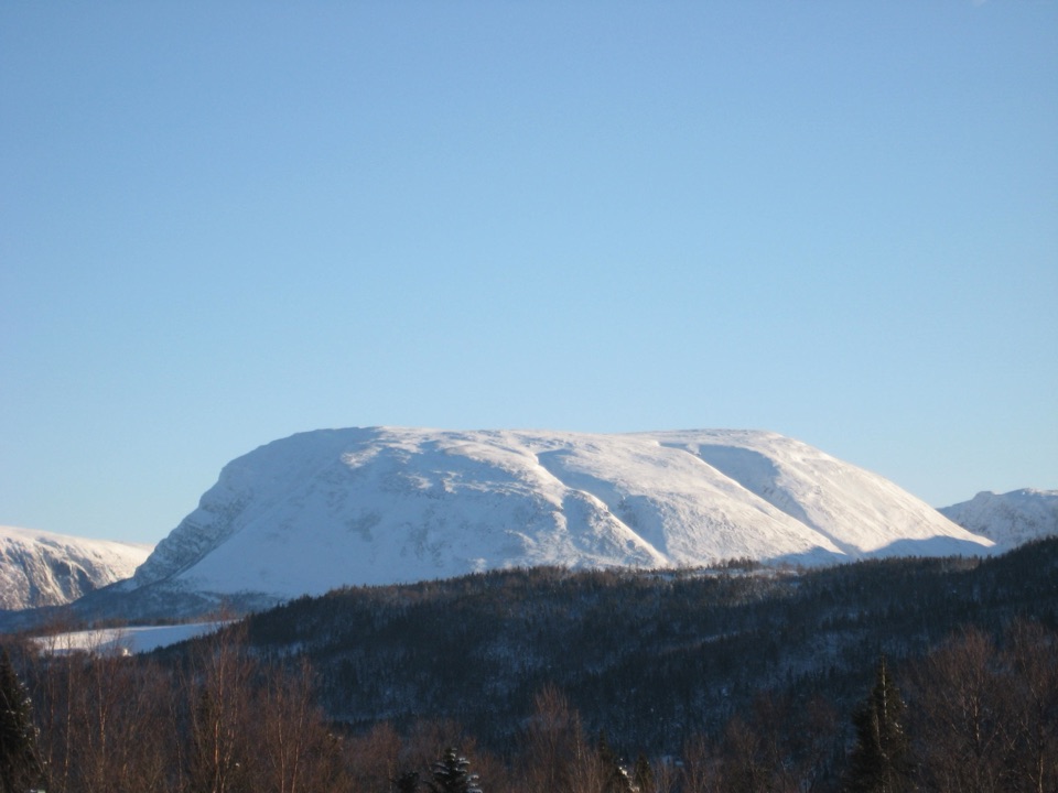
Gros Morne Mountain in Gros Morne National Park

#3 of 22 sights in Gros Morne

Sight · Gros Morne National Park

Gros Morne Mountain

A demanding summit hike to Arctic-alpine tundra and big views.

Photo: Wikimedia Commons
Type
Sight
Nearest trail
4.7 km

Hear the audio tour

Gros Morne Mountain Trailhead

Overview

About Gros Morne Mountain

Why stop

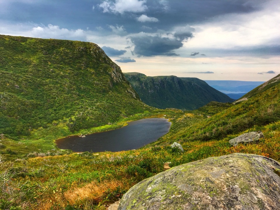
  • Views over Ten Mile Pond gorge and the Long Range Mountains
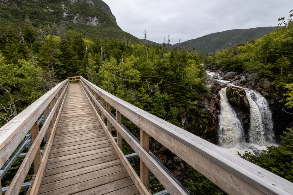
  • A waterfall bridge gives the approach a shorter-turnaround option

Heads up

  • The summit means 17 km of difficult hiking with rough, exposed terrain

Map

Where it is

Loading the Gros Morne map
Full map
SightGros Morne Mountain49.59401, -57.78388
Keep this map with you offline in the Parkwolf app

Plan your stop

Before you go

3 active Gros Morne alerts

  • ClosureGreen Gardens and Wallace Brook trail sections closedDo not enter the closed sections of the Green Gardens and Wallace Brook trails.Official details
  • CautionStuckless Pond Trail bridge outDo not use the Stuckless Pond Trail at the stream crossing. - The bridge is out, and Parks Canada says trail use is not recommended at this time because of high water levels at the stream crossing.Official details
See all 3 alerts
A park ranger sits on a dash-mounted phone, talking, as Parkwolf’s Tour Guide plays “Army Cutworm Moths: A Grizzly Bear Buffet” on Grand Loop Road below Dunraven Pass in Yellowstone
Parkwolf Tour GuideThe highest, rockiest slopes around here are a summer buffet for grizzly bears.

Gros Morne Tour Guide

Your drive to Gros Morne Mountain, narrated.

Parkwolf is a GPS audio tour guide for Gros Morne National Park. As you drive, it chimes in with what’s ahead: hidden gems, upcoming stops, history, geology, and wildlife, right through your car’s speakers.

Recorded for this place

Gros Morne Mountain Trailhead
0:00 / 0:32
“Up ahead is the Gros Morne Mountain trailhead, the start of a serious seventeen-kilometre summit hike. Allow six to eight and a half hours for the steep scree climb, exposed plateau and long boulder descent.”

Plays as you drive up to Gros Morne Mountain in the Parkwolf Gros Morne Tour Guide.

More stories near here in the app

  • The Guide Behind the Map
  • The Bird Dressed for the Summit
  • Rocky Harbour Visitor Centre
  • The House That Crossed the Ice
  • 87 audio storiesacross Gros Morne’s roads, triggered by GPS as you drive
  • Wildlife heatmapsfor Moose, Caribou, Black Bear, and 13 more
  • Works offlinemaps, 25 trails, 58 places, and audio download before you lose signal
  • CarPlay readysimple controls built for the drive
★★★★★
“Fantastic app with many points of information… It’s great to just turn on while you’re driving and it gives you an audio tour of the national Park. We love it!!!!”
JMJamesApp Store review
Download Parkwolf on the App StoreGet Parkwolf on Google Play

4.7 from 8,600+ ratings

Guide

More about Gros Morne Mountain

The park’s signature summitGros Morne Mountain is the park’s highest point, an 806-metre peak with a broad, flat summit in…

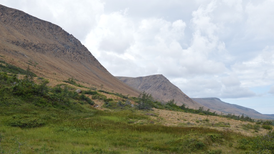
Gros Morne Mountain is the park’s highest point, an 806-metre peak with a broad, flat summit in a rare Arctic-alpine environment. Reaching it means a serious hike, not a quick stop at a roadside viewpoint: the standard route is 17 kilometres return, gains about 1,000 metres, and takes at least six to eight and a half hours. I’d save the summit for a day when you’re ready to make the mountain the main event. If that’s more than you want, the forested approach still earns its walk, with a waterfall bridge and views of the mountain before the steep climb begins.

The trail before the screeThe first part is the 9-kilometre-return Approach Trail.

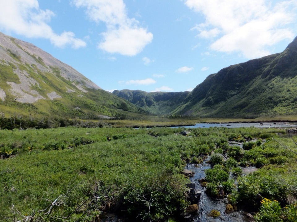
The first part is the 9-kilometre-return Approach Trail. It winds through forest beside Crow Gulch Brook, with waterfalls and views toward Crow Cliff and Gros Morne Mountain. The bridge above a waterfall makes a useful turnaround for a shorter outing; you get the stream and mountain scenery without committing to the summit loop.

From the viewing platform at the mountain’s base, the 8-kilometre Summit Trail climbs almost 500 metres up a steep scree slope, crosses the rocky plateau, then drops through Ferry Gulch on a long, boulder-strewn path. The complete route combines both sections. Follow the loop clockwise so the scree is the climb, not the descent. The rocks make the return from the summit demanding too, so don’t mistake the broad plateau for an easy finish.

A different world at the topThe flat summit is exposed and windswept, with views across the Ten Mile Pond gorge and the…

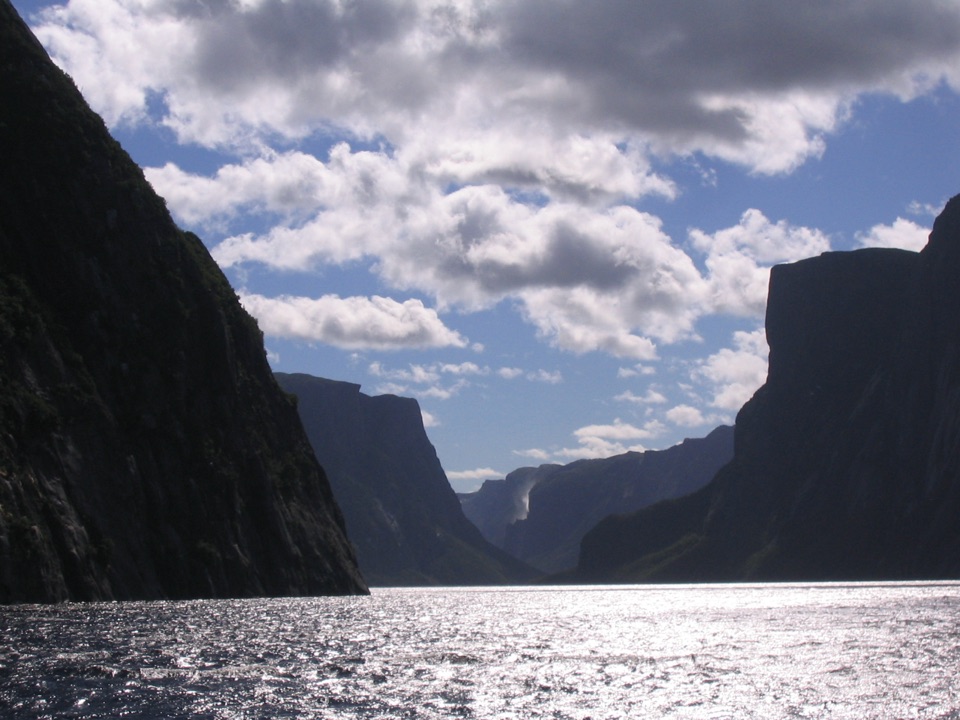
The flat summit is exposed and windswept, with views across the Ten Mile Pond gorge and the Long Range Mountains. It’s also a slice of Arctic tundra far south of its usual range. Arctic hares, rock ptarmigan and caribou live in this habitat, and the plants grow slowly in the harsh conditions. Stay on the marked route: cairns guide the way across the plateau, and keeping to the trail helps protect plants that recover slowly from trampling.

For a photo, try to frame the Ten Mile Pond gorge with the Long Range Mountains beyond it. That gives the shot a sense of the distance and scale around the summit; cloud can hide the view, so don’t count on a clear panorama.

Plan around the mountainThis is a difficult, exposed hike with loose scree, uneven boulders and a long day on foot.

This is a difficult, exposed hike with loose scree, uneven boulders and a long day on foot. The summit can be clouded in, making navigation difficult; if it is, the summit route isn’t recommended. Parks Canada closes the Summit Trail each year from May 1 through June 27 to protect wildlife, reopening it June 28. Winter summit hiking is also discouraged because of snow, ice, storms, short days and avalanche risk.

There’s no food, water or shelter on the mountain. Bring at least three litres of water per person, more in hot weather, along with food and a waterproof wind layer; the summit can be much colder and windier than the trailhead. Dogs are strongly discouraged because they disturb wildlife and the rough rock can hurt their paws. A national park pass is required.

Wildlife

Wildlife in Gros Morne

All Gros Morne wildlife maps

Sighting maps show where each species has been reported across Gros Morne. Wildlife moves, so no sighting is guaranteed.

Parkwolf’s Gros Morne ranking

Top sights in Gros Morne

All 58 places
  1. 1Western Brook PondSight
  2. 2The TablelandsSight
  3. 4Lobster Cove Head LighthouseSight
  4. 5Shallow Bay BeachBeach
  5. 6Broom Point Fishing PremisesSight
  6. 7Green Point Geological SiteSight

Take Parkwolf to Gros Morne.

The audio tour guide for the drive, plus offline maps, trails, and wildlife heatmaps for when the signal drops.

4.7 from 8,600+ ratings

Download Parkwolf on the App StoreGet Parkwolf on Google Play