Green Point Geological Site in Gros Morne National Park

#7 of 22 sights in Gros Morne

Sight · Gros Morne National Park

Green Point Geological Site

A coastal rock sequence that defines a global time boundary.

Photo: Wikimedia Commons
Type
Sight
Nearest trail
3.1 km
Audio stories
4 nearby
  • Scenic viewpoint

Hear the audio tour

Green Point Geological Site

Overview

About Green Point Geological Site

Why stop

  • Tilted seabed layers make deep time easy to see.

Heads up

  • The shore is best at low tide, and the cliff edge needs care.

Map

Where it is

Loading the Gros Morne map
Full map
SightGreen Point Geological Site49.68332, -57.96519
Keep this map with you offline in the Parkwolf app

Plan your stop

Before you go

3 active Gros Morne alerts

  • ClosureGreen Gardens and Wallace Brook trail sections closedDo not enter the closed sections of the Green Gardens and Wallace Brook trails.Official details
  • CautionStuckless Pond Trail bridge outDo not use the Stuckless Pond Trail at the stream crossing. - The bridge is out, and Parks Canada says trail use is not recommended at this time because of high water levels at the stream crossing.Official details
See all 3 alerts
A park ranger sits on a dash-mounted phone, talking, as Parkwolf’s Tour Guide plays “Army Cutworm Moths: A Grizzly Bear Buffet” on Grand Loop Road below Dunraven Pass in Yellowstone
Parkwolf Tour GuideThe highest, rockiest slopes around here are a summer buffet for grizzly bears.

Gros Morne Tour Guide

Your drive to Green Point Geological Site, narrated.

Parkwolf is a GPS audio tour guide for Gros Morne National Park. As you drive, it chimes in with what’s ahead: hidden gems, upcoming stops, history, geology, and wildlife, right through your car’s speakers.

Recorded for this place

Green Point Geological Site
0:00 / 0:33
“You're approaching Green Point; the geological site is a separate stop about 500 metres north of the campground. The sharply tilted beds here began as ocean-floor sediment nearly 500 million years ago.”

Plays as you drive up to Green Point Geological Site in the Parkwolf Gros Morne Tour Guide.

More stories near here in the app

  • The Trees the Wind Prunes
  • Coastal Trail from Baker’s Brook
  • Green Point’s Golden Spike
  • Watch for the Minke
  • 87 audio storiesacross Gros Morne’s roads, triggered by GPS as you drive
  • Wildlife heatmapsfor Moose, Caribou, Black Bear, and 13 more
  • Works offlinemaps, 25 trails, 58 places, and audio download before you lose signal
  • CarPlay readysimple controls built for the drive
★★★★★
“Fantastic app with many points of information… It’s great to just turn on while you’re driving and it gives you an audio tour of the national Park. We love it!!!!”
JMJamesApp Store review
Download Parkwolf on the App StoreGet Parkwolf on Google Play

4.7 from 8,600+ ratings

Guide

More about Green Point Geological Site

A shoreline with a global jobGreen Point Geological Site is a coastal outcrop north of Rocky Harbour, where steep layers of…

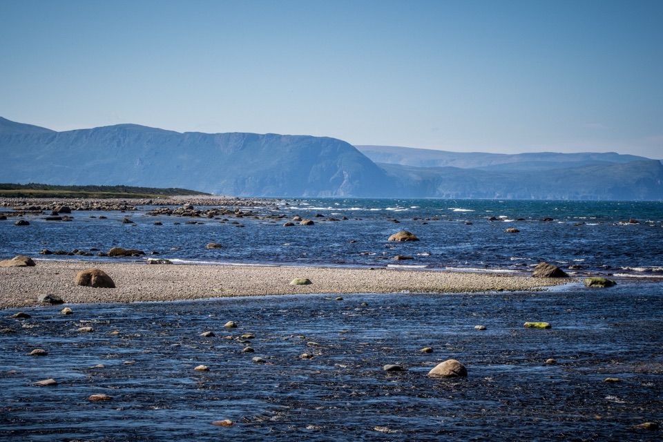
Green Point Geological Site is a coastal outcrop north of Rocky Harbour, where steep layers of ancient seabed rise above the coast. It's a rare place where a short visit puts you beside the rock sequence used to define the boundary between the Cambrian and Ordovician periods. If geology interests you, keep both the shore and the cliff-top paths in your plan; the story is split between close-up rock and the shape of the point.

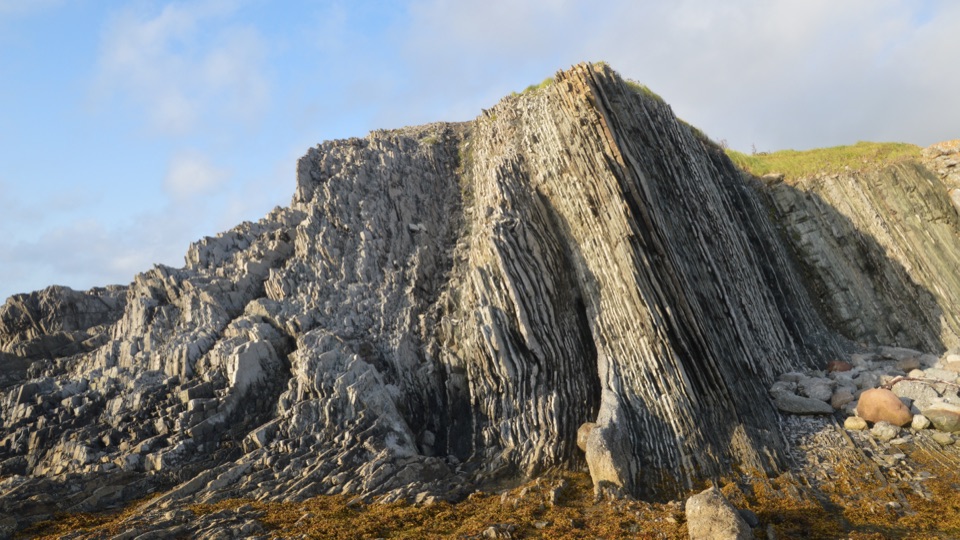
These layers began as sediment on an ocean floor almost 500 million years ago. Today the beds lean sharply, exposing a long stack of shale and limestone. Fossils within that stack let geologists identify a precise moment in the history of life, not just a general change in the rock.

Get down to the shoreA short path leads to the shoreline for close views of the tilted beds, and a separate path…

A short path leads to the shoreline for close views of the tilted beds, and a separate path above the point opens a view over the coast. Low tide is the best time to see the rock platform. Check the tide before you set out if the shore is the reason you're stopping; the cliff-top view still gives you the wider setting.

This is a good place to look slowly rather than plan a long hike. On the shore, the layers tip almost upright and break into ridges and slabs. From above, you can see how the exposed rock continues around the point. For a photo, get low beside the strata for their sharp angles, then take a second frame from the higher path to show the outcrop in its coastal setting.

The boundary is a fossil horizonThe Cambrian–Ordovician line here isn't a broad stripe painted across the cliff.

The Cambrian–Ordovician line here isn't a broad stripe painted across the cliff. Geologists fixed it at a specific fossil horizon inside Bed 23, associated with the first appearance of the tiny marine fossil Iapetognathus fluctivagus. In the measured rock section, the boundary sits 101.8 metres into the sequence. You don't have to spot the fossil to appreciate the idea: a wall of tilted stone holds a boundary that scientists use around the world to mark the beginning of a new period.

The section is more than 400 metres thick, and its beds are tilted roughly 60 to 70 degrees. The International Union of Geological Sciences approved Green Point as the global reference for the base of the Ordovician in 2000. That makes this more than a pretty shore walk; it is a place where a visible landscape and a very precise scientific marker meet.

Keep the visit simpleGreen Point is off Route 430, about 500 metres north of Green Point Campground.

Green Point is off Route 430, about 500 metres north of Green Point Campground. Parks Canada describes a short shoreline path and a cliff-top path, but a precise route length and grade aren't published in the material checked. The agency warns about falling rocks and the cliff edge, so stay back from the rim and don't linger below unstable rock.

The campground is a separate stop; its services shouldn't be assumed at the geological site. Parking details, toilets, drinking water, accessibility features, and food at the outcrop weren't verified. If those matter to your stop, check with Parks Canada before relying on them. The tide is the useful planning detail here; there's no need to turn the visit into a long hike to understand why this coast matters.

Wildlife

Wildlife in Gros Morne

All Gros Morne wildlife maps

Sighting maps show where each species has been reported across Gros Morne. Wildlife moves, so no sighting is guaranteed.

Parkwolf’s Gros Morne ranking

Top sights in Gros Morne

All 58 places
  1. 1Western Brook PondSight
  2. 2The TablelandsSight
  3. 3Gros Morne MountainSight
  4. 4Lobster Cove Head LighthouseSight
  5. 5Shallow Bay BeachBeach
  6. 6Broom Point Fishing PremisesSight

Take Parkwolf to Gros Morne.

The audio tour guide for the drive, plus offline maps, trails, and wildlife heatmaps for when the signal drops.

4.7 from 8,600+ ratings

Download Parkwolf on the App StoreGet Parkwolf on Google Play