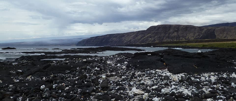
Keauhou Backcountry Campsite in Hawaiʻi Volcanoes National Park

Campground · Hawaiʻi Volcanoes National Park

Keauhou Backcountry Campsite

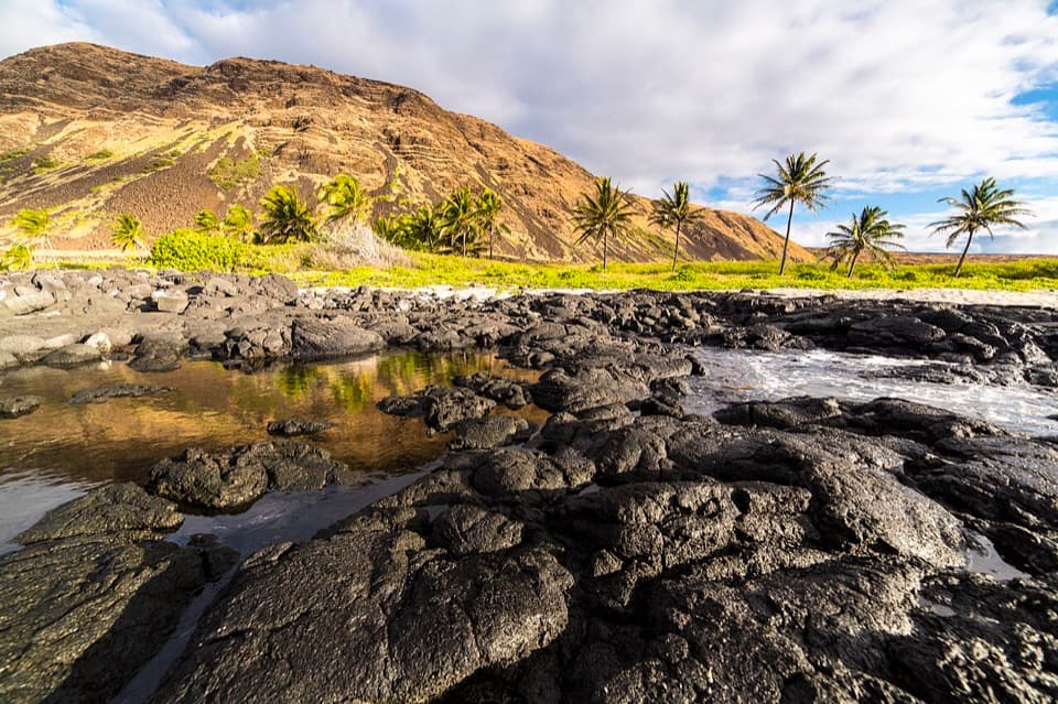
A primitive shelter and rocky bay reward a hard coastal hike.

Photo: National Park Service
Type
Campground
  • Restrooms

Hear the audio tour

Mau Loa o Maunaulu: Glassy Lava and a Long Trail

Overview

About Keauhou Backcountry Campsite

Why stop

  • A rocky bay where cold fresh water meets the sea.

Heads up

  • The long, exposed approach is hot and rocky, and the catchment tank may be empty.

Map

Where it is

Loading the Hawaiʻi Volcanoes map
Full map
CampgroundKeauhou Backcountry Campsite19.26865, -155.23119
Keep this map with you offline in the Parkwolf app

Plan your stop

Before you go

5 active Hawaiʻi Volcanoes alerts

  • ClosureStorm-damage closures at Kahuku, Kīpukapuaulu, and Sulphur BanksStorm damage and hazardous trees continue to restrict access at Kahuku and Kīpukapuaulu; the damaged Sulphur Banks Bridge is closed.Official details
  • ClosureWork closures on Hilina Pali and Mauna Loa roadsRoad work is restricting motorized and all-use access on portions of Hilina Pali Road and Mauna Loa Road.Official details

See all 5 alerts
A park ranger sits on a dash-mounted phone, talking, as Parkwolf’s Tour Guide plays “Army Cutworm Moths: A Grizzly Bear Buffet” on Grand Loop Road below Dunraven Pass in Yellowstone
Parkwolf Tour GuideThe highest, rockiest slopes around here are a summer buffet for grizzly bears.

Hawaiʻi Volcanoes Tour Guide

Your drive to Keauhou Backcountry Campsite, narrated.

Parkwolf is a GPS audio tour guide for Hawaiʻi Volcanoes National Park. As you drive, it chimes in with what’s ahead: hidden gems, upcoming stops, history, geology, and wildlife, right through your car’s speakers.

See the Hawaiʻi Volcanoes audio tour

Recorded for this place

Mau Loa o Maunaulu: Glassy Lava and a Long Trail
0:00 / 0:28
“You're nearing Mau Loa o Maunaulu, where you can look across the lava field straight from the pullout. Look uphill for Maunaulu's broad shield, the source of these flows.”

Plays as you drive up to Keauhou Backcountry Campsite in the Parkwolf Hawaiʻi Volcanoes Tour Guide.

More stories near here in the app

  • Muliwai a Pele: A Three-Day Lava River
  • One Park, Different Weather
  • Lava Stretched into Hair
  • Ferns for Mattress Stuffing
  • 58 audio storiesacross Hawaiʻi Volcanoes’s roads, triggered by GPS as you drive
  • Wildlife heatmapsfor Hawaiian Goose (Nēnē), Green Sea Turtle, Hawaiian Hawk ('Io), and 13 more
  • Works offlinemaps, 33 trails, 53 places, and audio download before you lose signal
  • CarPlay readysimple controls built for the drive
★★★★★
“Fantastic app with many points of information… It’s great to just turn on while you’re driving and it gives you an audio tour of the national Park. We love it!!!!”
JMJamesApp Store review
Download Parkwolf on the App StoreGet Parkwolf on Google Play

4.7 from 8,600+ ratings

Guide

More about Keauhou Backcountry Campsite

A planned overnight, not a quick coastal stopKeauhou is a remote backcountry campsite on the park’s southern coast, near a small rocky bay…

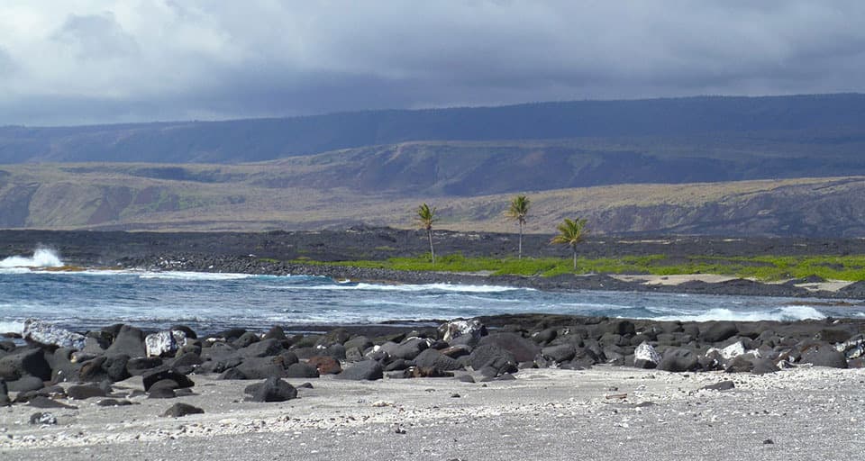
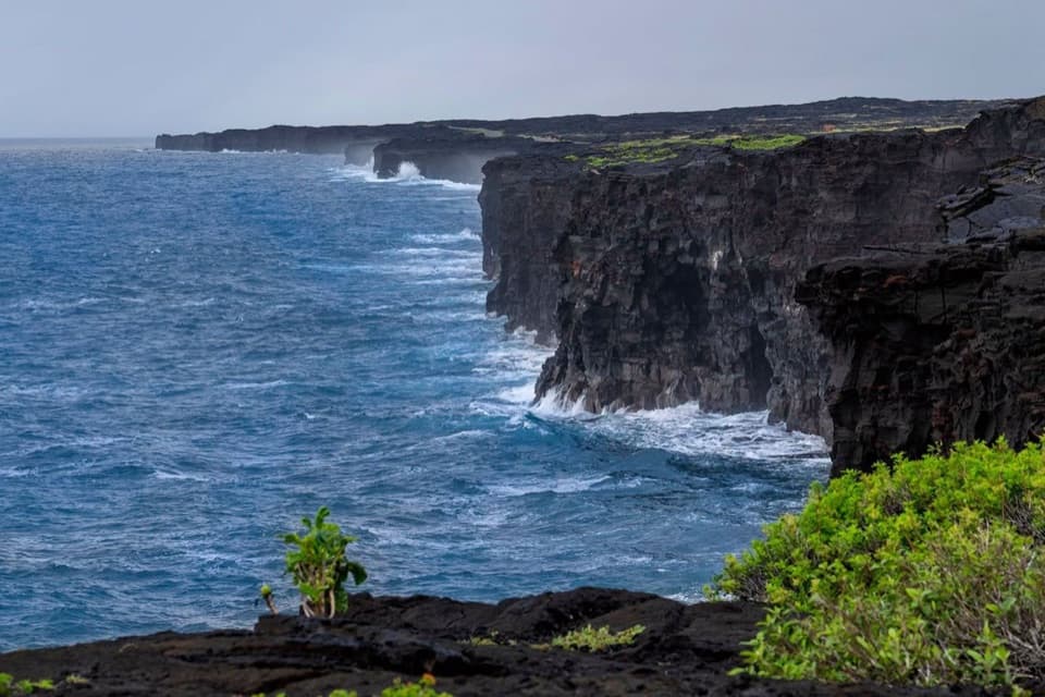
Keauhou is a remote backcountry campsite on the park’s southern coast, near a small rocky bay at the end of a long route across rough lava and grassland. The shortest approach is 7.6 miles from the Maunaulu trailhead via Keauhou Trail, reached from Chain of Craters Road; the elevation change from trailhead to camp can reach 3,000 feet. You need a backcountry permit. The site is limited to 16 hikers a night and three consecutive nights per site.

The camp is simpleA three-walled shelter gives shade, and the site has a composting toilet and a roof-fed…

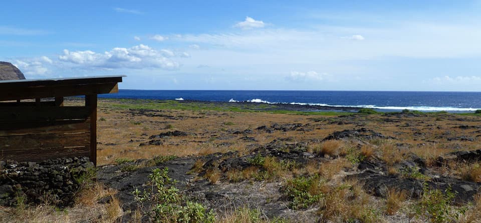
A three-walled shelter gives shade, and the site has a composting toilet and a roof-fed catchment tank. The tank may be empty, so check its level with rangers before setting out and treat any water you collect. There are no streams in this area. Carry at least four quarts of water per person a day; don't plan on topping up here.

Heat, footing and shorelineThe route is rocky, uneven and exposed.

The route is rocky, uneven and exposed. Stone cairns mark it and can be hard to see in rain or mist, and impossible to follow in darkness. Avoid hiking the coast during the hottest part of the day, roughly 10 a.m. to 2 p.m. At the shore, cold fresh water seeps to the surface and meets the sea in the rocky bay. Surf and currents along this coast are rough and unpredictable, so treat this as a place to camp and look, not an open-ocean swimming spot.

Wildlife

Wildlife in Hawaiʻi Volcanoes

All Hawaiʻi Volcanoes wildlife maps

Sighting maps show where each species has been reported across Hawaiʻi Volcanoes. Wildlife moves, so no sighting is guaranteed.

Parkwolf’s Hawaiʻi Volcanoes ranking

Top sights in Hawaiʻi Volcanoes

All 53 places
  1. 1UēkahunaSight
  2. 2Nāhuku Lava TubeSight
  3. 3Kīlauea OverlookSight
  4. 4Puʻuloa PetroglyphsSight
  5. 5Hōlei Sea ArchSight
  6. 6Kīlauea Iki OverlookSight

Take Parkwolf to Hawaiʻi Volcanoes.

The audio tour guide for the drive, plus offline maps, trails, and wildlife heatmaps for when the signal drops.

4.7 from 8,600+ ratings

Download Parkwolf on the App StoreGet Parkwolf on Google Play