Kaʻaha in Hawaiʻi Volcanoes National Park

Campground · Hawaiʻi Volcanoes National Park

Kaʻaha

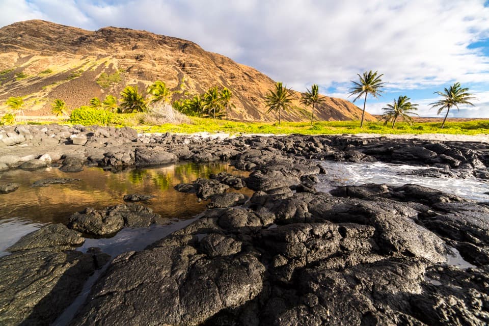
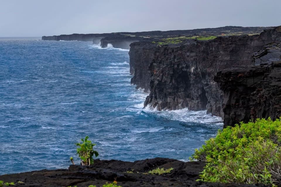
A remote coastal camp reached by a steep switchback descent.

Photo: National Park Service
Type
Campground
Nearest trail
2.3 mi
  • Restrooms

Hear the audio tour

Hilina Pali: The View Beyond the Shelter

Overview

About Kaʻaha

Why stop

  • A remote shoreline, primitive shelter and composting toilet.

Heads up

  • The steep, exposed 3.6-mile approach is a serious commitment.

Map

Where it is

Loading the Hawaiʻi Volcanoes map
Full map
CampgroundKaʻaha19.26196, -155.30367
Keep this map with you offline in the Parkwolf app

Plan your stop

Before you go

5 active Hawaiʻi Volcanoes alerts

  • ClosureWork closures on Hilina Pali and Mauna Loa roadsMentions Hilina Pali, referenced in this guideRoad work is restricting motorized and all-use access on portions of Hilina Pali Road and Mauna Loa Road.Official details
  • ClosureStorm-damage closures at Kahuku, Kīpukapuaulu, and Sulphur BanksStorm damage and hazardous trees continue to restrict access at Kahuku and Kīpukapuaulu; the damaged Sulphur Banks Bridge is closed.Official details

See all 5 alerts
A park ranger sits on a dash-mounted phone, talking, as Parkwolf’s Tour Guide plays “Army Cutworm Moths: A Grizzly Bear Buffet” on Grand Loop Road below Dunraven Pass in Yellowstone
Parkwolf Tour GuideThe highest, rockiest slopes around here are a summer buffet for grizzly bears.

Hawaiʻi Volcanoes Tour Guide

Your drive to Kaʻaha, narrated.

Parkwolf is a GPS audio tour guide for Hawaiʻi Volcanoes National Park. As you drive, it chimes in with what’s ahead: hidden gems, upcoming stops, history, geology, and wildlife, right through your car’s speakers.

See the Hawaiʻi Volcanoes audio tour

Recorded for this place

Hilina Pali: The View Beyond the Shelter
0:00 / 0:35
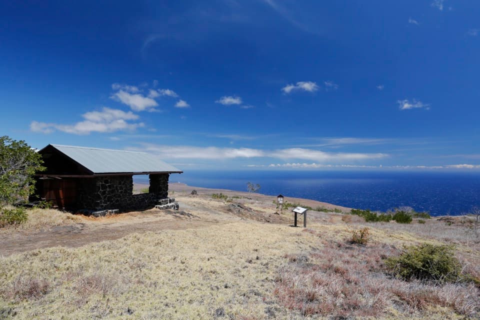
“Hilina Pali Overlook is ahead, high above the Pacific coast. For the fullest view, follow the short grass path beyond the stone shelter to the rocky outcrop and orientation plate.”

Plays as you drive up to Kaʻaha in the Parkwolf Hawaiʻi Volcanoes Tour Guide.

More stories near here in the app

  • Lava Stretched into Hair
  • When the Coast Dropped
  • Ferns for Mattress Stuffing
  • Kulanaokuaiki: A Basic Walk-In Camp
  • 58 audio storiesacross Hawaiʻi Volcanoes’s roads, triggered by GPS as you drive
  • Wildlife heatmapsfor Hawaiian Goose (Nēnē), Green Sea Turtle, Hawaiian Hawk ('Io), and 13 more
  • Works offlinemaps, 33 trails, 53 places, and audio download before you lose signal
  • CarPlay readysimple controls built for the drive
★★★★★
“Fantastic app with many points of information… It’s great to just turn on while you’re driving and it gives you an audio tour of the national Park. We love it!!!!”
JMJamesApp Store review
Download Parkwolf on the App StoreGet Parkwolf on Google Play

4.7 from 8,600+ ratings

Guide

More about Kaʻaha

A remote campsite below the paliKaʻaha is a remote backcountry campsite and coastal cove on the park’s south shore, with a…

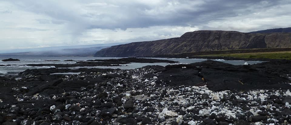
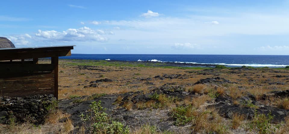
Kaʻaha is a remote backcountry campsite and coastal cove on the park’s south shore, with a simple three-walled shelter near the rocky shoreline. From the Hilina Pali Overlook Trailhead, the main approach is 3.6 miles one way. It drops down the pali on steep switchbacks, then crosses open coastal flats. Choose it for a quiet night by the ocean; it is a poor fit for a quick coastal stop or a shaded walk.

Plan for a self-contained overnightBackcountry camping here requires a permit.

Backcountry camping here requires a permit. The primitive shelter has a composting toilet and a roof-fed catchment tank, but tank water is not always available. Ask a ranger about the level, treat any water you collect, and carry at least four quarts per person per day. Hikers must pack out everything they bring.

An exposed coastal walkThere is no tree shade along this coast, and sun, wind and heat can be intense.

There is no tree shade along this coast, and sun, wind and heat can be intense. The park advises against hiking coastal trails during the hottest part of the day, roughly 10 a.m. to 2 p.m., and warns that surf and currents can be rough and unpredictable. If you continue west along the coast, unexploded World War II ammunition may be present; leave anything suspicious alone.

Traces of earlier settlementSmall communities once lived along this dry coast.

Small communities once lived along this dry coast. Archaeological traces recorded in the area include agricultural pits used to grow sweet potatoes, house sites, petroglyphs and a papamu stone game board.

Wildlife

Wildlife in Hawaiʻi Volcanoes

All Hawaiʻi Volcanoes wildlife maps

Sighting maps show where each species has been reported across Hawaiʻi Volcanoes. Wildlife moves, so no sighting is guaranteed.

Parkwolf’s Hawaiʻi Volcanoes ranking

Top sights in Hawaiʻi Volcanoes

All 53 places
  1. 1UēkahunaSight
  2. 2Nāhuku Lava TubeSight
  3. 3Kīlauea OverlookSight
  4. 4Puʻuloa PetroglyphsSight
  5. 5Hōlei Sea ArchSight
  6. 6Kīlauea Iki OverlookSight

Take Parkwolf to Hawaiʻi Volcanoes.

The audio tour guide for the drive, plus offline maps, trails, and wildlife heatmaps for when the signal drops.

4.7 from 8,600+ ratings

Download Parkwolf on the App StoreGet Parkwolf on Google Play