
Place · 0.5 mi away
Easy
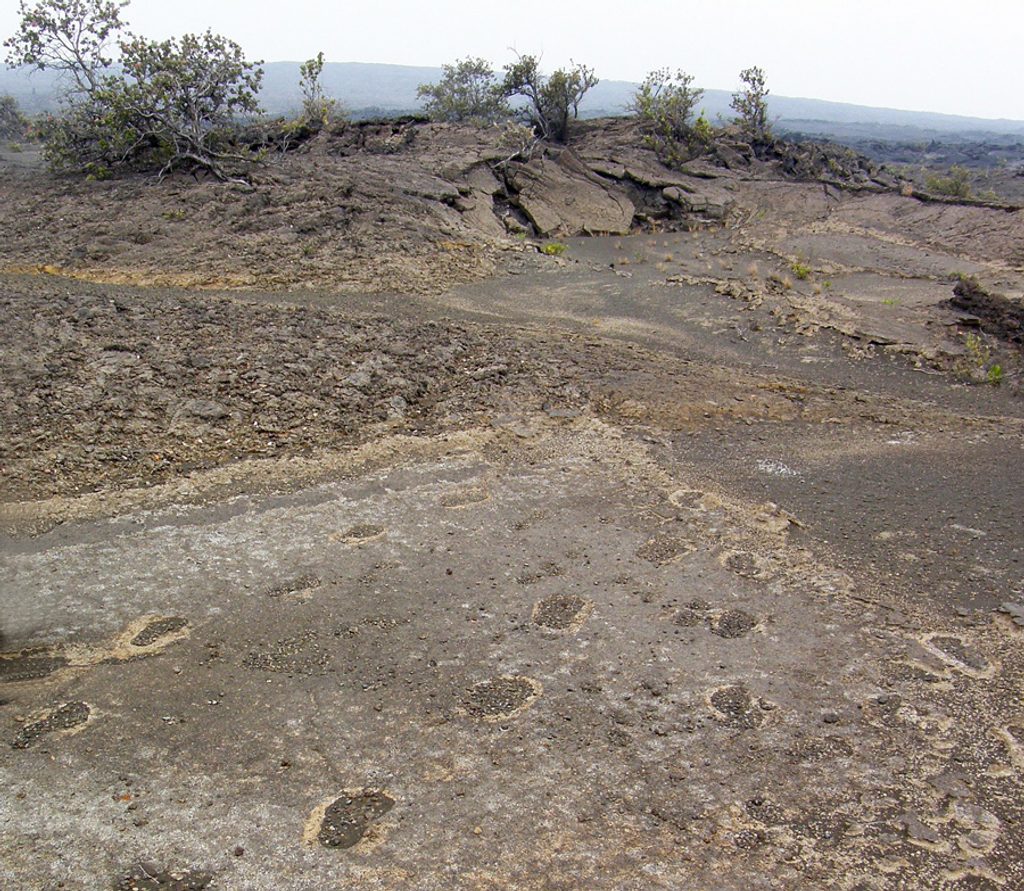
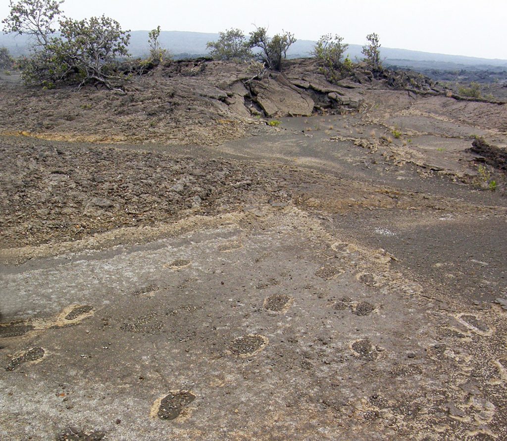
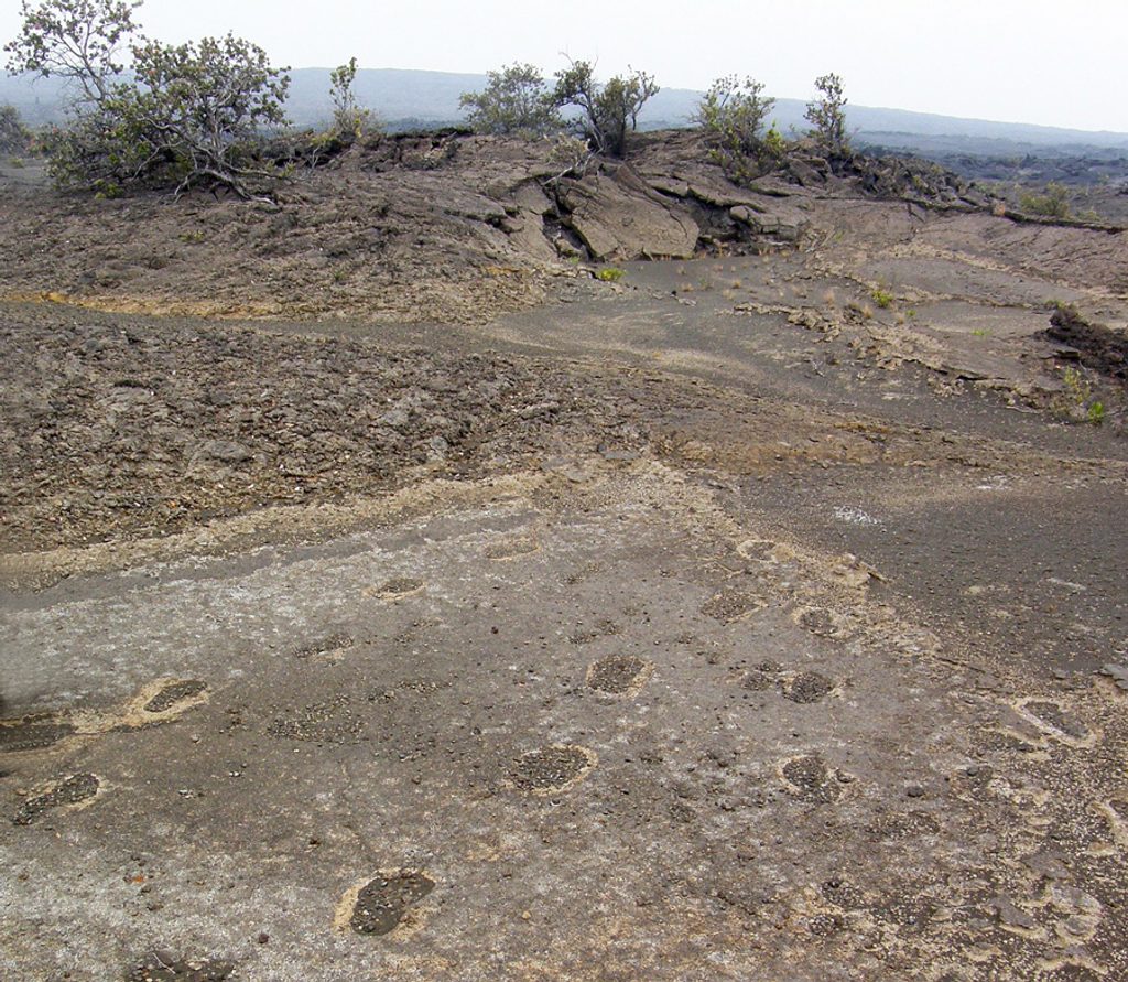
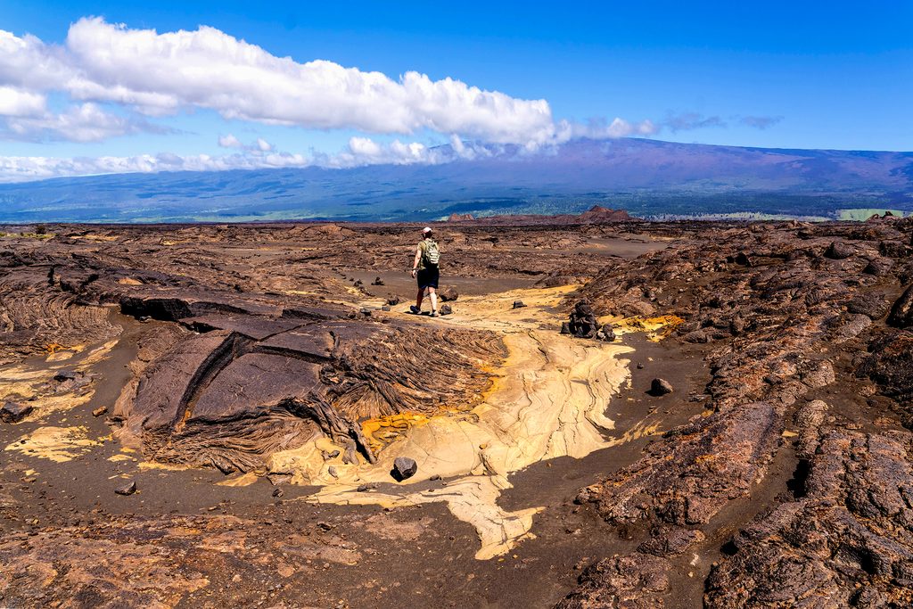
A surreal, wide‑open sweep of the Kaʻū Desert: windblown volcanic ash, rippling pāhoehoe lava, and a few stunted ʻōhiʻa trees that look bonsai‑like. The star is the field of human footprints—impressions left in wet ash during Kīlauea’s 1790 activity—protected by a small shelter. Because sand shifts, some of the clearest prints are often just outside the shelter.
From the Kaʻū Desert Trailhead on Highway 11, follow cairns across ash flats and lava to the footprint shelter. It’s about 0.8 miles one way (roughly 1.6 miles total, out‑and‑back), mostly flat and easy. If you’re feeling it, you can continue beyond the shelter on the Kaʻū Desert Trail into more rugged backcountry; a common longer out‑and‑back variant is about 3.9 miles total.
This is less a “scenic stroll” and more a quietly powerful walk through recent volcanic history. It feels remote and exposed, with little to no shade and strong winds at times. The trail is easy to follow by cairns, but the landscape can be disorienting if fog or weather rolls in. Expect gritty ash underfoot and some uneven lava—sturdy shoes help.
Bring plenty of water, sun protection, and a light rain layer—weather turns quickly out here. There are no services at the trailhead (no water or restrooms). Take a few minutes to wander the ash flats near the shelter; wind often uncovers better‑defined prints. Pets aren’t allowed, and no special permit is needed beyond the park entrance fee.
Year‑round. Go early or late for cooler temps and softer light across the ash and lava textures. Midday can be hot and harsh, and winds may pick up in the afternoon.
Past the shelter, the Kaʻū Desert Trail continues across older and newer flows toward the Mauna Iki area. It’s more remote and committing—only continue if you’re prepared for a longer, exposed day and careful navigation between cairns.
Park at the Kaʻū Desert Trailhead on Highway 11; marked trailhead with basic signage. No restrooms or water—plan to be self‑sufficient.
Full sun exposure and strong winds; follow cairns to avoid drifting off route. Rough lava and deep ash in spots; no services and limited cell coverage—carry ample water and protection.
Place · 0.5 mi away
Place · 1.7 mi away
Place · 6 mi away
Place · 6.1 mi away
Easy · 0 mi away
Moderate · 0 mi away
Challenging · 6.3 mi away
Easy · 6.3 mi away

Parkwolf Tour Guide
