Rick's Pond and Stonebridge Area in Hot Springs National Park

Sight · Hot Springs National Park

Rick's Pond and Stonebridge Area

A pond-side stop for stone bridges and an old waterwheel's story.

Photo: National Park Service
Type
Sight
Nearest trail
0.7 mi
Audio stories
9 nearby
  • Parking
  • Exhibit
  • Scenic viewpoint
  • Trailhead

Hear the audio tour

Rick's Pond: Stonework and Estate History

Overview

About Rick's Pond and Stonebridge Area

Why stop

  • Historic pond, terraced dam, and stone bridges in one stop.

Heads up

  • The hilltop house and 17 acres above the pond are private.

Map

Where it is

Loading the Hot Springs map
Full map
SightRick's Pond and Stonebridge Area34.53740, -93.03396
Keep this map with you offline in the Parkwolf app

Plan your stop

Before you go

2 active Hot Springs alerts

  • CautionPark-wide burn ban in effectA park-wide burn ban is in effect because of high fire danger. - The ban was enacted on August 15, 2026.Official details
  • ClosureMaurice Bathhouse closed for renovationsThe Maurice Bathhouse is currently closed for renovations. - Do not plan to use the building during your visit. Check current Bathhouse Row status before visiting.Official details

Hot Springs alerts
A park ranger sits on a dash-mounted phone, talking, as Parkwolf’s Tour Guide plays “Army Cutworm Moths: A Grizzly Bear Buffet” on Grand Loop Road below Dunraven Pass in Yellowstone
Parkwolf Tour GuideThe highest, rockiest slopes around here are a summer buffet for grizzly bears.

Hot Springs Tour Guide

Your drive to Rick's Pond and Stonebridge Area, narrated.

Parkwolf is a GPS audio tour guide for Hot Springs National Park. As you drive, it chimes in with what’s ahead: hidden gems, upcoming stops, history, geology, and wildlife, right through your car’s speakers.

Recorded for this place

Rick's Pond: Stonework and Estate History
0:00 / 0:24
“Rick's Pond, also called the Stonebridge Area, is ahead. John Fordyce dammed the creek to make this pond for his wife Lillian, and the estate's water wheel generated electricity for the house.”

Plays as you drive up to Rick's Pond and Stonebridge Area in the Parkwolf Hot Springs Tour Guide.

More stories near here in the app

  • North Mountain Overlook and Goat Rock
  • A Woodpecker Leaves a Clue
  • Gulpha Gorge: A Creekside Picnic
  • North Mountain Shelter: Down to Gulpha Creek
  • 18 audio storiesacross Hot Springs’s roads, triggered by GPS as you drive
  • Wildlife heatmapsfor White-tailed Deer, Groundhog, Mexican Long-nosed Armadillo, and 13 more
  • Works offlinemaps, 19 trails, 33 places, and audio download before you lose signal
  • CarPlay readysimple controls built for the drive
★★★★★
“Fantastic app with many points of information… It’s great to just turn on while you’re driving and it gives you an audio tour of the national Park. We love it!!!!”
JMJamesApp Store review
Download Parkwolf on the App StoreGet Parkwolf on Google Play

4.7 from 8,600+ ratings

Guide

More about Rick's Pond and Stonebridge Area

Rick's Pond and StonebridgeRick's Pond, also called the Stonebridge Area, is a wooded pond-and-dam stop in the former…

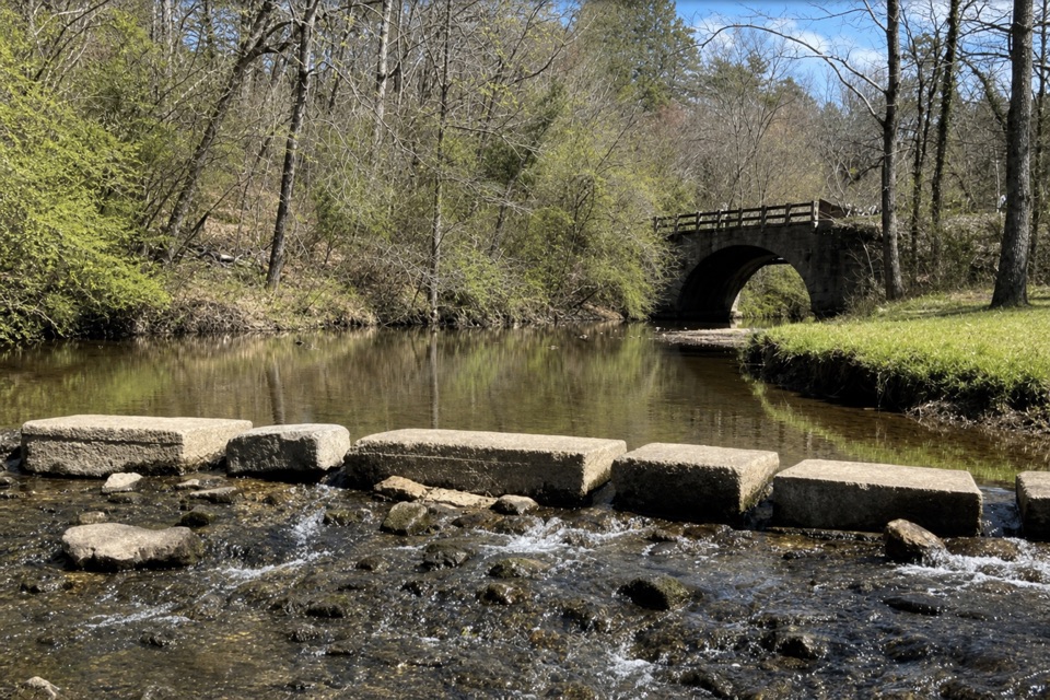
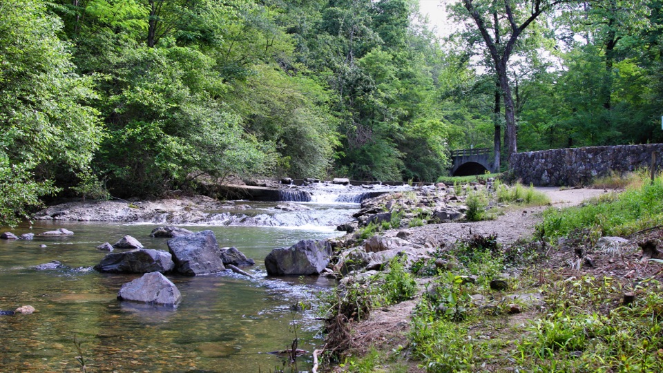
Rick's Pond, also called the Stonebridge Area, is a wooded pond-and-dam stop in the former Fordyce-Ricks estate. The stonework and old water system make it worth a brief pause if you like history built into a landscape. From Park Avenue, turn onto Stonebridge Road; the pond and a parking area are on the left. Keep to the public pond area: the hilltop house and its 17 acres are private.

A pond made for LillianAfter inheriting the property, John Fordyce dammed the creek to make a pond for his wife…

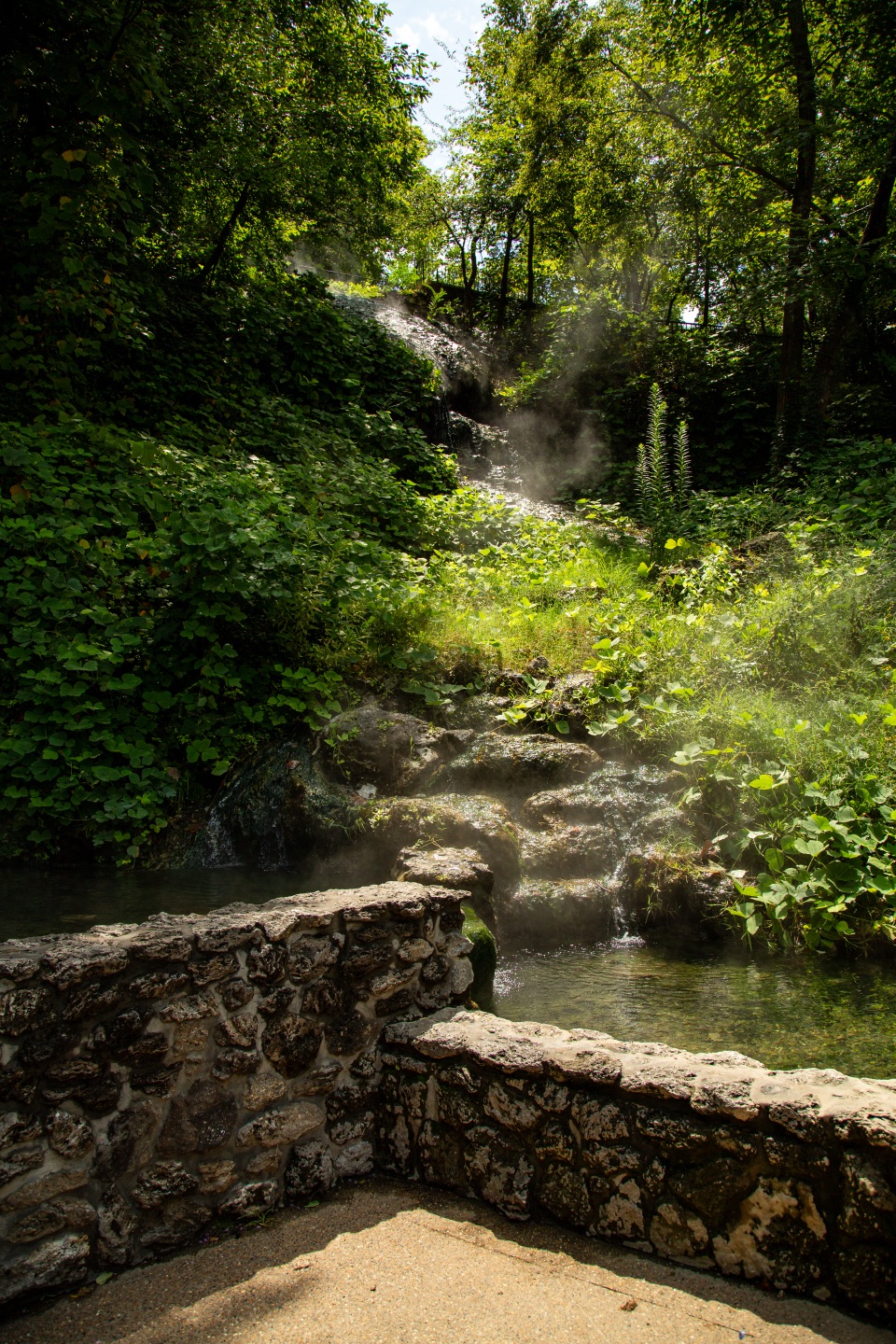
After inheriting the property, John Fordyce dammed the creek to make a pond for his wife Lillian, first named Lake Lillian. The estate also had large and small stone bridges, a boathouse, and a water wheel that generated electricity for the house. The dam was part of the estate's water and power system, not just a decorative feature.

The estate above itSamuel W. Fordyce bought about 1,200 acres here in 1878.

Samuel W. Fordyce bought about 1,200 acres here in 1878. He later commissioned a rustic Adirondack-style log house called The Cabin, completed by 1909. The pond and bridge area is the public-facing piece; the house and 17 hilltop acres remain privately owned.

Start at the pondThere's auto parking beside the pond, plus interpretive information and a trailhead.

There's auto parking beside the pond, plus interpretive information and a trailhead. The park material doesn't give a trail length or surface, so come for the waterworks and stonework rather than planning a defined hike.

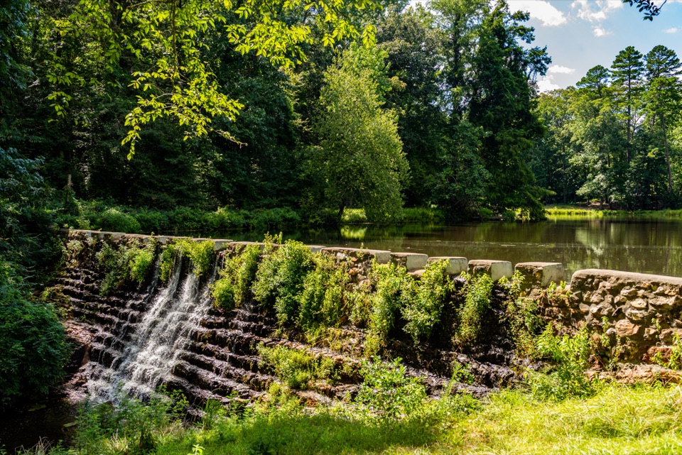
What to photographThe terraced stone dam lets you frame the falling water with the pond just beyond it.

The terraced stone dam lets you frame the falling water with the pond just beyond it. The stone bridge gives you a second distinctive detail to look for.

Wildlife

Wildlife in Hot Springs

All Hot Springs wildlife maps

Sighting maps show where each species has been reported across Hot Springs. Wildlife moves, so no sighting is guaranteed.

Keep exploring

Near Rick's Pond and Stonebridge Area

See it all on the map

Trails nearby

More stops nearby

Parkwolf’s Hot Springs ranking

Top sights in Hot Springs

All 33 places
  1. 1Fordyce Bathhouse Visitor Center and MuseumSight
  2. 2Buckstaff BathhouseSight
  3. 3Quapaw Baths & SpaSight
  4. 4Hot Springs Mountain TowerSight
  5. 5Hot Water CascadeSight
  6. 6Display SpringSight

Take Parkwolf to Hot Springs.

The audio tour guide for the drive, plus offline maps, trails, and wildlife heatmaps for when the signal drops.

4.7 from 8,600+ ratings

Download Parkwolf on the App StoreGet Parkwolf on Google Play