Hoosier Prairie Accessible Trail in Indiana Dunes National Park

Indiana Dunes National Park, IN

Hoosier Prairie Accessible Trail

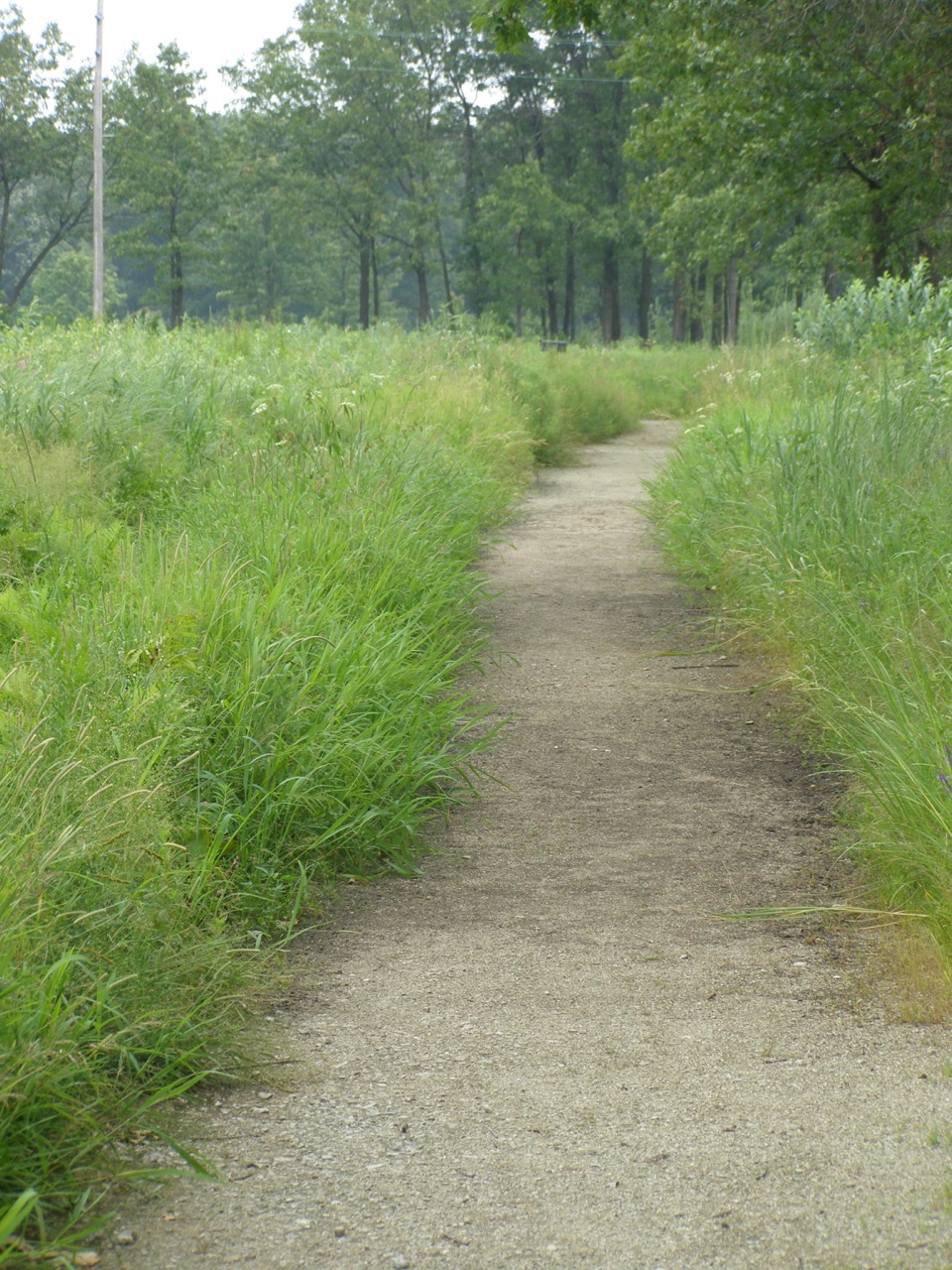
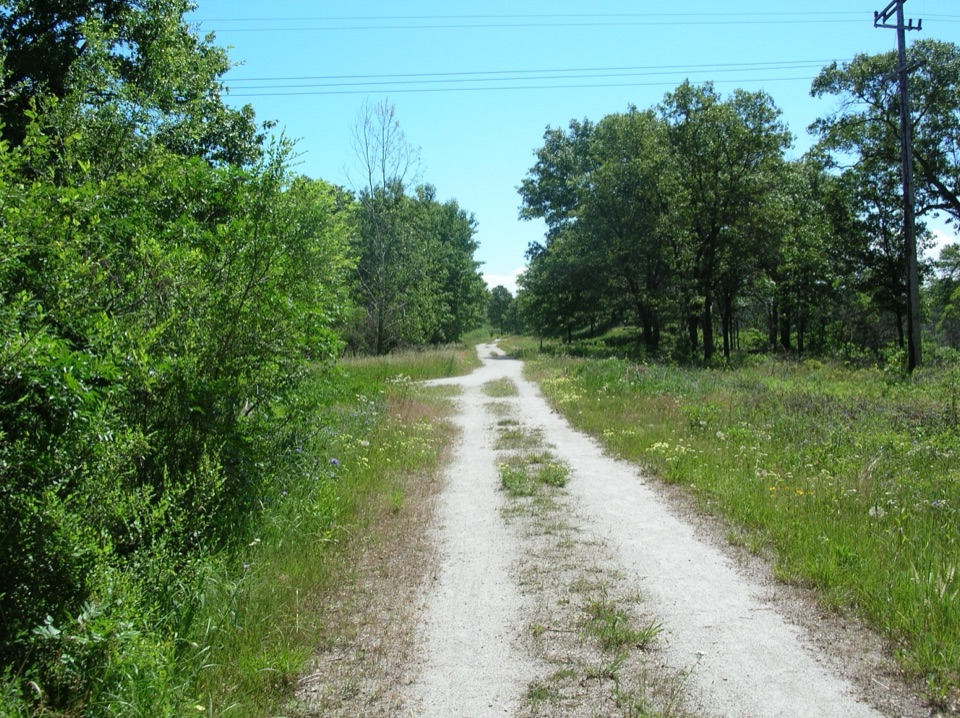
A flat gravel path opens a short window into rare prairie.

Length
0.2mi
Time
12min
Elevation
Flat
Difficulty
Easy
  • Dogs allowed
  • High point 627 ft

Hear the audio tour

Hoosier Prairie: A Short Walk Through Three Habitats

Overview

About Hoosier Prairie Accessible Trail

Why go

  • Flat crushed-gravel access for a brief prairie outing
  • A quick look at one of Indiana’s rare prairie remnants

Heads up

  • Very short out-and-back; the longer circuit continues on mixed surfaces
Hoosier Prairie became both a State Nature Preserve and a National Natural Landmark in 1977. A decade-long campaign led by Irene Herlocker-Meyer helped save it from development. Fire once kept trees from overtaking prairie plants; carefully controlled burns now help maintain the open habitat. Dogs are allowed on a leash no longer than six feet. Ticks are present year-round, and poison ivy can grow along trail edges. Paper maps are available at the trailhead kiosk; there is no restroom or potable water at the lot.
Parkwolf’s verdictWhy this prairie survived

Map & elevation

The route

Loading the Indiana Dunes map
Full map
Elevation617–627 ft
TrailheadHoosier Prairie Parking Lot41.52276, -87.45757
Keep this map with you offline in the Parkwolf app

Plan your hike

Before you go

Parking

Use Hoosier Prairie Parking Lot, east of U.S. 41 on Main Street (E 53rd Avenue) in Schererville. The gravel lot is at the trailhead; no pass is required. There is no restroom or potable water at the lot, and paper maps are available at the kiosk.

Safety

Ticks are present year-round, and poison ivy may grow along the trail edge. Stay on the marked tread and respect closed-area signs to protect fragile habitat.

4 active Indiana Dunes alerts

  • ClosureTrail closures and flooding-related access limitsSeveral Indiana Dunes trails are closed or partially inaccessible because of tree damage, riverbank collapse, flooding, and Marquette Greenway construction; stay out of closed sections and use…Official details
  • ClosureBailly/Chellberg Trail stair sections closedPortions of the Bailly/Chellberg Trail with stairs are closed through October 30, 2026, to allow completion of a boardwalk replacement project. Check current park conditions before setting out.Official details
See all 4 alerts
A park ranger sits on a dash-mounted phone, talking, as Parkwolf’s Tour Guide plays “Army Cutworm Moths: A Grizzly Bear Buffet” on Grand Loop Road below Dunraven Pass in Yellowstone
Parkwolf Tour GuideThe highest, rockiest slopes around here are a summer buffet for grizzly bears.

Indiana Dunes Tour Guide

Your drive to Hoosier Prairie Accessible Trail, narrated.

Parkwolf is a GPS audio tour guide for Indiana Dunes National Park. As you drive, it chimes in with what’s ahead: hidden gems, upcoming stops, history, geology, and wildlife, right through your car’s speakers.

Recorded for this trailhead

Hoosier Prairie: A Short Walk Through Three Habitats
0:00 / 0:27
“You're approaching Hoosier Prairie, where a short walk links dry prairie, marsh and scattered oaks.”

Plays as you drive up to this trailhead in the Parkwolf Indiana Dunes Tour Guide.

  • 51 audio storiesacross Indiana Dunes’s roads, triggered by GPS as you drive
  • Wildlife heatmapsfor Bald Eagle, Sandhill Crane, White-tailed Deer, and 13 more
  • Works offlinemaps, 34 trails, 30 places, and audio download before you lose signal
  • CarPlay readysimple controls built for the drive
★★★★★
“Fantastic app with many points of information… It’s great to just turn on while you’re driving and it gives you an audio tour of the national Park. We love it!!!!”
JMJamesApp Store review
Download Parkwolf on the App StoreGet Parkwolf on Google Play

4.7 from 8,600+ ratings

Trail guide

Hiking Hoosier Prairie Accessible Trail

A short, level prairie walkHoosier Prairie Accessible Trail is the flat, crushed-gravel opening stretch of the Hoosier…

Hoosier Prairie Accessible Trail is the flat, crushed-gravel opening stretch of the Hoosier Prairie trail system. Walk south from the parking lot to the junction with Prairie Marsh Trail, then return on the same path. The best-supported distance for this stand-alone out-and-back is about 0.15 mile; allow 10 to 15 minutes with a stop. It is the quick, level way to see the preserve rather than a substitute name for the longer hike.

Where the accessible stretch endsThe gravel route ends where the natural-surface Prairie Marsh section begins.

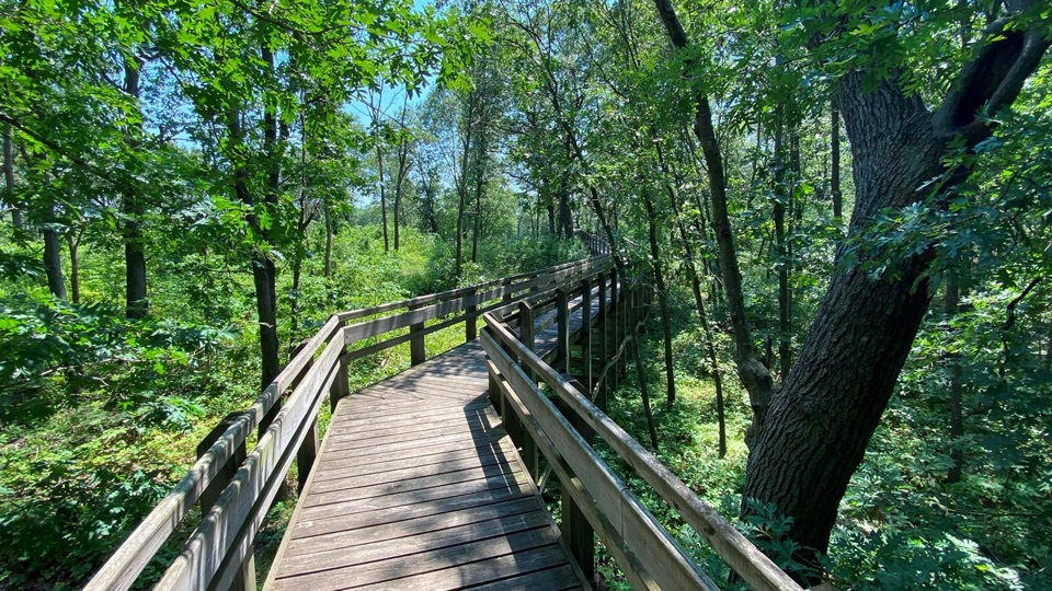
The gravel route ends where the natural-surface Prairie Marsh section begins. The full featured hike continues through Prairie Marsh and the Savanna loop for about 0.7 mile, on a mix of loose sand, packed dirt and gravel. The accessible designation applies to this flat opening section only; it does not establish that the longer circuit is accessible. The trail map marks a wheelchair-accessible side access along the route, but its length and exact view are not specified, so it is not included in the mapped main line.

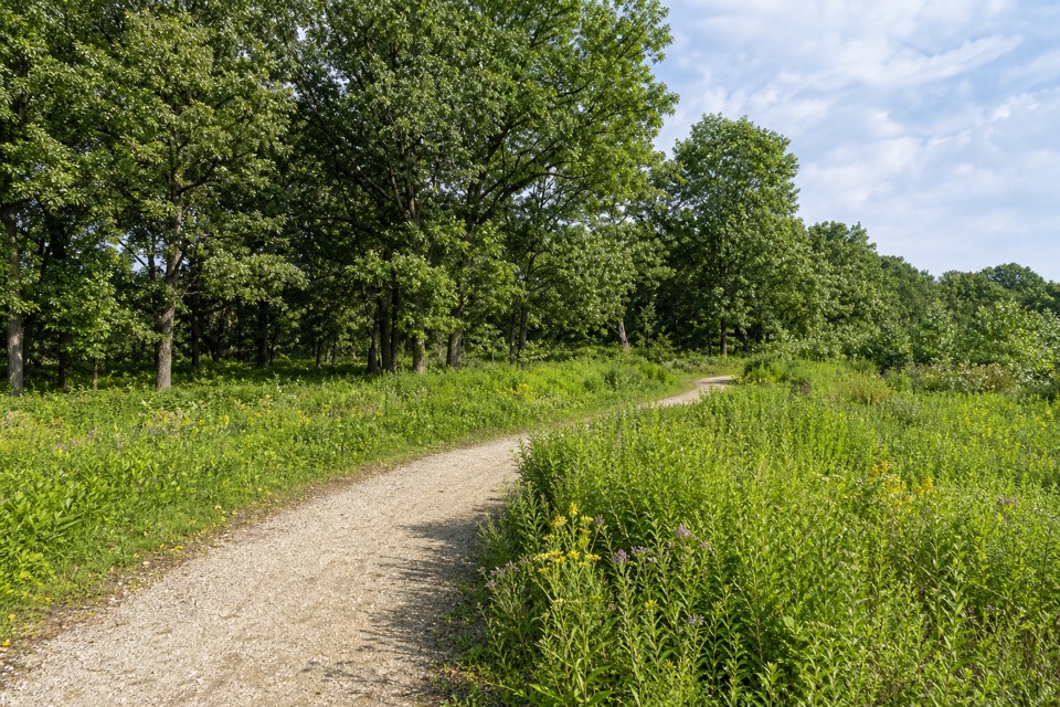
A patchwork of prairie habitatsThe preserve changes with the ground: dry black-oak savanna grows on sandy rises, mesic prairie…

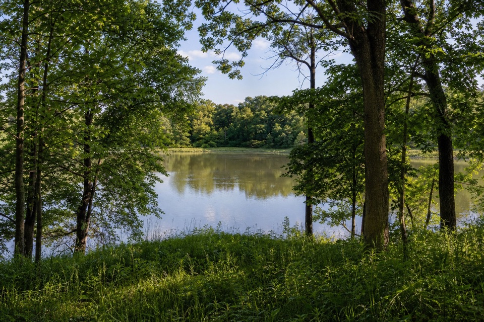
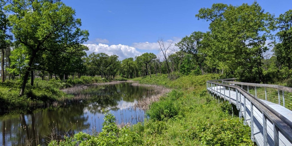
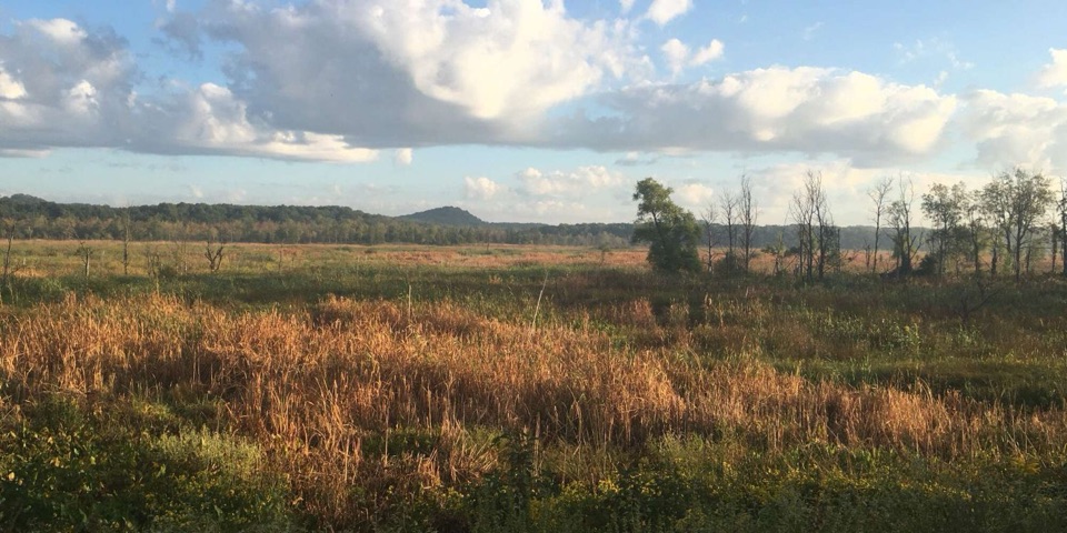
The preserve changes with the ground: dry black-oak savanna grows on sandy rises, mesic prairie sits on slopes, and wet prairie, sedge meadow and marsh occupy the lower ground. Hoosier Prairie supports more than 350 native plant species, including dozens uncommon or rare in Indiana. Stay on the gravel tread and respect closed-area signs; walking into the vegetation damages fragile habitat.

Wildlife

Wildlife in Indiana Dunes

All Indiana Dunes wildlife maps

Sighting maps show where each species has been reported across Indiana Dunes. Wildlife moves, so no sighting is guaranteed.

Parkwolf’s Indiana Dunes ranking

Top-rated trails in Indiana Dunes

All 34 trails
  1. 1Cowles Bog TrailModerate · 4.7 mi
  2. 2Dune Succession TrailModerate · 0.9 mi
  3. 3Paul H. Douglas Trail (Miller Woods)Moderate · 3.4 mi
  4. 4West Beach 3-Loop TrailModerate · 3.4 mi
  5. 5Mount Baldy Beach TrailModerate · 0.8 mi
  6. 6Dune Ridge TrailModerate · 0.7 mi

Take Parkwolf to Indiana Dunes.

The audio tour guide for the drive, plus offline maps, trails, and wildlife heatmaps for when the signal drops.

4.7 from 8,600+ ratings

Download Parkwolf on the App StoreGet Parkwolf on Google Play