
Place
Easy
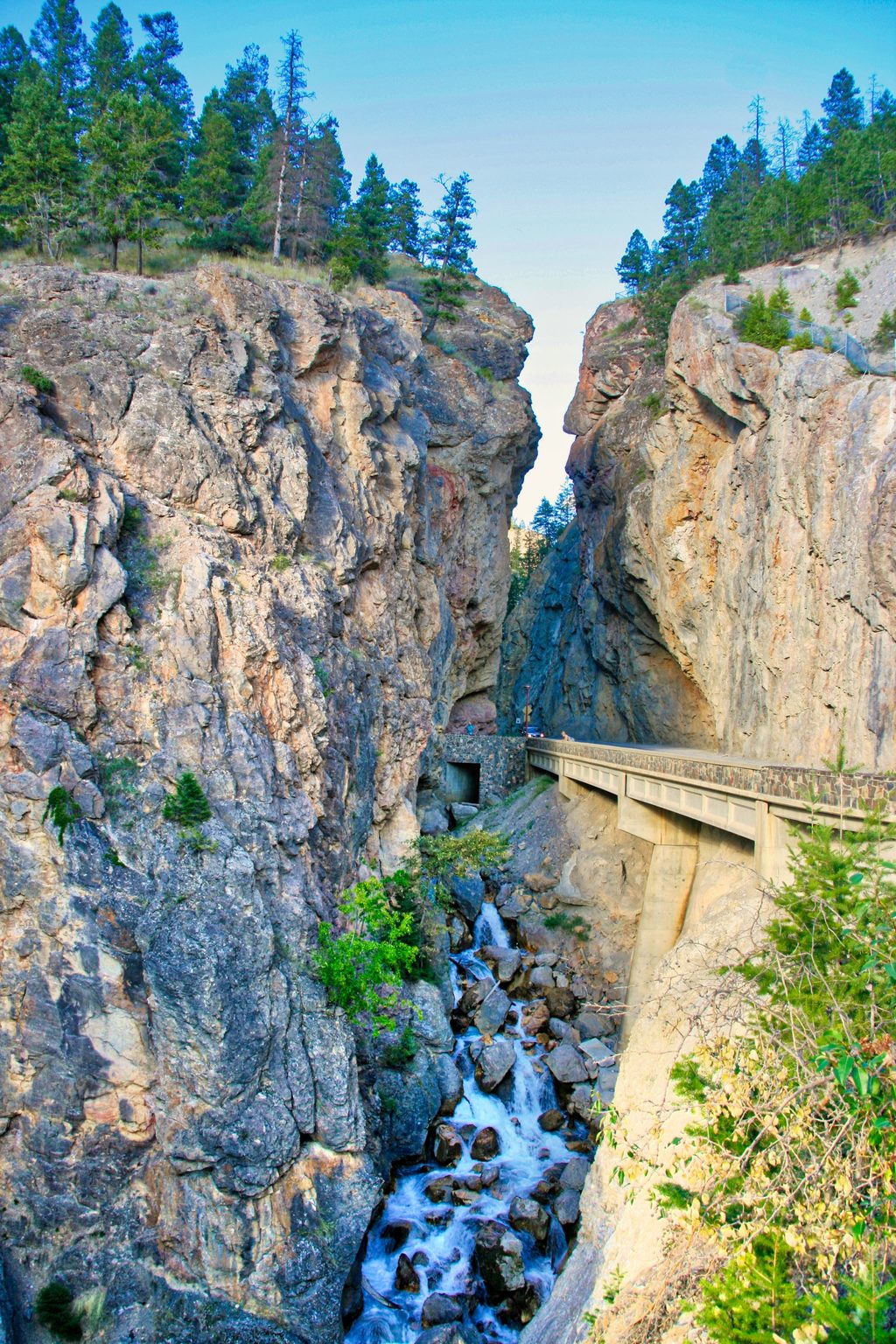
This rim-and-canyon walk hugs the west entrance of Kootenay’s Sinclair Canyon, delivering frequent lookouts over the Columbia Valley and peeks into the gorge. Officially, the Juniper / Sinclair Canyon route is 2.6 km one way (about 1.6 miles) between trailheads, taking about 2 hours return, with roughly 350 m of elevation gain and 260 m of loss in one direction. It’s easy to moderately easy overall—well graded, but expect some sustained climbing and stairs—and the big trade‑off is persistent highway noise from nearby 93/95.
You can hike it as an out‑and‑back or link paths into a popular loop of about 6.4 km (~4 miles), typically 2.5–3 hours. Starting above the Radium Hot Springs pools, you pass through a wildlife tunnel, then climb switchbacks (the first ~100 m of gain comes quickly) before traversing pleasant open forest. Near Redstreak Campground, viewpoints pop up; a spur drops to Sinclair Creek for a look at the small falls, then the north side climbs back toward the West Gate with more canyon vistas. Clockwise or counter‑clockwise both work.
Expect open Douglas‑fir forest on arid slopes, striking chalky banks stitched together by roots and moss, and repeated windows into Sinclair Canyon. From the north side, you’ll glance across the Columbia Valley and even straight down to the highway in places. Bighorn sheep sometimes tiptoe across the gravelly bluffs. In August, keep an eye out for wild raspberries along the route.
This is a shoulder‑season star when higher alpine routes are snowed in. Summer brings the most stable footing (and berries), while winter conditions can leave snow or ice on the trail—check current conditions and bring traction if needed. The loop’s varied viewpoints make it rewarding in most weather, but wind can funnel through the canyon and the road noise is a constant.
Trailheads sit just inside the park’s West Gate and above the Radium Hot Springs pools; parking is available at Radium Hot Springs, and there’s a restroom at the trailhead area. Dogs are allowed on leash. A Parks Canada entry pass is required to visit the park. Bring bear spray, give wildlife space, and mind the steep, friable edges—stay back from drop‑offs. Use the wildlife tunnel and be cautious where the route approaches or crosses the road for canyon viewpoints.
Park above the Radium Hot Springs pools or in the small lot just inside the West Gate; signed access with a restroom at the Radium Hot Springs trailhead.
Steep, friable canyon edges and stairs; use the wildlife tunnel and be careful near any road crossings. Expect highway noise; carry bear spray and give bighorn sheep space. In winter, snow or ice may require traction.
Place
Place
Place
Place
Challenging
Moderate
Challenging
Challenging

Parkwolf Tour Guide
