

Place · 11.4 mi away
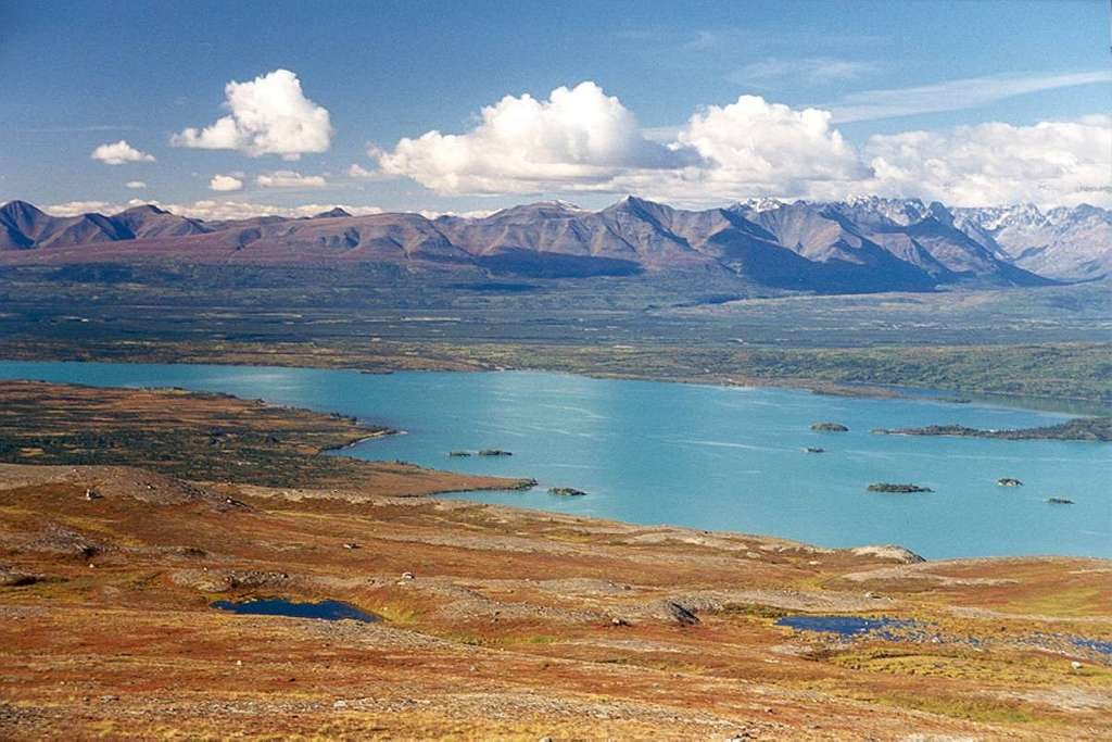
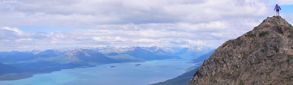
Telaquana Lake is classic Alaska backcountry: a big, blue, glacier-fed lake ringed by mountains and tundra, with no roads, no trails, and almost no people. Most visitors use it as a jump-off for the Telaquana Route toward Turquoise and Twin Lakes. Expect a committing, self-supported experience and world-class quiet.
There are no trailheads or parking here—summer access is by float or amphibious plane, and the shoreline is undeveloped. From a mid-lake drop, you’ll punch through dense brush for a few hours before reaching alpine where travel, water, and camps improve. Above treeline, tundra walking and route-finding over ridges/valleys take over; below it, alder thickets, tussocks, and bugs slow everything down.
This traverse is fully off-trail and strenuous. Expect steep, loose descents in places and several significant water features. Glacial creeks run silty and swell through the day—cross earlier when possible. Heat waves can dry up small ponds and seeps, so don’t trust every blue dot on a map; favor clear side-streams. Near Turquoise Lake, brush and mosquitoes intensify close to shore, with only a handful of flat camps.
Key crossings on the broader route include the Mulchatna and other named rivers; timing matters. Plan ford attempts in the morning when flows are lower, carry extra capacity, and bring a prefilter plus chemical/UV backup for silty sources. A critical note from local guidance: the Mulchatna is typically safest to ford upstream of the first major south-side tributary a short distance below Turquoise—build that into your line. Once you gain alpine from mid-lake Telaquana, camps and drinking water options are generally better.
You’re traveling in the footsteps of the Dena’ina. The Telaquana trail corridor is a historic route once used for travel and subsistence and later tied to fur trading. Modern backpackers follow pieces of this line on the way between Telaquana, Turquoise, and the Twin Lakes country.
This is brown and black bear country. Proper food storage is required in many areas, and backcountry etiquette is non-negotiable here. Bear-resistant canisters are the norm for this trip; plan ahead for how you’ll carry and store food.
Summer can be surprisingly hot—90°F isn’t out of the question—making mid-day travel punishing and water management more critical. Katabatic winds can pour off nearby ice, so carry layers for sudden cold even in July. Sun exposure is real above treeline, while brushy sections concentrate mosquitoes; a head net and sunscreen pay off.
Most parties come in summer when floatplanes can land. For river management, lower flows are often found in May–June and again in mid-August. Travel early and late to avoid heat and to time easier glacial fords. Crowds are a non-issue; your main constraints are weather windows and flight logistics.
Place · 11.4 mi away
Place · 19.8 mi away
Place · 21.3 mi away
Place · 21.8 mi away
Challenging · 54 mi away
Moderate · 54 mi away
Easy · 54 mi away
Easy · 54 mi away

Parkwolf Tour Guide
