Portage Creek Trail in Lake Clark National Park

#5 of 5 trails in Lake Clark

Lake Clark National Park, AK

Portage Creek Trail

A remote climb from Lake Clark's shore to alpine tundra.

Length
6.5mi
Time
4.5hr
Elev. change
1,919ft
Difficulty
Moderate
  • Dogs allowed
  • High point 2,215 ft
Parkwolf audio tour18 stories across Lake Clark’s roads

Overview

About Portage Creek Trail

Why go

  • A clear change from spruce and birch forest to open tundra
  • Lake Clark and mountain views reward the climb

Heads up

  • A steep 1,850-foot climb and a required creek crossing
  • The trailhead beach is reachable only by boat or floatplane

Map & elevation

The route

Loading the Lake Clark map
Full map
Elevation295–2,215 ft
TrailheadJoe Thompson Public Use Cabin60.34802, -154.04280
Keep this map with you offline in the Parkwolf app

Plan your hike

Before you go

Parking

There is no roadside lot. The trail starts at the beach in front of Joe Thompson Public Use Cabin, reached by boat or floatplane. There are no docks or mooring buoys; water taxis from Port Alsworth may be available. Stay off private land west of the cabin and around the point.

Safety

Portage Creek must be crossed, and seasonal foliage can obscure the tread. After the crossing stay left on the maintained public trail, follow the switchbacks, and keep clear of private property near the cabin.

A park ranger sits on a dash-mounted phone, talking, as Parkwolf’s Tour Guide plays “Army Cutworm Moths: A Grizzly Bear Buffet” on Grand Loop Road below Dunraven Pass in Yellowstone
Parkwolf Tour GuideThe highest, rockiest slopes around here are a summer buffet for grizzly bears.

Lake Clark Tour Guide

Your drive to Portage Creek Trail, narrated.

Parkwolf is a GPS audio tour guide for Lake Clark National Park. As you drive, it chimes in with what’s ahead: hidden gems, upcoming stops, history, geology, and wildlife, right through your car’s speakers.

See the Lake Clark audio tour
  • 18 audio storiesacross Lake Clark’s roads, triggered by GPS as you drive
  • Wildlife heatmapsfor Brown Bear, Bald Eagle, Common Merganser
  • Works offlinemaps, 5 trails, 34 places, and audio download before you lose signal
  • CarPlay readysimple controls built for the drive
★★★★★
“Fantastic app with many points of information… It’s great to just turn on while you’re driving and it gives you an audio tour of the national Park. We love it!!!!”
JMJamesApp Store review
Download Parkwolf on the App StoreGet Parkwolf on Google Play

4.7 from 8,600+ ratings

Trail guide

Hiking Portage Creek Trail

The full walkPortage Creek Trail is a remote out-and-back from the beach beside Joe Thompson Public Use…

Portage Creek Trail is a remote out-and-back from the beach beside Joe Thompson Public Use Cabin on Lake Clark. The maintained tread runs 3.25 miles one way to alpine tundra, so retrace it for 6.5 miles total. You gain about 1,850 feet on the way up. Plan on roughly 4 to 4.5 hours on foot, then add the time it takes to reach and leave the cabin by boat or plane.

Getting to the beachThis isn't a roadside trailhead.

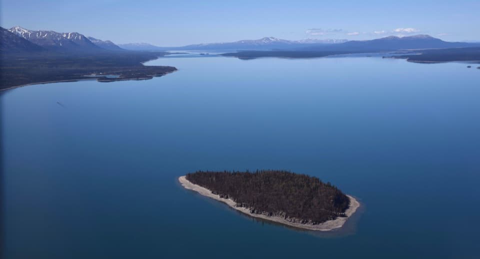
This isn't a roadside trailhead. Reach the beach in front of the cabin by boat or floatplane; there are no docks or mooring buoys, and water taxis from Port Alsworth may be available. The cabin sits in a clearing of white spruce and birch. Private property lies west of the cabin and around the point, so stay on the public approach.

Portage Creek and the climbThe first mile is mostly flat through thick spruce and birch forest before you reach Portage…

The first mile is mostly flat through thick spruce and birch forest before you reach Portage Creek. Cross it and stay left for the public trail. The foliage changes a lot by season and can hide the tread. After the creek, the route climbs through alders in switchbacks; follow them rather than cutting across the slope.

Where the maintained trail endsThe maintained tread stops in alpine tundra at about 2,150 feet.

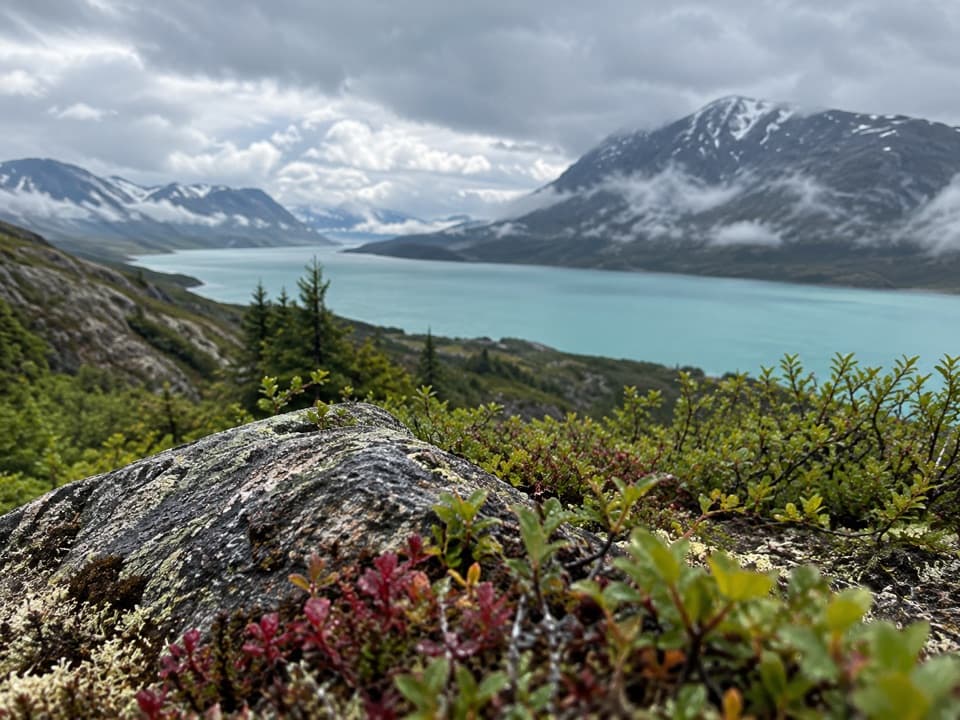
The maintained tread stops in alpine tundra at about 2,150 feet. The trees give way to open ground and views over Lake Clark and the surrounding mountains. This is not a loop or a summit route: turn around at the trail's end and follow the same line back.

Bringing a dogLeashed pets are permitted in the park and preserve, but the park strongly encourages leaving…

Leashed pets are permitted in the park and preserve, but the park strongly encourages leaving them at home for their safety and the ecosystem. If you bring a dog, keep it leashed the whole time.

Wildlife

Wildlife in Lake Clark

All Lake Clark wildlife maps

Sighting maps show where each species has been reported across Lake Clark. Wildlife moves, so no sighting is guaranteed.

Parkwolf’s Lake Clark ranking

Top-rated trails in Lake Clark

All 5 trails
  1. 1Tanalian Falls TrailModerate · 4 mi
  2. 2Kontrashibuna Lake TrailModerate · 5.8 mi
  3. 3Tanalian Mountain TrailChallenging · 8.6 mi
  4. 4Teetering Rock TrailModerate · 1.6 mi

Take Parkwolf to Lake Clark.

The audio tour guide for the drive, plus offline maps, trails, and wildlife heatmaps for when the signal drops.

4.7 from 8,600+ ratings

Download Parkwolf on the App StoreGet Parkwolf on Google Play