Overview
About Tommy Island
Why stop
- Fish may jump beside the kayak, with bush planes and mountains in view.
Heads up
- A multi-hour crossing on cold water where wind can make the return rough.
Map
Where it is

The highest, rockiest slopes around here are a summer buffet for grizzly bears.
Lake Clark Tour Guide
Your drive to Tommy Island, narrated.
Parkwolf is a GPS audio tour guide for Lake Clark National Park. As you drive, it chimes in with what’s ahead: hidden gems, upcoming stops, history, geology, and wildlife, right through your car’s speakers.
See the Lake Clark audio tourMore stories near here in the app
- Cissie's Kitchen
- Tanalian Trails and Falls
- Port Alsworth Visitor Center and Fish Cache
- Libby's Orange Sailboat
- 18 audio storiesacross Lake Clark’s roads, triggered by GPS as you drive
- Wildlife heatmapsfor Brown Bear, Bald Eagle, Common Merganser
- Works offlinemaps, 5 trails, 34 places, and audio download before you lose signal
- CarPlay readysimple controls built for the drive
“Fantastic app with many points of information… It’s great to just turn on while you’re driving and it gives you an audio tour of the national Park. We love it!!!!”


Guide
More about Tommy Island
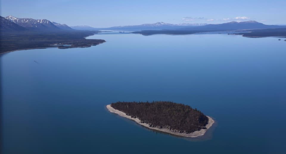
The island and the decisionTommy Island is a wooded islet in Lake Clark, promoted as a kayak destination from Port…
Tommy Island is a wooded islet in Lake Clark, promoted as a kayak destination from Port Alsworth. This is a substantial lake outing, not a quick stop: the trip estimate is 2–7 hours. Landing guidance is not established, so confirm shore access locally before planning to get out on the island.
Set up for exposed waterPort Alsworth is the access point, and it is not connected to the road system.
Port Alsworth is the access point, and it is not connected to the road system. Local outfitters have offered kayak rentals; check availability and current conditions before you build a trip around them. Wind and rain can turn the lake rough, and the return may be into a headwind. The water is cold, so ask park staff or an outfitter about cold-water safety before setting out.
What you can see from the waterThe crossing is part of the experience.
The crossing is part of the experience. Fish may jump beside your kayak, and bush planes descend toward Port Alsworth with mountains behind them. For a photo, frame the wooded island and its pale rocky edge against the open lake and mountain backdrop.
A name on older mapsThe island’s local name was reported in 1954, while Lake Clark topographic maps show it as far…
The island’s local name was reported in 1954, while Lake Clark topographic maps show it as far back as 1946. The name is well established, though the sources found no story explaining who Tommy was.
Wildlife
Wildlife in Lake Clark
 142 sightingsBrown BearMost seen around 8 AMSighting map
 11 sightingsBald EagleMost seen around 6 PMSighting map
 13 sightingsCommon MerganserMost seen around 8 AMSighting map
Sighting maps show where each species has been reported across Lake Clark. Wildlife moves, so no sighting is guaranteed.