
Place · 0 mi away
Easy
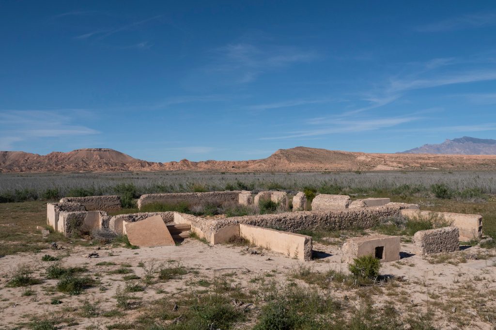
If you like history with your hikes, this is your Lake Mead walk. The St. Thomas Ghost Town Trail is an easy, mostly flat loop across former lakebed to the foundations of a town flooded by Lake Mead and revealed again as water levels dropped. Expect a well-defined path, excellent interpretive signs, and the surreal sight of seashells crunching underfoot where streets once ran. The basic signed loop is about 2.2 miles total, but wandering side foundations can push it closer to 3.0 miles.
From the parking area, a short descent drops you onto the old lakebed. It’s roughly 0.6 mile to reach the first ruins, then a gentle loop along old streets passes building pads for the schoolhouse, general and grocery stores, cisterns, and more. Tamarisk thickets edge parts of the site—long sleeves or pants help if you like to poke around. Return the same way to the trailhead.
This is a choose-your-own-adventure among foundations with clear signage that brings the place to life. Keep an eye out for scattered shells in the lakebed soils, subtle reminders of how long this was underwater. You may spot burros in the area. Nearby springs host the endangered relic leopard frog, but that managed population isn’t for visitors—stay on established routes.
The trailhead sits at the end of a graded dirt road about 3–3.5 miles from the Lake Mead entrance off NV‑169, just south of Overton. Most vehicles make it in dry conditions, but the road is washboarded and can be slick after rain—go slow. Day-use only here. A vault toilet is available; there’s no water or shade. Pets are allowed but must stay leashed. As part of Lake Mead National Recreation Area, an entrance fee or federal pass is required.
This is an archaeological site. Do not move or take artifacts, and don’t climb on structures—it’s illegal and ruins the experience for everyone.
Go fall through spring when temperatures are reasonable. Summer heat is fierce and the open lakebed reflects it right back at you. Aim for morning or late afternoon for softer light and cooler air. Avoid visiting right after storms when the road and lakebed can be muddy.
The St. Thomas cemetery was relocated before flooding and sits near Overton. If you go, use the signed dirt access from NV‑169 (about 7.1 miles north of the St. Thomas road). Some map apps misroute you to a gated private driveway—if you hit a gate or no‑trespassing signs, you’re in the wrong spot.
End of the graded dirt road signed for St. Thomas, ~3–3.5 miles past the Lake Mead entrance off NV‑169; parking area at trailhead with a vault toilet.
Extreme sun exposure and no water. Road and lakebed get muddy after storms. Do not disturb artifacts or structures. Mapping apps may misroute the cemetery side trip to a gated driveway—use the signed dirt road from NV‑169.
Place · 0 mi away

Place · 2 mi away
Place · 2.6 mi away

Place · 3.1 mi away
Easy · 7.1 mi away
Easy · 17.2 mi away
Easy · 17.3 mi away
Moderate · 21.2 mi away

Parkwolf Tour Guide
