Parking
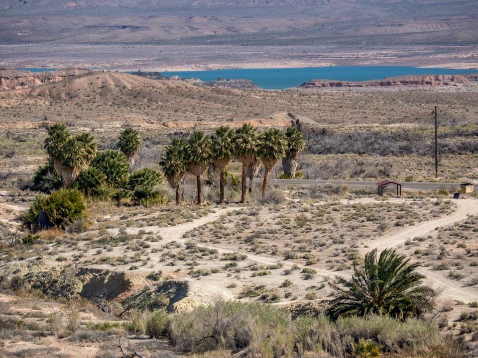
Park at the end of Old St. Thomas Access Road, just beyond milepost 46 on Northshore Road. Stay right at the fork for the trailhead; the left branch is separate. The access is in Lake Mead's fee area.
#10 of 42 trails in Lake Mead
Lake Mead National Recreation Area, AZ · NV
Trace old streets across the floor of a former lake.
Overview
St. Thomas Trail is a roughly 2.1-mile round-trip loop with a shared approach: it descends from a low ridge into the old townsite, circles among the remains, then returns to the same parking area. You walk across loose rock, sand, and scattered foundations, reading interpretive panels about a town that spent decades beneath Lake Mead. Choose it if you like history and are comfortable on uneven, exposed ground; this is a walk among ruins, not a preserved street of standing buildings. Allow about 1.5 to 2.5 hours with sign stops. Published distances range from about 2.1 to 2.5 miles; the mapped line and detailed waypoint route measure about 2.0 to 2.1, and roaming among the scattered ruins can add distance.
 Parkwolf’s verdictIs this the hike for you?
Map & elevation
Plan your hike

The highest, rockiest slopes around here are a summer buffet for grizzly bears.
Lake Mead Tour Guide
Parkwolf is a GPS audio tour guide for Lake Mead National Recreation Area. As you drive, it chimes in with what’s ahead: hidden gems, upcoming stops, history, geology, and wildlife, right through your car’s speakers.
See the Lake Mead audio tourRecorded for this trailhead
St. Thomas: The Town Beneath the Lake“You're nearing the access road for St. Thomas, a town that disappeared beneath Lake Mead. The ruins are about three miles down a bumpy dirt road, then reached on foot.”
Plays as you drive up to this trailhead in the Parkwolf Lake Mead Tour Guide.
More stories near here in the app
“Fantastic app with many points of information… It’s great to just turn on while you’re driving and it gives you an audio tour of the national Park. We love it!!!!”


Trail guide
From the kiosk, the trail heads east along the ridge before dropping on a short sequence of switchbacks. Rounded stones roll underfoot, especially as the path leaves the ridge toe. The descent is brief but awkward enough to slow down and watch each step. Below, the route crosses nearly level former lakebed, where saltcedar and open sandy stretches replace the rocky slope. A washout area can make part of the path less distinct. The town loop follows the old streets, then returns to the west edge of the ruins and retraces the ridge approach to the parking area.
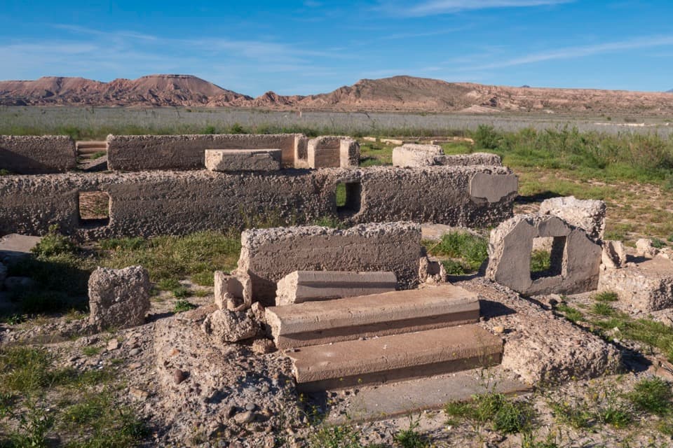
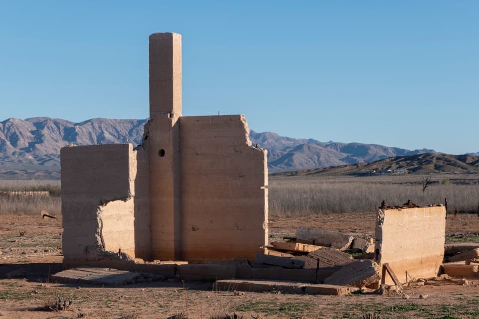
The townsite rewards a slow look. The path follows the line of old Main Street, also part of the Arrowhead Highway, past interpretive panels and the remains of homes, shops, and civic buildings. The Fenton Whitney home still has walls and a cistern; the Frehner home is remembered by its steps. A former store and gas station, often called the ice-cream parlor, is one of the few places with part of a second story still standing. Elsewhere, the schoolhouse, post office, and Gentry Hotel are mostly foundations or low walls, easy to miss if you expect a row of intact buildings. Look for the different ways residents built with local river cobbles, concrete, and stone. Do not climb on the remains, move glass or other objects, or collect fragments; the whole site is an archaeological resource.
Mormon pioneers settled here in the 1850s and 1860s. Changes to the state boundary placed the community in Nevada, where a demand for back taxes led most residents to leave for Utah. St. Thomas continued as a small agricultural and service town: a railroad arrived in 1912, and nearby mining increased the importance of its stores and transport links. The town was abandoned as Lake Mead rose in the 1930s and the site was submerged. As the reservoir later receded, foundations and streets reappeared. The signs trace that sequence through farming, water storage, the railroad, the highway, and the town's eventual disappearance.
There is little shade and no drinking water at the trailhead, so bring what you need and plan for cooler hours or seasons. The access is in Lake Mead's fee area. The route is not maintained; take care where the route crosses saltcedar and do not cut between foundations. Sturdy shoes help on loose, uneven rock, and a hiking pole is useful on the ridge descent. Dogs are allowed on leash up to six feet. Parking is at the end of Old St. Thomas Access Road, just beyond milepost 46 on Northshore Road; stay right at the fork for the trailhead. For a photo, frame the surviving walls or chimney against the open lakebed and mountains rather than trying to make the town look more intact than it is.
Wildlife
 525 sightingsBighorn SheepMost seen around 5 PMSighting map
 116 sightingsBurroMost seen around 7 PMSighting map
 18 sightingsBald EagleMost seen around 4 PMSighting map
 99 sightingsWhite PelicanMost seen around 7 AMSighting map
 145 sightingsGreat Blue HeronMost seen around 7 AMSighting map
 106 sightingsTurkey VultureMost seen around noonSighting map
Sighting maps show where each species has been reported across Lake Mead. Wildlife moves, so no sighting is guaranteed.
Keep exploring
Parkwolf’s Lake Mead ranking
The audio tour guide for the drive, plus offline maps, trails, and wildlife heatmaps for when the signal drops.