
Place · 4.6 mi away
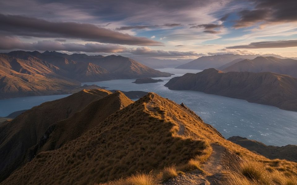
Roys Peak Track is the big, brag‑worthy climb near Wānaka: a 16 km out‑and‑back on a well‑formed but consistently steep path to a 1,578 m summit with sweeping views of Lake Wānaka, its islands, and the Southern Alps/Kā Tiritiri o te Moana, including Mt Aspiring/Tititea. Expect 5–7 hours round‑trip and about 1,228 m of elevation gain. It’s tough on lungs going up and tough on knees coming down, but the scenery keeps expanding the whole way.
The track leaves farmland and zigzags through open tussock slopes. About 6.5 km up you’ll hit the Instagram‑famous ridgeline lookout—this is not the summit. From there, it’s roughly 30 minutes more to the true peak, which delivers the highest, widest panorama. Many hikers are satisfied turning around at the lookout and still get the classic Wānaka vistas.
There are toilets at the trailhead car park and a drop toilet near the popular lookout. The route crosses private farmland—stay on the marked track, use stiles, and give livestock space. Dogs aren’t permitted. Drones require a permit on public conservation land. An honesty box at the start has been noted ($5 NZD per person).
Start at dawn for cooler temps, easier parking, and fewer people, or go late afternoon for golden light—bring headlamps if you’ll finish in the dark. Sunrise and sunset deliver the best photography. The track is closed annually for lambing from October 1 to November 10; plan around that window. Outside the closure, summer is busiest; shoulder months (April–May, September) are quieter but still scenic.
The large car park sits ~6 km from Wānaka on the Wānaka–Mount Aspiring Road, but it often fills by mid‑morning in peak season. If it’s jammed, consider walking or cycling via the Waterfall Creek Track, or use a local shuttle/taxi from town. Avoid roadside verge parking—wait for a spot or arrange transport.
There’s essentially no shade or water on the route. Bring 2–3 L per person, high‑energy snacks, sun protection, and layered clothing (it can be windy and cold up high even in summer). In winter, snow/ice is possible; the upper track above ~1,000 m includes avalanche terrain—check conditions and carry appropriate traction and poles if needed. If you’re aiming for dawn or dusk, pack a headlamp and spare batteries.
Yes—the climb is monotonous but the payoff is massive. Even if you only reach the famous lookout, you’ll bag the signature Wānaka view; push to the summit for the full 360‑degree panorama.
Place · 4.6 mi away
Place · 19.1 mi away
Place · 19.5 mi away
Place · 22 mi away
Moderate · 20 mi away
Challenging · 20 mi away
Easy · 20 mi away
Challenging · 20 mi away

Parkwolf Tour Guide
