Overview
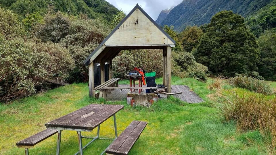
Young Hut is a no-frills backcountry stop in a stunning corner of the park, built for trampers who don’t mind carrying their comforts. Expect mattresses on bunks, a wood burner for heat, long‑drop toilets, and rain‑tank water you’ll need to treat. It’s simple, quiet, and exactly what you want on a multi‑day mission.
Where it fits in your trip
This hut sits on the Gillespie Pass Circuit, so it’s a natural overnight if you’re linking valleys. From SH6 (Haast Highway) it’s roughly 6–7 hours (about 20 km); from Siberia Hut allow 6–8 hours (about 12 km). In other words: start early and plan your daylight.
Facilities at a glance
- 20 bunks with mattresses; bring a sleeping bag.
- Wood burner (bring fire starter and matches/lighter).
- Long‑drop toilets; bring your own toilet paper.
- Rain‑tank water; treat or boil before drinking.
- No gas, cookers, pots, or utensils—bring your stove and full kitchen kit.
- No lighting or power—bring a torch/headlamp.
- Pack out all rubbish.
Bookings, passes, and fees
- Labour Weekend (late October) to 30 April: bookings required; pay when you book.
- 1 May to Labour Weekend: no bookings; pay with Serviced Hut Tickets at the honesty box.
- Standard fees: Adult NZ$25/night; Youth (5–17) NZ$12.50; 0–4 free.
- Backcountry Hut Pass valid 1 May–30 September only; not accepted 1 October–30 April.
- For the 2025–26 season, bookings are open for stays 25 October 2025–30 April 2026.
Getting there
- From SH6 via the Gillespie Pass Circuit: ~6–7 hr (20 km).
- From Siberia Hut: ~6–8 hr (12 km).
Expect river/stream crossings on the circuit—plan around recent weather and flows.
Best time to visit
If you prefer certainty, go during the booking season (late Oct–Apr) when bunks can be reserved. For a quieter vibe, the non‑booking period (May–Labour Weekend) is first come, first served—carry Serviced Hut Tickets. Weekends see more trampers; starting early helps you snag a bunk and arrive with daylight to spare.
Good to know
- Don’t confuse this with Aspiring Hut near Raspberry Creek—they’re in different valleys with different facilities and rules.
- Map refs (for your nav app/map): NZTopo50 BZ12; NZTM E1287389 N5101129; elevation ~740 m.