Burn Creek Hut in Nelson Lakes National Park

Lodging · Nelson Lakes National Park

Burn Creek Hut

A two-bunk alpine bivouac for experienced, self-reliant trampers.

Photo: CC BY 4.0

Overview

About Burn Creek Hut

Why stop

  • A distinctive 1958 bivouac with a story as spare as its $80 build.

Heads up

  • No DOC track access; reach it only on a demanding self-navigated route.

Map

Where it is

Loading the Nelson Lakes map
Full map
LodgingBurn Creek Hut-42.15621, 172.45001
Keep this map with you offline in the Parkwolf app

Plan your stop

Before you go

Getting there is the commitment

One route estimate from Downie Creek is 8–10 hours. The Burn Creek approach involves repeated creek crossings, a steep climb at Jacobs Ladder, bluffs and a waterfall bypass. Traverses over the tops from Nardoo or Bob’s Hut are also described for experienced parties. Snow can add avalanche exposure on the high approaches, and alpine weather can make river crossings unsafe; DOC advises waiting or turning back when a crossing is not safe.

3 active Nelson Lakes alerts

  • ClosureRotoroa Route permanently closedThe Rotoroa Route is permanently closed along the eastern side of Lake Rotoroa between Rotoroa village and Sabine Hut.Official details
  • CautionUnbridged stream between Sabine and D’Urville hutsThe bridge on the track between Sabine Hut and D’Urville Hut has been removed; trampers must cross an unbridged stream at GR E1571366 N5359831.Official details
See all 3 alerts
A park ranger sits on a dash-mounted phone, talking, as Parkwolf’s Tour Guide plays “Army Cutworm Moths: A Grizzly Bear Buffet” on Grand Loop Road below Dunraven Pass in Yellowstone
Parkwolf Tour GuideThe highest, rockiest slopes around here are a summer buffet for grizzly bears.

Nelson Lakes Tour Guide

Your drive to Burn Creek Hut, narrated.

Parkwolf is a GPS audio tour guide for Nelson Lakes National Park. As you drive, it chimes in with what’s ahead: hidden gems, upcoming stops, history, geology, and wildlife, right through your car’s speakers.

  • 26 audio storiesacross Nelson Lakes’s roads, triggered by GPS as you drive
  • Wildlife heatmapsfor New Zealand Falcon, Weka, Kererū, and 13 more
  • Works offlinemaps, 57 trails, 47 places, and audio download before you lose signal
  • CarPlay readysimple controls built for the drive
★★★★★
“Fantastic app with many points of information… It’s great to just turn on while you’re driving and it gives you an audio tour of the national Park. We love it!!!!”
JMJamesApp Store review
Download Parkwolf on the App StoreGet Parkwolf on Google Play

4.7 from 8,600+ ratings

Guide

More about Burn Creek Hut

A remote hut, not a casual walkBurn Creek Hut is a tiny, two-bunk backcountry bivouac at 1,260 m on the bushline beside an…

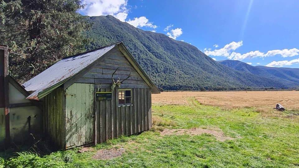
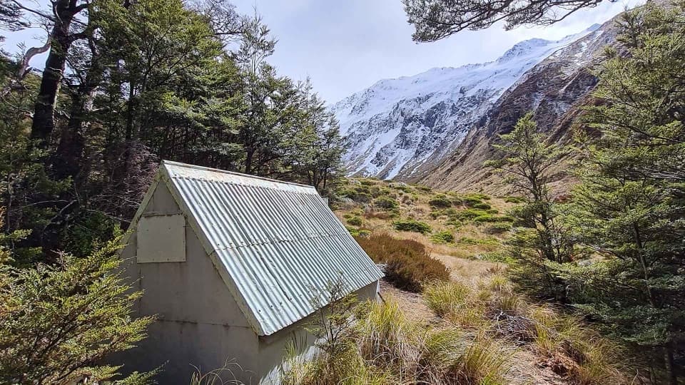
Burn Creek Hut is a tiny, two-bunk backcountry bivouac at 1,260 m on the bushline beside an alpine basin in the Emily Peaks. It suits fit, experienced trampers who can plan and navigate a remote route: there is no DOC track access. The hut is free and first come, with no booking. There is no food service, so plan for a self-reliant overnight.

A hut built from leftoversThe New Zealand Forest Service built this two-bunk bivouac in 1958 for $80.

The New Zealand Forest Service built this two-bunk bivouac in 1958 for $80. Jock Fisher wanted a hut tall enough to stand in, and builder Ray Osman used leftover materials from Bob’s Hut. A volunteer overhaul in February 2024 replaced the floor and sleeping platform and rebuilt the chimney and hearth. The restoration is also reported to have added an outdoor toilet and roof-fed water tank, but the current facility list confirms only the bunks; the tank’s water quality is not established, so don’t count on it as potable.

Gold-mining traces on the wayA river flat upstream of Jacobs Ladder has stacked-rock remains from a gold-mining settlement…

A river flat upstream of Jacobs Ladder has stacked-rock remains from a gold-mining settlement used in the 1870s and again during the Great Depression. The sources disagree on when miners first established the route, so the hut’s date is the firmer piece of history.

Wildlife

Wildlife in Nelson Lakes

All Nelson Lakes wildlife maps

Sighting maps show where each species has been reported across Nelson Lakes. Wildlife moves, so no sighting is guaranteed.

Parkwolf’s Nelson Lakes ranking

Top sights in Nelson Lakes

All 47 places
  1. 1Lake Rotoiti – Kerr Bay and JettySight
  2. 2Rotomairewhenua / Blue LakeSight
  3. 3Lake Rotoroa – Foreshore and JettySight
  4. 4Rotomaninitua / Lake AngelusSight
  5. 5Rotopōhueroa / Lake ConstanceSight
  6. 6Whisky FallsSight

Take Parkwolf to Nelson Lakes.

The audio tour guide for the drive, plus offline maps, trails, and wildlife heatmaps for when the signal drops.

4.7 from 8,600+ ratings

Download Parkwolf on the App StoreGet Parkwolf on Google Play