Matakitaki Forks Route in Nelson Lakes National Park

Nelson Lakes National Park, TM

Matakitaki Forks Route

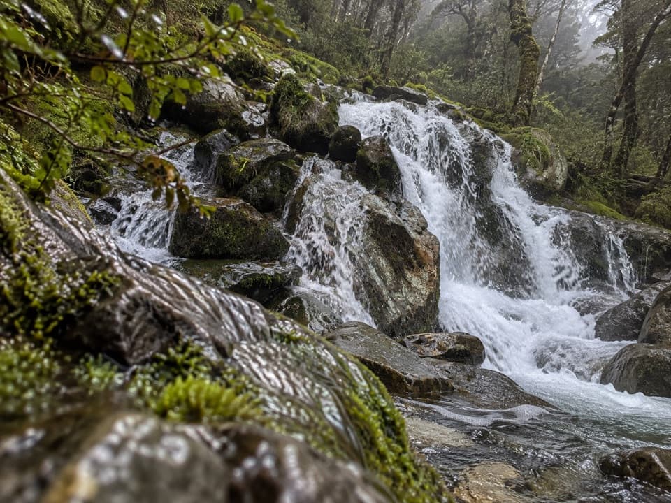
A mossy beech track to a remote Matakitaki river crossing.

Length
11.9km
Time
5hr
Elev. change
302m
Difficulty
Moderate
  • No dogs
  • High point 826 m
Parkwolf audio tour26 stories across Nelson Lakes’s roads

Overview

About Matakitaki Forks Route

Why go

  • Mossy, well-marked beech track
  • Historic four-bunk hut at the start

Heads up

  • Remote one-way logistics
  • River crossings can be dangerous after heavy rain

Map & elevation

The route

Loading the Nelson Lakes map
Full map
Elevation524–826 m
TrailheadDownie Hut-42.13440, 172.52260
Keep this map with you offline in the Parkwolf app

Plan your hike

Before you go

Parking

The segment starts at Downie Hut, not the Mt Ella Station roadend. DOC’s valley access has a parking area and orientation panel opposite the cowshed; follow orange track markers and put electric-tape gates back as you go. Pushbikes, motorbikes and quad bikes may continue as far as Downie Hut; no other vehicles are permitted.

Safety

Heavy rain can make river crossings dangerous. The West Matakitaki walkwire’s current condition was not confirmed; check with DOC before relying on it. Dogs are prohibited in the park.

3 active Nelson Lakes alerts

  • ClosureRotoroa Route permanently closedThe Rotoroa Route is permanently closed along the eastern side of Lake Rotoroa between Rotoroa village and Sabine Hut.Official details
  • CautionUnbridged stream between Sabine and D’Urville hutsThe bridge on the track between Sabine Hut and D’Urville Hut has been removed; trampers must cross an unbridged stream at GR E1571366 N5359831.Official details
See all 3 alerts
A park ranger sits on a dash-mounted phone, talking, as Parkwolf’s Tour Guide plays “Army Cutworm Moths: A Grizzly Bear Buffet” on Grand Loop Road below Dunraven Pass in Yellowstone
Parkwolf Tour GuideThe highest, rockiest slopes around here are a summer buffet for grizzly bears.

Nelson Lakes Tour Guide

Your drive to Matakitaki Forks Route, narrated.

Parkwolf is a GPS audio tour guide for Nelson Lakes National Park. As you drive, it chimes in with what’s ahead: hidden gems, upcoming stops, history, geology, and wildlife, right through your car’s speakers.

  • 26 audio storiesacross Nelson Lakes’s roads, triggered by GPS as you drive
  • Wildlife heatmapsfor New Zealand Falcon, Weka, Kererū, and 13 more
  • Works offlinemaps, 57 trails, 47 places, and audio download before you lose signal
  • CarPlay readysimple controls built for the drive
★★★★★
“Fantastic app with many points of information… It’s great to just turn on while you’re driving and it gives you an audio tour of the national Park. We love it!!!!”
JMJamesApp Store review
Download Parkwolf on the App StoreGet Parkwolf on Google Play

4.7 from 8,600+ ratings

Trail guide

Hiking Matakitaki Forks Route

A remote through-routeMatakitaki Forks Route is an 11.9 km (7.

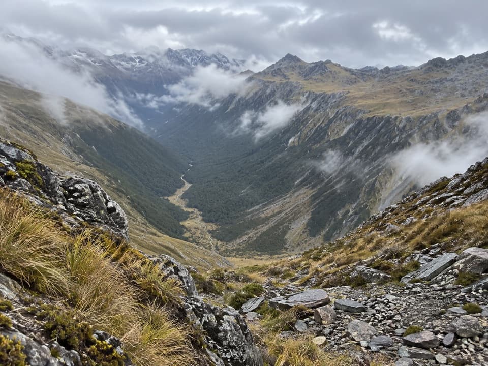
Matakitaki Forks Route is an 11.9 km (7.4 mile) one-way tramp from Downie Hut to the West Matakitaki River walkwire. Allow about five hours for this segment. It is a remote backcountry leg, not a road-to-road day loop: Downie Hut is the start, and the walkwire is the endpoint. Arrange the approach to the hut and your onward exit before setting out. The distance here does not include the separate continuation toward East Matakitaki Hut.

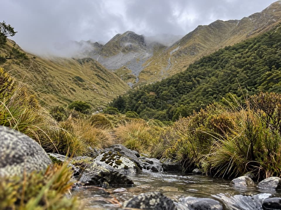
Underfoot and uphillThe marked route follows a natural, rough-surfaced tramping track through mossy beech forest.

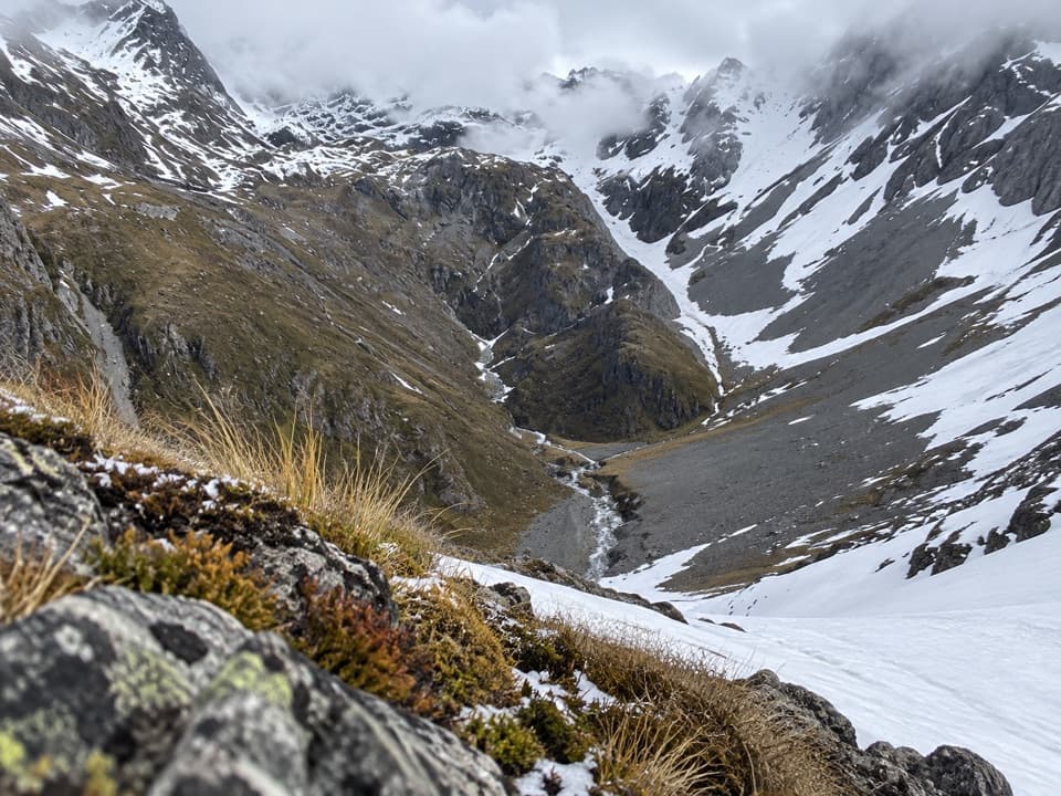
The marked route follows a natural, rough-surfaced tramping track through mossy beech forest. The average grade is gentle, but the whole leg is not an easy stroll: in the Downie-to-walkwire direction its recorded profile has about 720 m of climbing and 490 m of descent. Expect uneven ground and stream crossings; the trail is best suited to trampers comfortable with a long backcountry day.

The forksThe route ends at the West Matakitaki River walkwire, just above the meeting of the East and…

The route ends at the West Matakitaki River walkwire, just above the meeting of the East and West branches. Trip reports also describe a separate East Branch wire crossing on the continuation toward East Matakitaki Hut. The bridge descriptions are easy to mix up, so keep the branch names straight when planning; the 11.9 km figure ends at the West wire.

River conditionsHeavy rain can make rivers dangerous in this valley.

Heavy rain can make rivers dangerous in this valley. The current condition of the West walkwire could not be confirmed, so check with DOC before relying on that crossing. Dogs are not allowed in Nelson Lakes National Park.

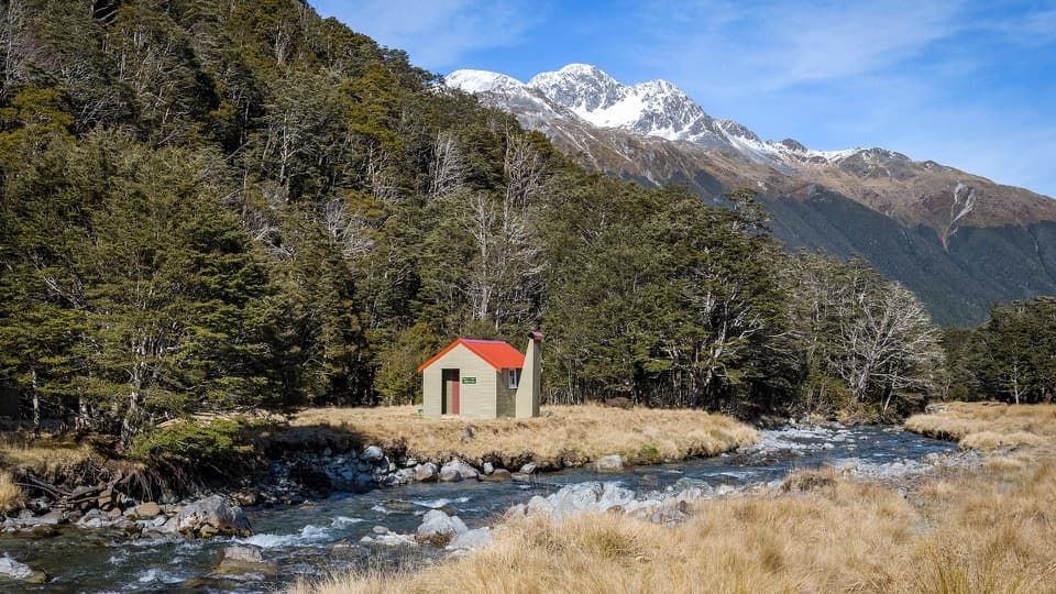
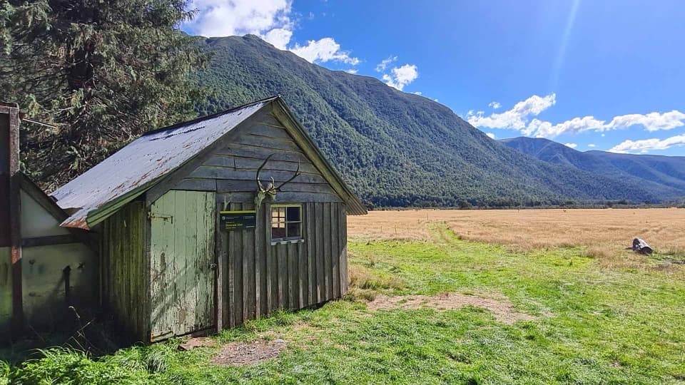
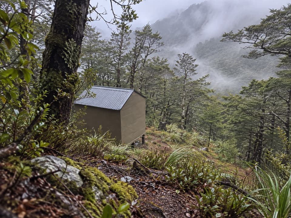
Begin at Downie HutDownie Hut sits on a grassy flat by the forest edge and has four bunks.

Downie Hut sits on a grassy flat by the forest edge and has four bunks. It is free and first come, with no booking. Its construction date is unknown, though graffiti inside dates to 1902. Local accounts differ on whether it began as a gold-mining base or a musterers’ hut; the story is still unsettled.

A changing beech forestThe lower slopes carry red and silver beech and kanuka on wetter ground; higher up, silver and…

The lower slopes carry red and silver beech and kanuka on wetter ground; higher up, silver and mountain beech take over. The valley’s forest sits between the drier beech forests to the west and the mixed beech-podocarp forests farther toward North Westland. Red deer occur through the valley, and chamois are also present.

Wildlife

Wildlife in Nelson Lakes

All Nelson Lakes wildlife maps

Sighting maps show where each species has been reported across Nelson Lakes. Wildlife moves, so no sighting is guaranteed.

Keep exploring

Near Matakitaki Forks Route

See it all on the map

Trails that start nearby

Places near the trailhead

Parkwolf’s Nelson Lakes ranking

Top-rated trails in Nelson Lakes

All 57 trails
  1. 1Mount Robert CircuitChallenging · 9 km
  2. 2Angelus Hut via Pinchgut Track and Robert Ridge RouteChallenging · 12.2 km
  3. 3St Arnaud Range TrackChallenging · 10 km
  4. 4Rotomairewhenua/Blue Lake TrackChallenging · 15.4 km
  5. 5Travers-Sabine CircuitChallenging · 80 km
  6. 6Lake Rotoiti CircuitChallenging · 23.4 km

Take Parkwolf to Nelson Lakes.

The audio tour guide for the drive, plus offline maps, trails, and wildlife heatmaps for when the signal drops.

4.7 from 8,600+ ratings

Download Parkwolf on the App StoreGet Parkwolf on Google Play