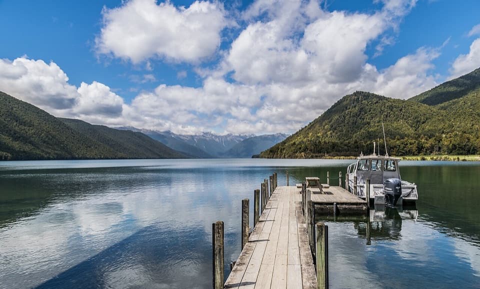
Lake Rotoiti – Kerr Bay and Jetty in Nelson Lakes National Park

#1 of 15 sights in Nelson Lakes

Sight · Nelson Lakes National Park

Lake Rotoiti – Kerr Bay and Jetty

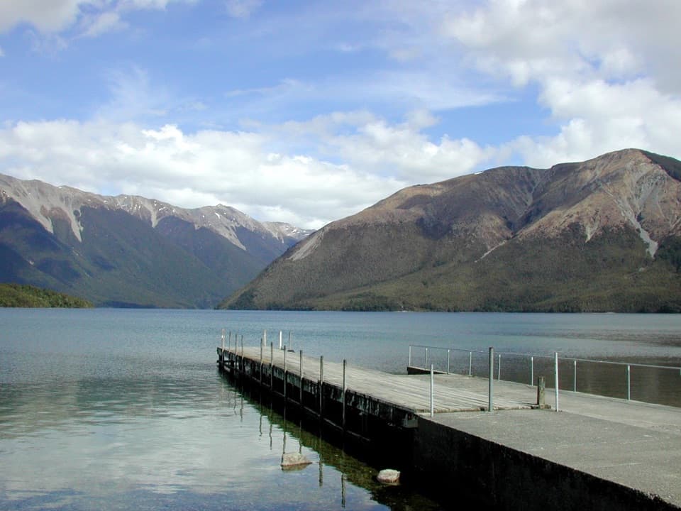
A mountain-framed jetty with eels beneath the water.

Photo: Wikimedia Commons
Type
Sight
Nearest trail
Right here
Audio stories
9 nearby
  • Parking
  • Restrooms
  • Scenic viewpoint
  • Picnic tables

Hear the audio tour

Kerr Bay and Lake Rotoiti

Overview

About Lake Rotoiti – Kerr Bay and Jetty

Why stop

  • The pier puts you over the lake, with short forest walks close by.

Heads up

  • Sandflies can make a long stay on shore unpleasant.

Map

Where it is

Loading the Nelson Lakes map
Full map
SightLake Rotoiti – Kerr Bay and Jetty-41.80667, 172.84391
Keep this map with you offline in the Parkwolf app

Plan your stop

Before you go

Getting there and what to expect

Follow Kerr Bay Road off State Highway 63 to the east-jetty car park. Public toilets and picnic tables are nearby, and a boat ramp serves the wider bay. The short Bellbird loop is rated wheelchair-standard; that rating is for the walk, not a separate accessibility assessment of the jetty itself. Alpine weather can turn cold or freezing at any time of year, and sandflies are a recurring nuisance if you linger by the shore. Dogs aren’t allowed in the national park.

3 active Nelson Lakes alerts

  • ClosureRotoroa Route permanently closedThe Rotoroa Route is permanently closed along the eastern side of Lake Rotoroa between Rotoroa village and Sabine Hut.Official details
  • CautionUnbridged stream between Sabine and D’Urville hutsThe bridge on the track between Sabine Hut and D’Urville Hut has been removed; trampers must cross an unbridged stream at GR E1571366 N5359831.Official details
See all 3 alerts
A park ranger sits on a dash-mounted phone, talking, as Parkwolf’s Tour Guide plays “Army Cutworm Moths: A Grizzly Bear Buffet” on Grand Loop Road below Dunraven Pass in Yellowstone
Parkwolf Tour GuideThe highest, rockiest slopes around here are a summer buffet for grizzly bears.

Nelson Lakes Tour Guide

Your drive to Lake Rotoiti – Kerr Bay and Jetty, narrated.

Parkwolf is a GPS audio tour guide for Nelson Lakes National Park. As you drive, it chimes in with what’s ahead: hidden gems, upcoming stops, history, geology, and wildlife, right through your car’s speakers.

Recorded for this place

Kerr Bay and Lake Rotoiti
0:00 / 0:27
“You're approaching Kerr Bay, an easy place to get down to Lake Rotoiti without taking on a hike.”

Plays as you drive up to Lake Rotoiti – Kerr Bay and Jetty in the Parkwolf Nelson Lakes Tour Guide.

More stories near here in the app

  • Nelson Lakes Visitor Centre
  • St Arnaud: Food and Village Stops
  • Lodge Road and Black Hill Walk
  • West Bay, Lake Rotoiti
  • 26 audio storiesacross Nelson Lakes’s roads, triggered by GPS as you drive
  • Wildlife heatmapsfor New Zealand Falcon, Weka, Kererū, and 13 more
  • Works offlinemaps, 57 trails, 47 places, and audio download before you lose signal
  • CarPlay readysimple controls built for the drive
★★★★★
“Fantastic app with many points of information… It’s great to just turn on while you’re driving and it gives you an audio tour of the national Park. We love it!!!!”
JMJamesApp Store review
Download Parkwolf on the App StoreGet Parkwolf on Google Play

4.7 from 8,600+ ratings

Guide

More about Lake Rotoiti – Kerr Bay and Jetty

Make time for the waterKerr Bay is Lake Rotoiti’s main road-accessible shore at St Arnaud, and its small wooden east…

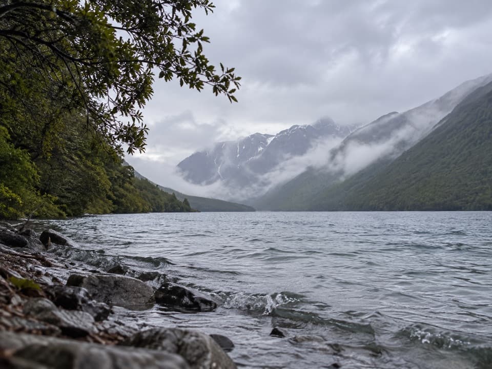
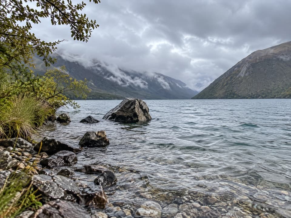
Kerr Bay is Lake Rotoiti’s main road-accessible shore at St Arnaud, and its small wooden east jetty reaches out over the glacial lake. It’s a satisfying stop even if you only walk onto the pier and look around; stay longer for the short Bellbird Walk or to watch the large eels often seen below the jetty. The clear water and steep mountain walls are the draw, and the shore is easy to reach from the road.

The jetty viewFrom the pier, look south across the lake toward Pourangahau (Mount Robert) and the forested…

From the pier, look south across the lake toward Pourangahau (Mount Robert) and the forested ranges. For the classic picture, start on shore and let the timber jetty lead out toward the water and mountains. When the lake is still, the slopes can reflect in the surface; wind and cloud change the view quickly, so treat that as a bonus rather than a promise.

Add a short walkBellbird Walk starts at the east-jetty car park and makes a 15-minute wheelchair-standard loop…

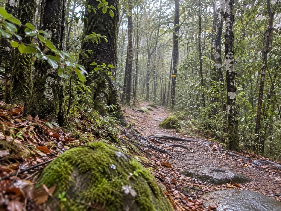
Bellbird Walk starts at the east-jetty car park and makes a 15-minute wheelchair-standard loop through red beech forest and wetland, with interpretive panels along the way. If you want a longer forest walk, Honeydew is a 1.7-kilometre loop that takes about 45 minutes, reached as an offshoot. Either makes Kerr Bay more than a photo stop without turning the visit into a major hike.

Eels beneath the pierPeople often pause to look for the large eels below the jetty.

People often pause to look for the large eels below the jetty. Eels in the park’s lakes and rivers are protected, so keep the visit to watching them beneath the pier.

A valley carved by iceThe Travers glacier occupied this valley roughly 20,000 to 12,000 years ago, carving the deep…

The Travers glacier occupied this valley roughly 20,000 to 12,000 years ago, carving the deep basin that holds Lake Rotoiti. Rivers still carry sediment into the lake, gradually filling a hollow made by much larger forces. The mountains around the shore make that glacial shape easier to read from the water’s edge.

The name that stuckRotoiti means “little lake.”

Rotoiti means “little lake.” European explorers briefly called it Lake Arthur in honour of Captain Arthur Wakefield, but the Māori name endured. It’s a useful reminder that the lake already had a name long before it became a popular stop at St Arnaud.

Beech forest and native birdsThe nearby red beech forest and wetland are part of the Rotoiti Nature Recovery Project, a…

The nearby red beech forest and wetland are part of the Rotoiti Nature Recovery Project, a mainland-island predator-control effort covering more than 5,000 hectares of honeydew beech forest. That honeydew supports native birds including kākāriki, kākā, tūī and korimako (bellbirds). Bellbird and Honeydew walks are the easiest way to see the forest setting beyond the lakefront.

Wildlife

Wildlife in Nelson Lakes

All Nelson Lakes wildlife maps

Sighting maps show where each species has been reported across Nelson Lakes. Wildlife moves, so no sighting is guaranteed.

Keep exploring

Near Lake Rotoiti – Kerr Bay and Jetty

See it all on the map

Trails nearby

More stops nearby

Parkwolf’s Nelson Lakes ranking

Top sights in Nelson Lakes

All 47 places
  1. 2Rotomairewhenua / Blue LakeSight
  2. 3Lake Rotoroa – Foreshore and JettySight
  3. 4Rotomaninitua / Lake AngelusSight
  4. 5Rotopōhueroa / Lake ConstanceSight
  5. 6Whisky FallsSight
  6. 7Parachute RocksSight

Take Parkwolf to Nelson Lakes.

The audio tour guide for the drive, plus offline maps, trails, and wildlife heatmaps for when the signal drops.

4.7 from 8,600+ ratings

Download Parkwolf on the App StoreGet Parkwolf on Google Play