Rotomaninitua / Lake Angelus in Nelson Lakes National Park

#4 of 15 sights in Nelson Lakes

Sight · Nelson Lakes National Park

Rotomaninitua / Lake Angelus

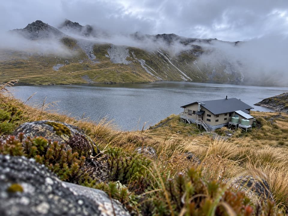
A remote glacial tarn with Angelus Hut on its shore.

Photo: Wikimedia Commons
Type
Sight
Nearest trail
0.1 km
  • Campground
  • Lodging
  • Restrooms

Hear the audio tour

Mount Robert: Views on Foot

Overview

About Rotomaninitua / Lake Angelus

Why stop

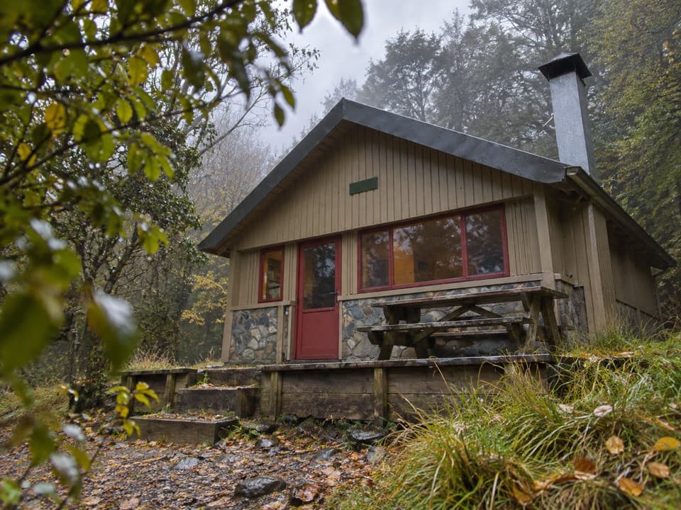
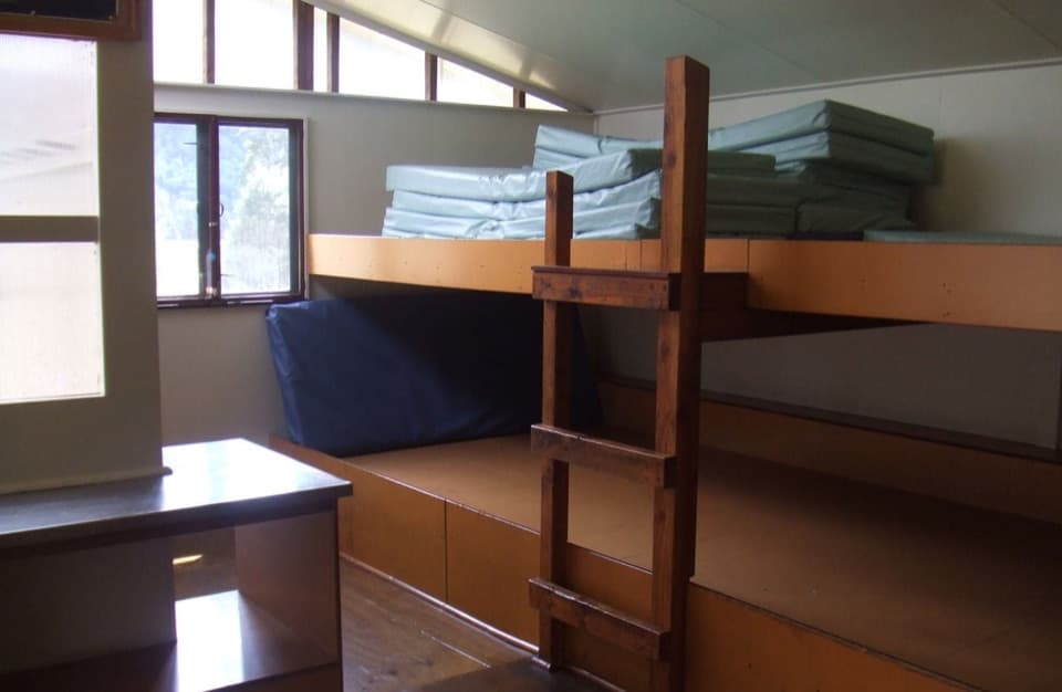
  • A designated campsite and 28-bunk hut sit beside the lake.

Heads up

  • The Robert Ridge route is steep, exposed, and has no water.

Map

Where it is

Loading the Nelson Lakes map
Full map
SightRotomaninitua / Lake Angelus-41.88741, 172.74810
Keep this map with you offline in the Parkwolf app

Plan your stop

Before you go

3 active Nelson Lakes alerts

  • ClosureRotoroa Route permanently closedThe Rotoroa Route is permanently closed along the eastern side of Lake Rotoroa between Rotoroa village and Sabine Hut.Official details
  • CautionUnbridged stream between Sabine and D’Urville hutsThe bridge on the track between Sabine Hut and D’Urville Hut has been removed; trampers must cross an unbridged stream at GR E1571366 N5359831.Official details
See all 3 alerts
A park ranger sits on a dash-mounted phone, talking, as Parkwolf’s Tour Guide plays “Army Cutworm Moths: A Grizzly Bear Buffet” on Grand Loop Road below Dunraven Pass in Yellowstone
Parkwolf Tour GuideThe highest, rockiest slopes around here are a summer buffet for grizzly bears.

Nelson Lakes Tour Guide

Your drive to Rotomaninitua / Lake Angelus, narrated.

Parkwolf is a GPS audio tour guide for Nelson Lakes National Park. As you drive, it chimes in with what’s ahead: hidden gems, upcoming stops, history, geology, and wildlife, right through your car’s speakers.

Recorded for this place

Mount Robert: Views on Foot
0:00 / 0:27
“The Mount Robert trailheads are coming up, where the lake lookout takes an uphill walk from the car park.”

Plays as you drive up to Rotomaninitua / Lake Angelus in the Parkwolf Nelson Lakes Tour Guide.

  • 26 audio storiesacross Nelson Lakes’s roads, triggered by GPS as you drive
  • Wildlife heatmapsfor New Zealand Falcon, Weka, Kererū, and 13 more
  • Works offlinemaps, 57 trails, 47 places, and audio download before you lose signal
  • CarPlay readysimple controls built for the drive
★★★★★
“Fantastic app with many points of information… It’s great to just turn on while you’re driving and it gives you an audio tour of the national Park. We love it!!!!”
JMJamesApp Store review
Download Parkwolf on the App StoreGet Parkwolf on Google Play

4.7 from 8,600+ ratings

Guide

More about Rotomaninitua / Lake Angelus

A serious backcountry destinationAt about 1,650 m, Rotomaninitua / Lake Angelus is a glacial alpine tarn in the Angelus basin.

At about 1,650 m, Rotomaninitua / Lake Angelus is a glacial alpine tarn in the Angelus basin. Angelus Hut stands by its shore, with the designated campsite below it. This is one of the park's major high-country destinations, but getting here takes a serious tramp. I'd plan an overnight or longer visit; it isn't a quick stop from St Arnaud.

The Robert Ridge routeThe classic route from Mount Robert car park is 12.2 km one way and takes about six hours.

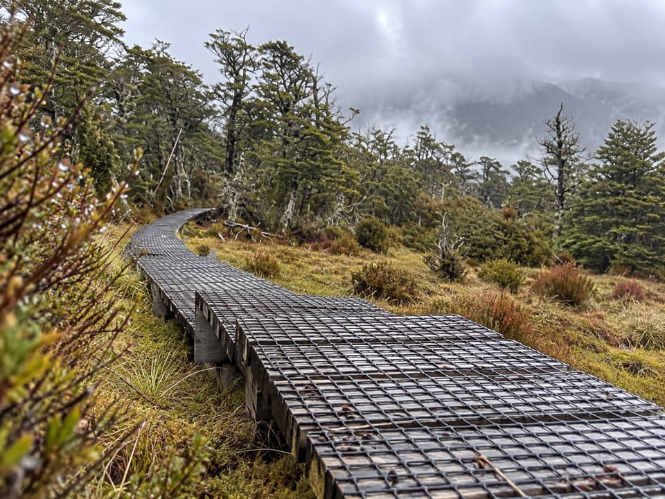
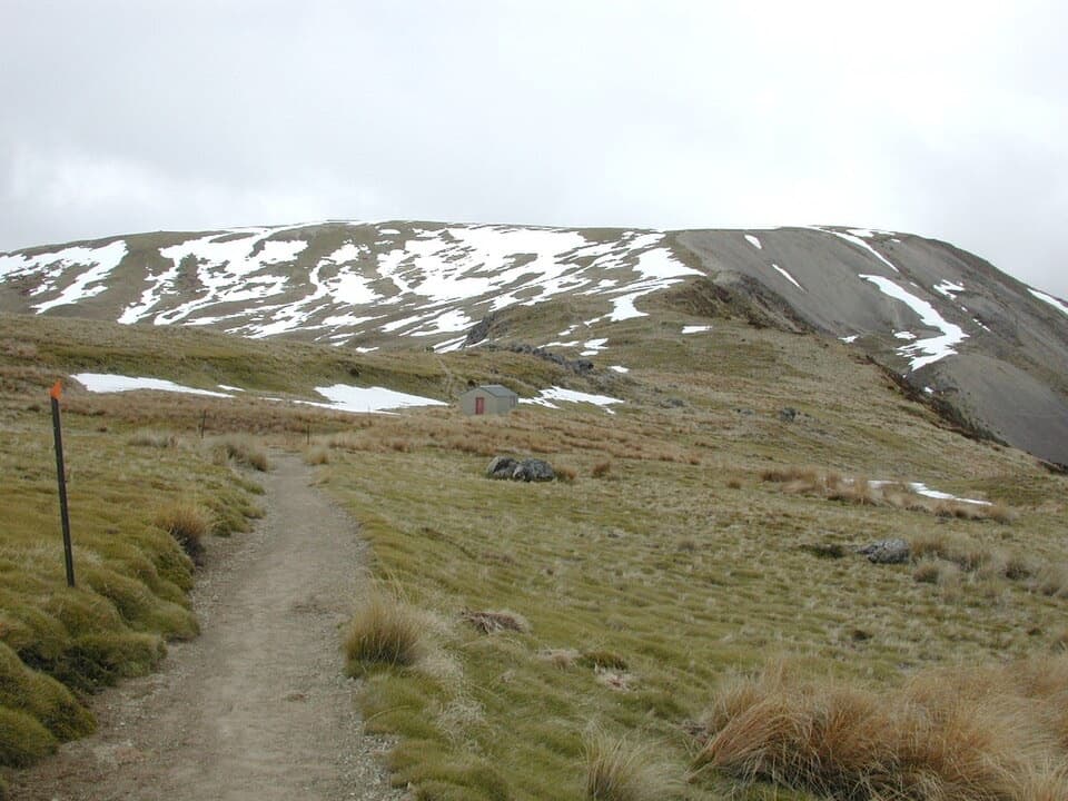
The classic route from Mount Robert car park is 12.2 km one way and takes about six hours. It climbs steep zigzags to Robert Ridge, follows exposed rocky ground over Julius Summit (1,794 m), then descends on poles into the basin. There is no water along Robert Ridge, so plan what you carry before leaving the car park.

Check your route and conditionsThe four approaches—Robert Ridge, Speargrass, Travers–Cascade and Mount Cedric—have different…

The four approaches—Robert Ridge, Speargrass, Travers–Cascade and Mount Cedric—have different demands. Robert Ridge is exposed and rocky; Speargrass includes unbridged stream crossings and muddy lower sections; crossings on the Travers–Cascade route can be difficult after rain or snowmelt. Read the advice for the route you actually plan to use.

Weather can turn from clear to whiteout within minutes, and snow is possible even in summer. The outing is graded as advanced tramping and an expert route; expect rough ground and exposed heights. Avalanche terrain and rapidly changing weather are serious parts of the route planning. In winter, usually May to October, the lake is often frozen and the approaches are snow-covered.


Staying beside the lakeAngelus Hut has 28 bunks and non-flush toilets; its tap water is untreated, so boil, filter or…

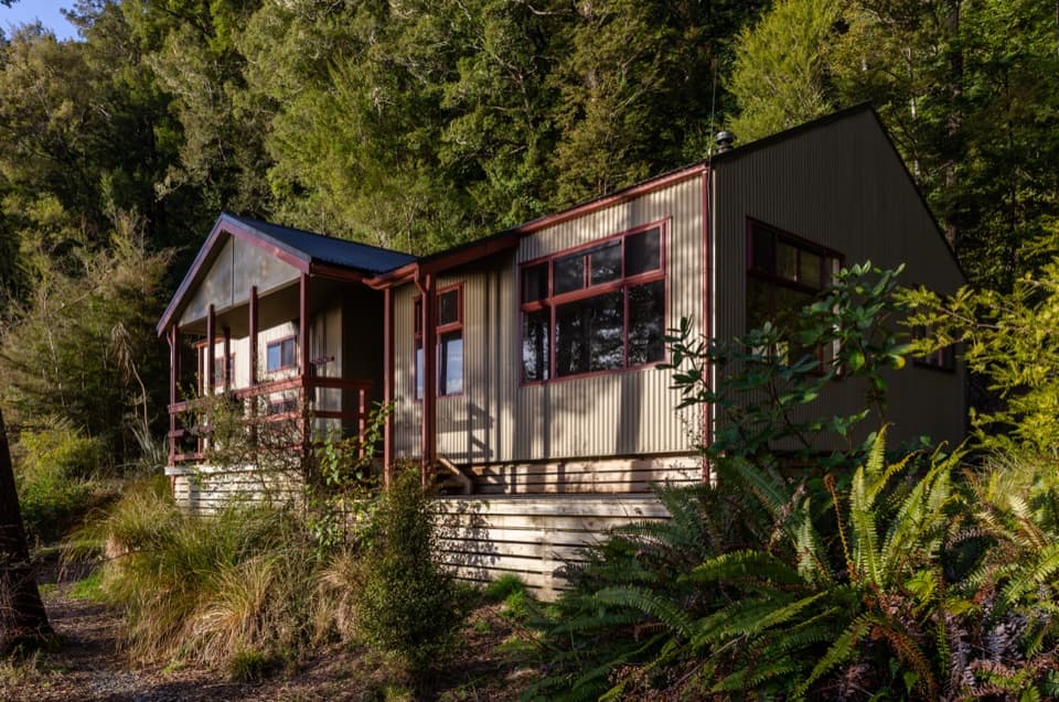
Angelus Hut has 28 bunks and non-flush toilets; its tap water is untreated, so boil, filter or chemically treat it. The designated campsite is below the hut, and campers use the hut toilet. Hut and campsite bookings are required year-round.

Bring your own food, gas and cooking kit: there is no food service or cooking equipment. Keep gear completely dry for 48 hours before swimming or taking water from an alpine tarn to help prevent invasive lindavia from spreading. Pack rubbish out.

A basin made by iceThe rounded lake basin and steep ridges are a legacy of glaciers and permanent snowfields that…

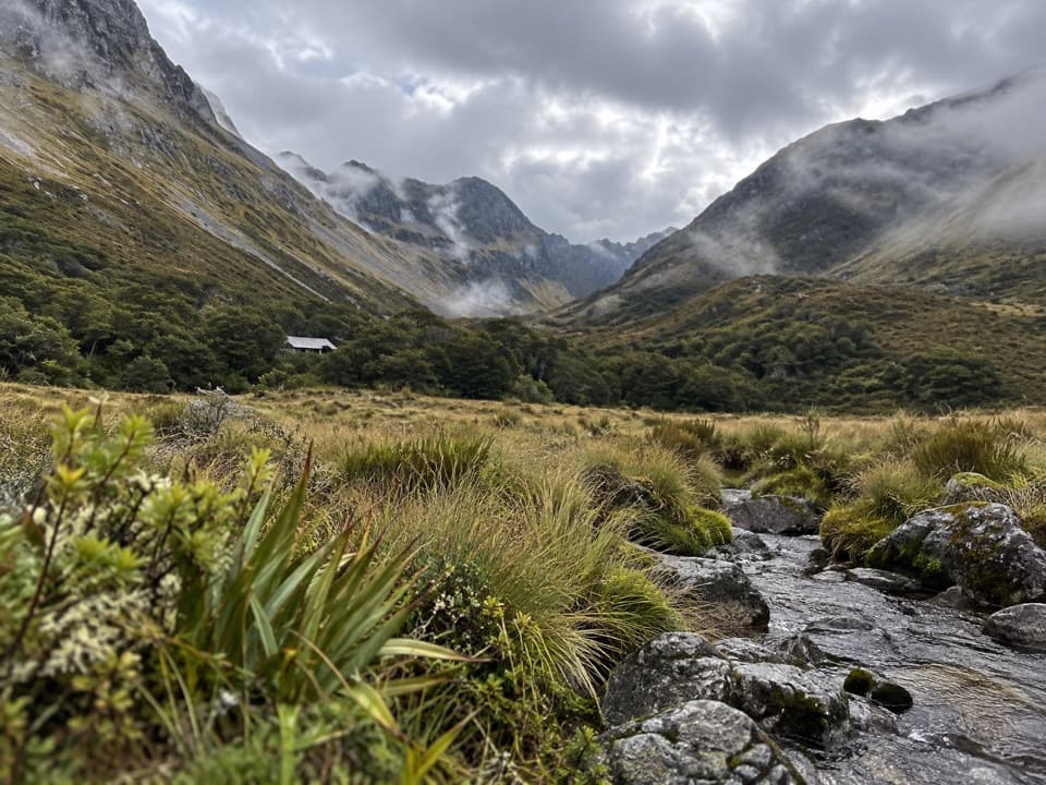
The rounded lake basin and steep ridges are a legacy of glaciers and permanent snowfields that carved the valley walls, bluffs and side creeks. Major ice advances ended about 10,000 years ago, leaving the water-filled basins and sharp surrounding ridges you see here.

The lake's namesAn earlier recorded name was Rangimārie, meaning “peaceful”; a European applied it.

An earlier recorded name was Rangimārie, meaning “peaceful”; a European applied it. Later climbers named a peak to the south Angelus after a devotional prayer, and the lake took the same name. Julius von Haast made the first recorded scramble along Robert Ridge in 1860, though he may not have been the first.

Take in the basin from aboveOn the Robert Ridge approach, pause on the high ridge overlooking the Angelus basin before…

On the Robert Ridge approach, pause on the high ridge overlooking the Angelus basin before following the poles down; that wide view shows the lake in its setting. At the shore, include Angelus Hut with the water and surrounding ridges to show the basin's scale.

Wildlife

Wildlife in Nelson Lakes

All Nelson Lakes wildlife maps

Sighting maps show where each species has been reported across Nelson Lakes. Wildlife moves, so no sighting is guaranteed.

Keep exploring

Near Rotomaninitua / Lake Angelus

See it all on the map

Trails nearby

More stops nearby

Parkwolf’s Nelson Lakes ranking

Top sights in Nelson Lakes

All 47 places
  1. 1Lake Rotoiti – Kerr Bay and JettySight
  2. 2Rotomairewhenua / Blue LakeSight
  3. 3Lake Rotoroa – Foreshore and JettySight
  4. 5Rotopōhueroa / Lake ConstanceSight
  5. 6Whisky FallsSight
  6. 7Parachute RocksSight

Take Parkwolf to Nelson Lakes.

The audio tour guide for the drive, plus offline maps, trails, and wildlife heatmaps for when the signal drops.

4.7 from 8,600+ ratings

Download Parkwolf on the App StoreGet Parkwolf on Google Play