Desolation Peak Lookout in North Cascades National Park

Sight · North Cascades National Park

Desolation Peak Lookout

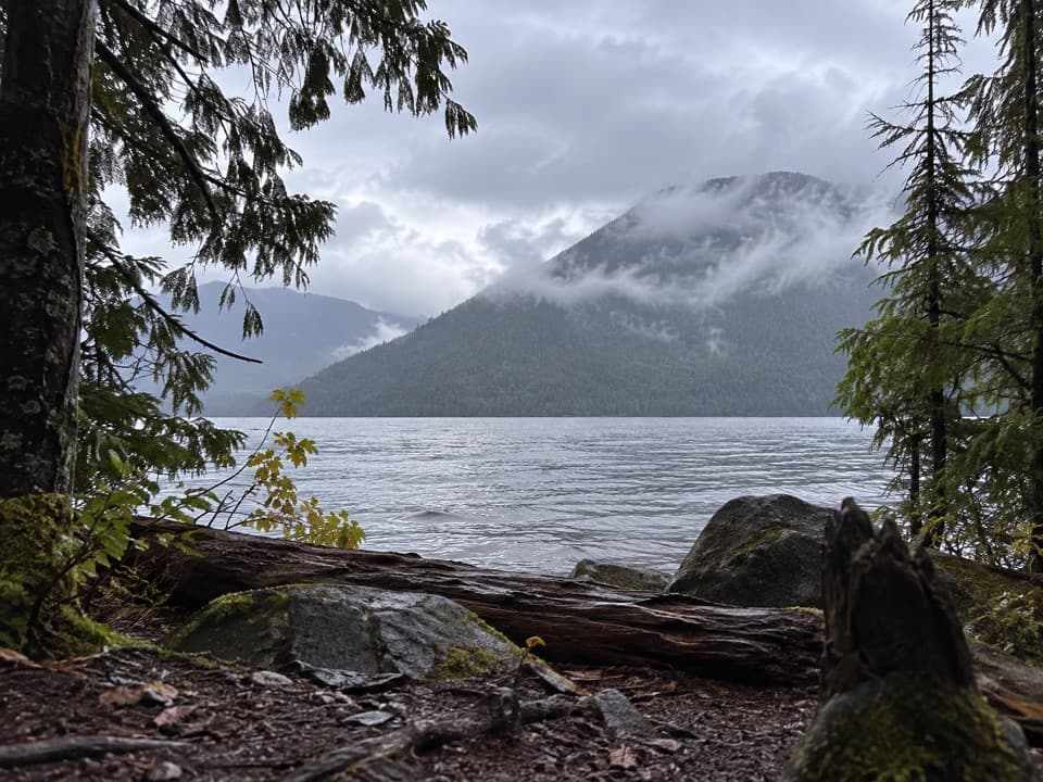
Kerouac’s 1956 lookout crowns a steep climb above Ross Lake.

Photo: Wikimedia Commons

Overview

About Desolation Peak Lookout

Why stop

  • Historic cabin tied to Kerouac’s 1956 lookout season
  • Broad summit views from Ross Lake to the Picket Range

Heads up

  • A strenuous, remote climb: 6.25 miles each way and 4,770 feet up from Lightning Creek

Map

Where it is

Loading the North Cascades map
Full map
SightDesolation Peak Lookout48.91130, -121.01632
Keep this map with you offline in the Parkwolf app

Plan your stop

Before you go

Best time to go

Kerouac served here in 1956 and later drew on that season for Desolation Angels. He described the twin peaks of Hozomeen as “the void,” a phrase that suits their stark outline above the lake. The wooden L-4 ground cabin is dated to 1933, more than two decades before his stay.

Getting there and being prepared

You can reach the trail by boat from Ross Lake, with boat transportation sometimes arranged through Ross Lake Resort, or by walking in on the East Bank Trail. From the East Bank trailhead near State Route 20, it is about 16 miles to the junction before the final climb. The route starts beside the lake, then climbs steeply through forest and onto exposed subalpine slopes. Carry all the water you need: after the snow melts there is no reliable source once you leave Ross Lake. Overnight visitors need a backcountry permit and must camp at the small designated site below the summit, not on the summit itself.

7 active North Cascades alerts

  • ClosureWildfire closures and Stehekin fire advisoryWildfire-related closures remain in effect; stay out of all closed trails, camps, and areas.Official details
  • CautionCampfires banned across the park complexCampfires and other ash-producing fires are banned throughout the North Cascades National Park Service Complex.Official details
See all 7 alerts
A park ranger sits on a dash-mounted phone, talking, as Parkwolf’s Tour Guide plays “Army Cutworm Moths: A Grizzly Bear Buffet” on Grand Loop Road below Dunraven Pass in Yellowstone
Parkwolf Tour GuideThe highest, rockiest slopes around here are a summer buffet for grizzly bears.

North Cascades Tour Guide

Your drive to Desolation Peak Lookout, narrated.

Parkwolf is a GPS audio tour guide for North Cascades National Park. As you drive, it chimes in with what’s ahead: hidden gems, upcoming stops, history, geology, and wildlife, right through your car’s speakers.

See the North Cascades audio tour

More stories near here in the app

  • Hozomeen Campground and Hozomeen Lake
  • 83 audio storiesacross North Cascades’s roads, triggered by GPS as you drive
  • Wildlife heatmapsfor Mountain Goat, Black Bear, Mule Deer, and 10 more
  • Works offlinemaps, 88 trails, 76 places, and audio download before you lose signal
  • CarPlay readysimple controls built for the drive
★★★★★
“Fantastic app with many points of information… It’s great to just turn on while you’re driving and it gives you an audio tour of the national Park. We love it!!!!”
JMJamesApp Store review
Download Parkwolf on the App StoreGet Parkwolf on Google Play

4.7 from 8,600+ ratings

Guide

More about Desolation Peak Lookout

A historic lookout at the end of a hard climbDesolation Peak Lookout is a 1933 L-4 fire lookout cabin on a summit above Ross Lake,…

Desolation Peak Lookout is a 1933 L-4 fire lookout cabin on a summit above Ross Lake, surrounded by open subalpine meadows and a wide Cascade panorama. Jack Kerouac worked here as a fire lookout in 1956, but the cabin is closed inside; the visit is about the historic building, the summit and the views. From Lightning Creek, it is 6.25 miles one way with 4,770 feet of climbing. This is a strenuous backcountry destination, not a quick roadside stop.

Turn through the mountain viewThe summit meadows open in every direction: Hozomeen Mountain rises to the north, the Picket…

The summit meadows open in every direction: Hozomeen Mountain rises to the north, the Picket Range and Ross Lake lie west, Jack Mountain is south, and Skagit Peak is east. The lookout makes a strong foreground for a photo; include some of the ridge behind it to show how exposed the cabin is, then turn toward Ross Lake for the broader panorama. Clear conditions make the distant peaks easier to pick out, but mountain weather can change quickly.

A meadow shaped by fireA major burn in 1926, followed by periodic fires, helped create the open summit meadows;…

A major burn in 1926, followed by periodic fires, helped create the open summit meadows; charred wood remains along the trail. Ponderosa and lodgepole pines grow on the route, and deer, grouse and marmots are among the wildlife hikers may encounter, with bears and cougars also present in the area. Keep to durable ground around the fragile meadow plants. The summit is exposed, and the weather can swing from hot and dry to stormy.

Wildlife

Wildlife in North Cascades

All North Cascades wildlife maps

Sighting maps show where each species has been reported across North Cascades. Wildlife moves, so no sighting is guaranteed.

Parkwolf’s North Cascades ranking

Top sights in North Cascades

All 76 places
  1. 1Diablo Lake OverlookSight
  2. 2Washington Pass OverlookSight
  3. 3Rainbow FallsSight
  4. 4Gorge Creek FallsSight
  5. 5Ross Lake OverlookSight
  6. 6Ladder Creek FallsSight

Take Parkwolf to North Cascades.

The audio tour guide for the drive, plus offline maps, trails, and wildlife heatmaps for when the signal drops.

4.7 from 8,600+ ratings

Download Parkwolf on the App StoreGet Parkwolf on Google Play