Anne’s Beach in Overseas Highway

Beach · Overseas Highway

Anne’s Beach

Mangrove boardwalk and shallow water make this an easy Keys pause.

Photo: Wikimedia Commons
Type
Beach
Audio stories
3 nearby
  • Parking
  • Restrooms
  • Picnic tables

Hear the audio tour

Anne’s Beach: Boardwalk, Picnic and Shallow Water

Overview

About Anne’s Beach

Why stop

  • The boardwalk and shaded pavilions make a good drive break.

Heads up

  • The narrow shore isn’t a broad, soft-sand swimming beach.

Map

Where it is

Loading the Overseas Highway map
Full map
BeachAnne’s Beach24.84833, -80.74105
Keep this map with you offline in the Parkwolf app

Plan your stop

Before you go

3 active Overseas Highway alerts

  • CautionCoastal flooding across the Florida KeysA Coastal Flood Warning remains in effect for the Upper Keys and Coastal Flood Advisories remain in effect for the Middle and Lower Keys until 5 a.m.Official details
  • CautionNighttime lane closures on Seven Mile BridgeExpect possible nighttime lane closures on Seven Mile Bridge for FDOT’s rehabilitation project to repair and strengthen the bridge.Official details

See all 3 alerts
A park ranger sits on a dash-mounted phone, talking, as Parkwolf’s Tour Guide plays “Army Cutworm Moths: A Grizzly Bear Buffet” on Grand Loop Road below Dunraven Pass in Yellowstone
Parkwolf Tour GuideThe highest, rockiest slopes around here are a summer buffet for grizzly bears.

Overseas Highway Tour Guide

Your drive to Anne’s Beach, narrated.

Parkwolf is a GPS audio tour guide for Overseas Highway. As you drive, it chimes in with what’s ahead: hidden gems, upcoming stops, history, geology, and wildlife, right through your car’s speakers.

See the Overseas Highway audio tour

Recorded for this place

Anne’s Beach: Boardwalk, Picnic and Shallow Water
0:00 / 0:30
“Up ahead is Anne's Beach, a small Atlantic-side park for a boardwalk stroll, picnic or shallow wade. The narrow shoreline can be muddy or rocky, so I'd choose it for a short break rather than a long swim.”

Plays as you drive up to Anne’s Beach in the Parkwolf Overseas Highway Tour Guide.

More stories near here in the app

  • An Iron Tower at Sea
  • The Sponge’s Hidden Work
  • A County Seat Offshore
  • Robbie’s of Islamorada: Tarpon and Seafood
  • 136 audio storiesacross Overseas Highway’s roads, triggered by GPS as you drive
  • Wildlife heatmapsfor Crocodile, Alligator, Manatee, and 13 more
  • Works offlinemaps, 26 trails, 88 places, and audio download before you lose signal
  • CarPlay readysimple controls built for the drive
★★★★★
“Fantastic app with many points of information… It’s great to just turn on while you’re driving and it gives you an audio tour of the national Park. We love it!!!!”
JMJamesApp Store review
Download Parkwolf on the App StoreGet Parkwolf on Google Play

4.7 from 8,600+ ratings

Guide

More about Anne’s Beach

A short break, not a full beach dayAnne’s Beach is a small, shallow Atlantic beach park at mile marker 73.

Anne’s Beach is a small, shallow Atlantic beach park at mile marker 73.5 on the oceanside of the Overseas Highway in Islamorada. Come for a shady pause, an easy boardwalk stroll and a calm wade. The shoreline is narrow, so this is a better stop for mangroves and a picnic than for a long swim on soft sand.

Walk the shoreA raised boardwalk follows the mangroves and buttonwood between the beach’s access areas, with…

A raised boardwalk follows the mangroves and buttonwood between the beach’s access areas, with openings down to the water. Six covered picnic pavilions give you a place to sit out of the sun, and the public restroom is by the north parking area. The two small lots can fill; if you see a space, take it. The park is open from sunrise to sunset, and dogs are allowed on leash.

Named for a local conservationistThe beach honors Anne Eaton, a Keys teacher and environmentalist who worked to protect this…

The beach honors Anne Eaton, a Keys teacher and environmentalist who worked to protect this stretch from overdevelopment. After her death in 1992, the beach was named for her. It’s a fitting name for a little public shoreline whose appeal depends on keeping the mangroves and water’s edge intact.

Look through the mangrovesSlow down on the boardwalk and look for crabs in the shallows and wading birds along the…

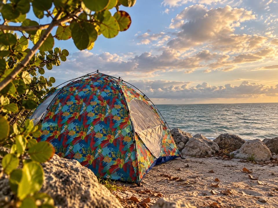
Slow down on the boardwalk and look for crabs in the shallows and wading birds along the mangrove edge. For a photo, use the branches as a foreground frame and catch the water beyond them; the best shoreline angles come after you leave the parking area. The water is usually calm, but the small sandy openings can be muddy or rocky, so expect more wading than swimming.

Wildlife

Wildlife in Overseas Highway

All Overseas Highway wildlife maps

Sighting maps show where each species has been reported across Overseas Highway. Wildlife moves, so no sighting is guaranteed.

Parkwolf’s Overseas Highway ranking

Top sights in Overseas Highway

All 88 places
  1. 1Old Seven Mile BridgeSight
  2. 2Southernmost Point BuoySight
  3. 3Mallory SquareSight
  4. 4Calusa BeachBeach
  5. 5Ernest Hemingway Home and MuseumSight
  6. 6Robbie’s of IslamoradaSight

Take Parkwolf to Overseas Highway.

The audio tour guide for the drive, plus offline maps, trails, and wildlife heatmaps for when the signal drops.

4.7 from 8,600+ ratings

Download Parkwolf on the App StoreGet Parkwolf on Google Play