Fort Zachary Taylor in Overseas Highway

Sight · Overseas Highway

Fort Zachary Taylor

Walk the cannon rooms of the fort built to guard Key West.

Photo: Wikimedia Commons
Type
Sight
Nearest trail
3.1 mi
Audio stories
12 nearby
  • Exhibit
  • Restrooms
  • Parking
  • #16 of 64 sights

Hear the audio tour

Fort Zachary Taylor: Beach and Cannon Rooms

Overview

About Fort Zachary Taylor

Why stop

  • A walk-through fort with cannon rooms that make Key West’s harbor defenses tangible.

Heads up

  • Upper levels require stairs, and the outdoor walk can be hot.

Map

Where it is

Loading the Overseas Highway map
Full map
SightFort Zachary Taylor24.54792, -81.81002
Keep this map with you offline in the Parkwolf app

Plan your stop

Before you go

3 active Overseas Highway alerts

  • CautionCoastal flooding across the Florida KeysA Coastal Flood Warning remains in effect for the Upper Keys and Coastal Flood Advisories remain in effect for the Middle and Lower Keys until 5 a.m.Official details
  • CautionNighttime lane closures on Seven Mile BridgeExpect possible nighttime lane closures on Seven Mile Bridge for FDOT’s rehabilitation project to repair and strengthen the bridge.Official details

See all 3 alerts
A park ranger sits on a dash-mounted phone, talking, as Parkwolf’s Tour Guide plays “Army Cutworm Moths: A Grizzly Bear Buffet” on Grand Loop Road below Dunraven Pass in Yellowstone
Parkwolf Tour GuideThe highest, rockiest slopes around here are a summer buffet for grizzly bears.

Overseas Highway Tour Guide

Your drive to Fort Zachary Taylor, narrated.

Parkwolf is a GPS audio tour guide for Overseas Highway. As you drive, it chimes in with what’s ahead: hidden gems, upcoming stops, history, geology, and wildlife, right through your car’s speakers.

See the Overseas Highway audio tour

Recorded for this place

Fort Zachary Taylor: Beach and Cannon Rooms
0:00 / 0:39
“Fort Zachary Taylor State Park is coming up, with a beach and a walk-through coastal fort in the same stop.”

Plays as you drive up to Fort Zachary Taylor in the Parkwolf Overseas Highway Tour Guide.

More stories near here in the app

  • Ingham: Inside a Coast Guard Cutter
  • Truman Little White House: A Working Retreat
  • Hemingway Home and Key West Lighthouse
  • U.S. 1 Mile Marker Zero
  • 136 audio storiesacross Overseas Highway’s roads, triggered by GPS as you drive
  • Wildlife heatmapsfor Crocodile, Alligator, Manatee, and 13 more
  • Works offlinemaps, 26 trails, 88 places, and audio download before you lose signal
  • CarPlay readysimple controls built for the drive
★★★★★
“Fantastic app with many points of information… It’s great to just turn on while you’re driving and it gives you an audio tour of the national Park. We love it!!!!”
JMJamesApp Store review
Download Parkwolf on the App StoreGet Parkwolf on Google Play

4.7 from 8,600+ ratings

Guide

More about Fort Zachary Taylor

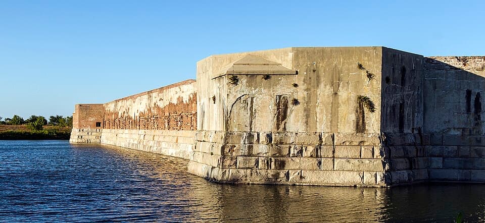
A fort, not just a beach stopFort Zachary Taylor is a red-brick coastal fort at the southern end of Key West, built to guard…

Fort Zachary Taylor is a red-brick coastal fort at the southern end of Key West, built to guard the harbor. You can walk its arched gun rooms, see cannons and gun ports, and climb toward the upper works. If you care about military history, make time for the fort itself; the beach is a separate stop within the same state park. Explore on your own or join a guided tour for more of the story.

Walk the gun roomsThe fort’s brick arcades put you among the covered rooms where guns could fire through openings…

The fort’s brick arcades put you among the covered rooms where guns could fire through openings in the walls. Look for the 10-inch Rodman and Columbiad cannons: these were the heavy coastal guns used against blockade runners. The walk also takes you past interpretive panels and out toward the upper level, where the views help explain why this position mattered.

A fort that stayed with the UnionConstruction began in 1845, named for President Zachary Taylor.

Construction began in 1845, named for President Zachary Taylor. When Florida seceded in 1861, the fort remained under federal control and became headquarters for the Navy’s East Gulf Coast Blockading Squadron. It remained in military use through 1947, long after the Civil War ended.

The arsenal beneath your feetIn 1968, workers uncovered a buried arsenal of Civil War-era guns and ammunition here.

In 1968, workers uncovered a buried arsenal of Civil War-era guns and ammunition here. It makes the artillery displays feel like more than relics: this fort really did hold the weapons for a harbor defense.

It used to stand offshoreThe fort was originally built about 1,200 feet offshore.

The fort was originally built about 1,200 feet offshore. Mid-1960s Navy dredging landlocked it, with dredged fill forming the surrounding land; a moat was later dug to echo the fort’s former waterside setting. From the outer path, include the moat and the long brick wall in a photo to show how the bastion wraps around the water.

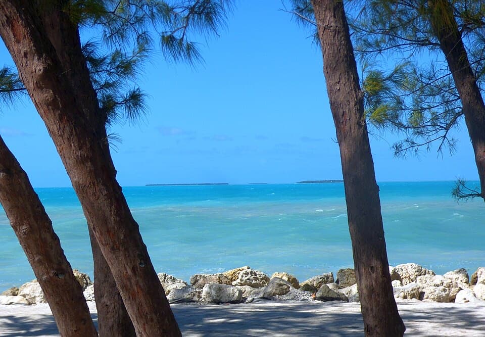
Make room for the rest of the parkThe beach and picnic area are elsewhere on the park grounds.

The beach and picnic area are elsewhere on the park grounds. Cayo Hueso Café serves food, refreshments, and local cuisine there, so it’s an easy add-on after the fort. If you head to the beach too, expect a rocky, coral-studded bottom rather than uniformly soft sand; water shoes help.

Look for more than the fortThe park’s hardwood hammock and coastline are a stopover for migrating birds.

The park’s hardwood hammock and coastline are a stopover for migrating birds. More than 35 wood-warbler species have been recorded here, especially around spring and fall migration, though sightings vary. The fort is the main reason to visit this stop; the bird habitat is a worthwhile bonus if you’re already taking time in the park.

Plan for stairs and heatSome ground-level areas and interpretive panels are accessible, but reaching the upper levels…

Some ground-level areas and interpretive panels are accessible, but reaching the upper levels means climbing stairs. The outdoor walk can feel hot, so take the fort at your own pace. Restrooms and a refillable-water station are by the fort; pets may visit other parts of the park on leash but aren’t allowed inside the fort or on the beach.

Wildlife

Wildlife in Overseas Highway

All Overseas Highway wildlife maps

Sighting maps show where each species has been reported across Overseas Highway. Wildlife moves, so no sighting is guaranteed.

Parkwolf’s Overseas Highway ranking

Top sights in Overseas Highway

All 88 places
  1. 1Old Seven Mile BridgeSight
  2. 2Southernmost Point BuoySight
  3. 3Mallory SquareSight
  4. 4Calusa BeachBeach
  5. 5Ernest Hemingway Home and MuseumSight
  6. 6Robbie’s of IslamoradaSight

Take Parkwolf to Overseas Highway.

The audio tour guide for the drive, plus offline maps, trails, and wildlife heatmaps for when the signal drops.

4.7 from 8,600+ ratings

Download Parkwolf on the App StoreGet Parkwolf on Google Play