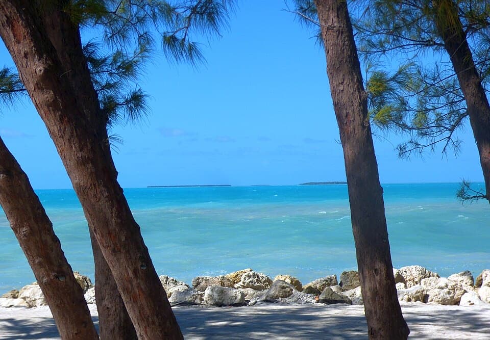
Fort Zachary Taylor Beach in Overseas Highway

Beach · Overseas Highway

Fort Zachary Taylor Beach

A rocky beach for snorkeling, shaded picnics, and sunset views.

Photo: Wikimedia Commons
Type
Beach
Nearest trail
3.1 mi
Audio stories
12 nearby
  • Parking
  • Restrooms
  • Picnic tables
  • Food
  • #13 of 64 sights

Hear the audio tour

Fort Zachary Taylor: Beach and Cannon Rooms

Overview

About Fort Zachary Taylor Beach

Why stop

  • Tropical fish gather around the rock breakwaters, making shore snorkeling worthwhile.
  • Shaded picnic grounds and the fort make it easy to stay longer.

Heads up

  • Pebbles and rocky footing make barefoot water entry uncomfortable.

Map

Where it is

Loading the Overseas Highway map
Full map
BeachFort Zachary Taylor Beach24.54550, -81.81032
Keep this map with you offline in the Parkwolf app

Plan your stop

Before you go

3 active Overseas Highway alerts

  • CautionCoastal flooding across the Florida KeysA Coastal Flood Warning remains in effect for the Upper Keys and Coastal Flood Advisories remain in effect for the Middle and Lower Keys until 5 a.m.Official details
  • CautionNighttime lane closures on Seven Mile BridgeExpect possible nighttime lane closures on Seven Mile Bridge for FDOT’s rehabilitation project to repair and strengthen the bridge.Official details

See all 3 alerts
A park ranger sits on a dash-mounted phone, talking, as Parkwolf’s Tour Guide plays “Army Cutworm Moths: A Grizzly Bear Buffet” on Grand Loop Road below Dunraven Pass in Yellowstone
Parkwolf Tour GuideThe highest, rockiest slopes around here are a summer buffet for grizzly bears.

Overseas Highway Tour Guide

Your drive to Fort Zachary Taylor Beach, narrated.

Parkwolf is a GPS audio tour guide for Overseas Highway. As you drive, it chimes in with what’s ahead: hidden gems, upcoming stops, history, geology, and wildlife, right through your car’s speakers.

See the Overseas Highway audio tour

Recorded for this place

Fort Zachary Taylor: Beach and Cannon Rooms
0:00 / 0:39
“Fort Zachary Taylor State Park is coming up, with a beach and a walk-through coastal fort in the same stop.”

Plays as you drive up to Fort Zachary Taylor Beach in the Parkwolf Overseas Highway Tour Guide.

More stories near here in the app

  • Ingham: Inside a Coast Guard Cutter
  • Hemingway Home and Key West Lighthouse
  • Truman Little White House: A Working Retreat
  • U.S. 1 Mile Marker Zero
  • 136 audio storiesacross Overseas Highway’s roads, triggered by GPS as you drive
  • Wildlife heatmapsfor Crocodile, Alligator, Manatee, and 13 more
  • Works offlinemaps, 26 trails, 88 places, and audio download before you lose signal
  • CarPlay readysimple controls built for the drive
★★★★★
“Fantastic app with many points of information… It’s great to just turn on while you’re driving and it gives you an audio tour of the national Park. We love it!!!!”
JMJamesApp Store review
Download Parkwolf on the App StoreGet Parkwolf on Google Play

4.7 from 8,600+ ratings

Guide

More about Fort Zachary Taylor Beach

A beach stop at the park's southern endFort Zachary Taylor Beach is the south-end shoreline of Fort Zachary Taylor Historic State Park…

Fort Zachary Taylor Beach is the south-end shoreline of Fort Zachary Taylor Historic State Park in Key West, with a mix of sand and pebbles, shallow swimming water, and a rocky bottom. Come for a swim, a snorkel around the breakwaters, or a shaded picnic; it isn't a broad, barefoot-soft beach. Bring water shoes—the pebbles and rocks can make getting in uncomfortable. There are no lifeguards, and swimming is at your own risk.

Fish along the breakwatersTropical fish gather around the rock breakwaters, making shore snorkeling a draw beyond the…

Tropical fish gather around the rock breakwaters, making shore snorkeling a draw beyond the swim. Visibility and seaweed can vary, so treat snorkeling as conditions-dependent. Fishing is allowed from the rock jetty beside the main shipping channel; check that you have the required fishing license.

Make an afternoon of itShaded picnic grounds with tables and charcoal grills are close to the beach.

Shaded picnic grounds with tables and charcoal grills are close to the beach. The park has public restrooms, rinse showers, parking, and a canoe and kayak launch at the east end of the beach. Cayo Hueso Café serves food and refreshments, and the beach concession rents snorkel gear, chairs, and umbrellas. Free beach wheelchairs are available on request at the café or park office; a bottle-refill station is at the fort restroom.

Add the fort if you have timeFort Taylor began in 1845 as a defense for Key West Harbor, was named for President Zachary…

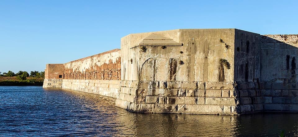
Fort Taylor began in 1845 as a defense for Key West Harbor, was named for President Zachary Taylor in 1850, and was completed in 1866. Pairing a swim with a walk through the fort turns the beach into a history stop as well.

Frame the shorelineFor a beach photograph, use the casuarina trunks and pale shoreline rocks to frame the…

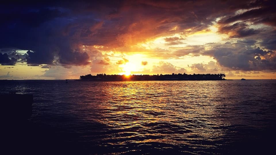
For a beach photograph, use the casuarina trunks and pale shoreline rocks to frame the turquoise water. Near sunset, include the dark rocks along the waterline against the open horizon. It is a worthwhile view even when conditions do not suit snorkeling.

Wildlife

Wildlife in Overseas Highway

All Overseas Highway wildlife maps

Sighting maps show where each species has been reported across Overseas Highway. Wildlife moves, so no sighting is guaranteed.

Parkwolf’s Overseas Highway ranking

Top sights in Overseas Highway

All 88 places
  1. 1Old Seven Mile BridgeSight
  2. 2Southernmost Point BuoySight
  3. 3Mallory SquareSight
  4. 4Calusa BeachBeach
  5. 5Ernest Hemingway Home and MuseumSight
  6. 6Robbie’s of IslamoradaSight

Take Parkwolf to Overseas Highway.

The audio tour guide for the drive, plus offline maps, trails, and wildlife heatmaps for when the signal drops.

4.7 from 8,600+ ratings

Download Parkwolf on the App StoreGet Parkwolf on Google Play