Sombrero Beach in Overseas Highway

#10 of 64 sights in Overseas Highway

Beach · Overseas Highway

Sombrero Beach

A small beach with showers, shady picnic spots and volleyball.

Type
Beach
Nearest trail
2.7 mi
Audio stories
4 nearby
  • Parking
  • Restrooms
  • Picnic tables

Hear the audio tour

Sombrero Beach: Sand and Picnic Shade

Overview

About Sombrero Beach

Why stop

  • Shady picnic space, showers and a playground sit just behind the sand.

Heads up

  • The usable shoreline is compact and can feel crowded.

Map

Where it is

Loading the Overseas Highway map
Full map
BeachSombrero Beach24.69170, -81.08476
Keep this map with you offline in the Parkwolf app

Plan your stop

Before you go

3 active Overseas Highway alerts

  • CautionCoastal flooding across the Florida KeysA Coastal Flood Warning remains in effect for the Upper Keys and Coastal Flood Advisories remain in effect for the Middle and Lower Keys until 5 a.m.Official details
  • CautionNighttime lane closures on Seven Mile BridgeExpect possible nighttime lane closures on Seven Mile Bridge for FDOT’s rehabilitation project to repair and strengthen the bridge.Official details

See all 3 alerts
A park ranger sits on a dash-mounted phone, talking, as Parkwolf’s Tour Guide plays “Army Cutworm Moths: A Grizzly Bear Buffet” on Grand Loop Road below Dunraven Pass in Yellowstone
Parkwolf Tour GuideThe highest, rockiest slopes around here are a summer buffet for grizzly bears.

Overseas Highway Tour Guide

Your drive to Sombrero Beach, narrated.

Parkwolf is a GPS audio tour guide for Overseas Highway. As you drive, it chimes in with what’s ahead: hidden gems, upcoming stops, history, geology, and wildlife, right through your car’s speakers.

See the Overseas Highway audio tour

Recorded for this place

Sombrero Beach: Sand and Picnic Shade
0:00 / 0:29
“Up ahead is Sombrero Beach, a compact sandy beach on Marathon's Atlantic side with a shady park behind it.”

Plays as you drive up to Sombrero Beach in the Parkwolf Overseas Highway Tour Guide.

More stories near here in the app

  • The Feet Between the Spines
  • The Manatee’s Marching Molars
  • Crane Point: Hammock Trails and the Adderley House
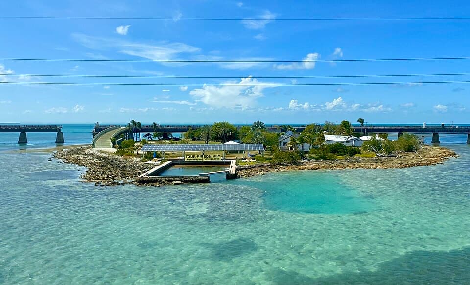
  • Old Seven Mile Bridge and Pigeon Key
  • 136 audio storiesacross Overseas Highway’s roads, triggered by GPS as you drive
  • Wildlife heatmapsfor Crocodile, Alligator, Manatee, and 13 more
  • Works offlinemaps, 26 trails, 88 places, and audio download before you lose signal
  • CarPlay readysimple controls built for the drive
★★★★★
“Fantastic app with many points of information… It’s great to just turn on while you’re driving and it gives you an audio tour of the national Park. We love it!!!!”
JMJamesApp Store review
Download Parkwolf on the App StoreGet Parkwolf on Google Play

4.7 from 8,600+ ratings

Guide

More about Sombrero Beach

A compact family beachSombrero Beach is a public sandy beach on Marathon’s Atlantic side, with a shady city park just…

Sombrero Beach is a public sandy beach on Marathon’s Atlantic side, with a shady city park just behind the shore. It works well for a beach-and-picnic stop: there are restrooms, showers, picnic pavilions, a playground and volleyball courts. The usable shoreline is modest, so arrive early on holidays or in high season if you want a little more room.

Getting from the park to the sandParking sits beside the park, and a wide, flat path leads from the facilities toward the beach.

Parking sits beside the park, and a wide, flat path leads from the facilities toward the beach. The City says its 2001 redevelopment added accessibility improvements. There are no RV or bus spaces, and visitors often report tight parking when the beach is busy. Leashed dogs are allowed; keep them on leash and clean up after them.

Swimming, and variable shore conditionsPeople come to swim, wade, sunbathe and play volleyball, with picnic shade and a playground…

People come to swim, wade, sunbathe and play volleyball, with picnic shade and a playground close by. Reviews disagree about water clarity and the amount of seaweed: some visits are clear and clean, while others find the shore cloudy, weedy or smelly. Treat clear water as a bonus rather than a guarantee.

Loggerheads on the beachLoggerhead turtles nest here, mostly at night from April through October.

Loggerhead turtles nest here, mostly at night from April through October. The City limits activity around active nests, which usually take up less than a tenth of the available beach. Give marked areas space and follow the posted protections.

Frame the palms with the waterFor a photo, include palms and beach grass at the edge of the sand instead of pointing straight…

For a photo, include palms and beach grass at the edge of the sand instead of pointing straight at open water. That foreground gives the shoreline a sense of place, and the palms stand out against the pale beach.

Wildlife

Wildlife in Overseas Highway

All Overseas Highway wildlife maps

Sighting maps show where each species has been reported across Overseas Highway. Wildlife moves, so no sighting is guaranteed.

Parkwolf’s Overseas Highway ranking

Top sights in Overseas Highway

All 88 places
  1. 1Old Seven Mile BridgeSight
  2. 2Southernmost Point BuoySight
  3. 3Mallory SquareSight
  4. 4Calusa BeachBeach
  5. 5Ernest Hemingway Home and MuseumSight
  6. 6Robbie’s of IslamoradaSight

Take Parkwolf to Overseas Highway.

The audio tour guide for the drive, plus offline maps, trails, and wildlife heatmaps for when the signal drops.

4.7 from 8,600+ ratings

Download Parkwolf on the App StoreGet Parkwolf on Google Play