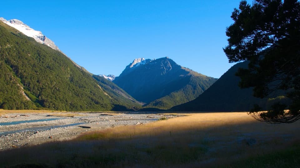
Hunter Valley Track to The Forks in Queenstown-Lakes District, New Zealand

Queenstown-Lakes District, New Zealand, OT

Hunter Valley Track to The Forks

A rugged river walk to where the Hunter splits in two.

Photo: Photo by Tomas Sobek, CC BY 4.0

Length
12.6km
Time
4.5hr
Elev. change
139m
Difficulty
Challenging
  • No dogs
  • High point 581 m
Parkwolf audio tour298 stories across Queenstown-Lakes District’s roads

Overview

About Hunter Valley Track to The Forks

Why go

  • Braided Hunter River, beech forest and the open sweep of Forbes Flat.

Heads up

  • Unmarked river-valley travel and a permission-based, separate approach to Ferguson Hut.

Map & elevation

The route

Loading the Queenstown-Lakes District map
Full map
Elevation442–581 m
TrailheadFerguson Hut-44.11948, 169.55042
Keep this map with you offline in the Parkwolf app

Plan your hike

Before you go

Parking

Ferguson Hut is the route start, not a car park. The western approach from Kidds Bush to Scrubby Flat Creek crosses Hunter Valley Station land and requires prior permission (at least 48 hours); vehicle access is seasonal, 1 December to 30 May, at the landowner’s discretion. Reaching Ferguson Hut from Scrubby Flat Creek adds 7 km of unmarked walking and at least four river crossings.

Safety

Unmarked sections and unbridged river crossings require navigation and safe river judgment. The Hunter crossing below the forks can be dangerous after heavy rain. The valley floor includes simple avalanche terrain; dogs are prohibited on both land approaches.

3 active Queenstown-Lakes District alerts

  • CautionRob Roy Track: stop at lower lookout during avalanche seasonFrom May to November, end your Rob Roy Track hike at the lower lookout: DOC strongly recommends this because the upper section crosses active avalanche paths.Official details
  • ClosureSkippers Bridge closed to all usersSkippers Bridge is closed to all vehicles, cyclists and pedestrians; stay off the bridge and obey closure signs and barriers.Official details
See all 3 alerts
A park ranger sits on a dash-mounted phone, talking, as Parkwolf’s Tour Guide plays “Army Cutworm Moths: A Grizzly Bear Buffet” on Grand Loop Road below Dunraven Pass in Yellowstone
Parkwolf Tour GuideThe highest, rockiest slopes around here are a summer buffet for grizzly bears.

Queenstown-Lakes District Tour Guide

Your drive to Hunter Valley Track to The Forks, narrated.

Parkwolf is a GPS audio tour guide for Queenstown-Lakes District, New Zealand. As you drive, it chimes in with what’s ahead: hidden gems, upcoming stops, history, geology, and wildlife, right through your car’s speakers.

See the Queenstown-Lakes District audio tour
  • 298 audio storiesacross Queenstown-Lakes District’s roads, triggered by GPS as you drive
  • Wildlife heatmapsfor Kea, Kākā, Kererū, and 13 more
  • Works offlinemaps, 155 trails, 129 places, and audio download before you lose signal
  • CarPlay readysimple controls built for the drive
★★★★★
“Fantastic app with many points of information… It’s great to just turn on while you’re driving and it gives you an audio tour of the national Park. We love it!!!!”
JMJamesApp Store review
Download Parkwolf on the App StoreGet Parkwolf on Google Play

4.7 from 8,600+ ratings

Trail guide

Hiking Hunter Valley Track to The Forks

A remote one-way sectionHunter Valley Track from Ferguson Hut to The Forks is a 12.

Hunter Valley Track from Ferguson Hut to The Forks is a 12.6 km one-way backcountry walk along the upper Hunter valley. The route follows braided river flats and narrow beech forest before opening onto Forbes Flat, where Forbes Hut stands about halfway up. It is a demanding point-to-point section, not a loop; arrange a return or onward trip before starting. Allow about four to five hours for this section. This record ends at the forks; the longer 23 km Scrubby Flat Creek-to-West Branch bushline itinerary continues farther.

Reaching Ferguson HutFerguson Hut is a backcountry starting point, not a roadside car park.

Ferguson Hut is a backcountry starting point, not a roadside car park. The western approach from Kidds Bush to Scrubby Flat Creek is a 45 km road through Hunter Valley Station land, and landowner permission is required at least 48 hours ahead. Vehicle access is seasonal, 1 December to 30 May, and at the landowner's discretion. From Scrubby Flat Creek, the hut is another 7 km on foot over unmarked ground, with at least four Hunter River crossings. Plan those access miles and ford decisions separately from the 12.6 km route recorded here.

To Forbes FlatFrom Ferguson Hut, follow the 4WD track across Ferguson Creek to the end of the main grassy…

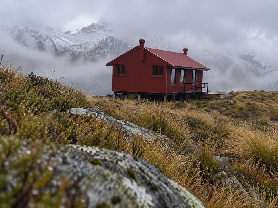
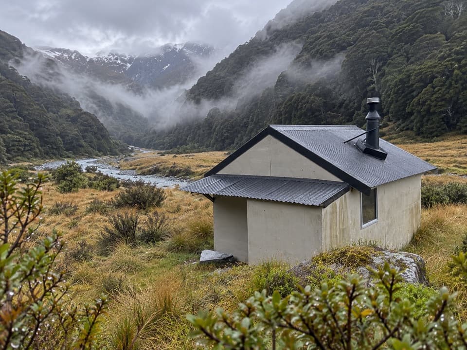
From Ferguson Hut, follow the 4WD track across Ferguson Creek to the end of the main grassy flat. Past that, the route is unmarked. It follows and crosses the Hunter River, threads through a narrow neck of forest to Joes Flat, then crosses the flat and enters forest again. The trees open onto a terrace below Forbes Flat; Forbes Hut sits about halfway up the broad grassy slope.

From Forbes Hut to The ForksContinue up the flat toward the meeting of the Hunter's East and West Branches.

Continue up the flat toward the meeting of the Hunter's East and West Branches. The Hunter River crossing below the forks can be dangerous after heavy rain, so treat water level as a serious go-or-no-go decision. The mapped section ends at The Forks, not at the West Branch bushline. Get the longer itinerary and return or onward transport clear before you leave the hut.

Effort, safety and the viewThis is a remote valley route with no marked track across stretches of the flats, several river…

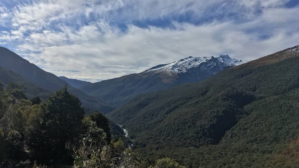
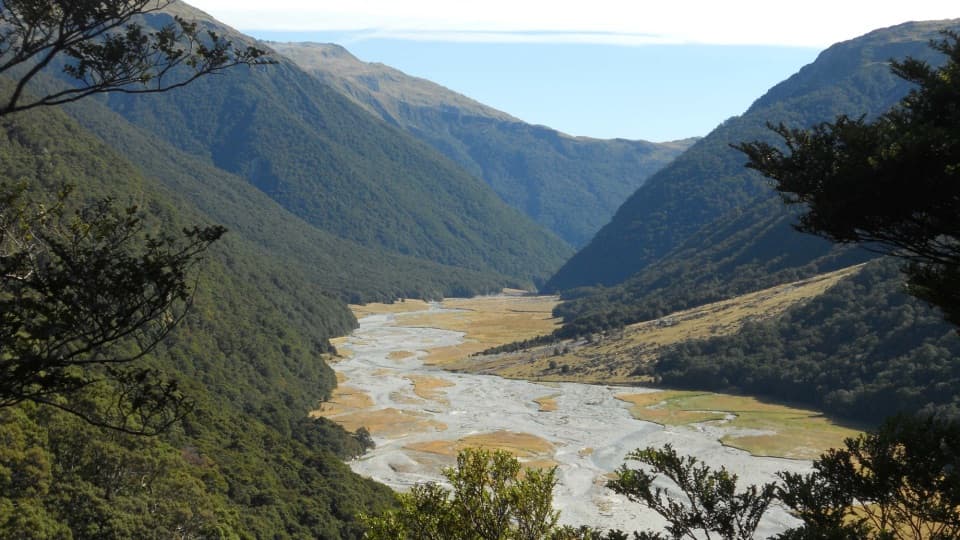
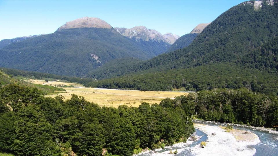
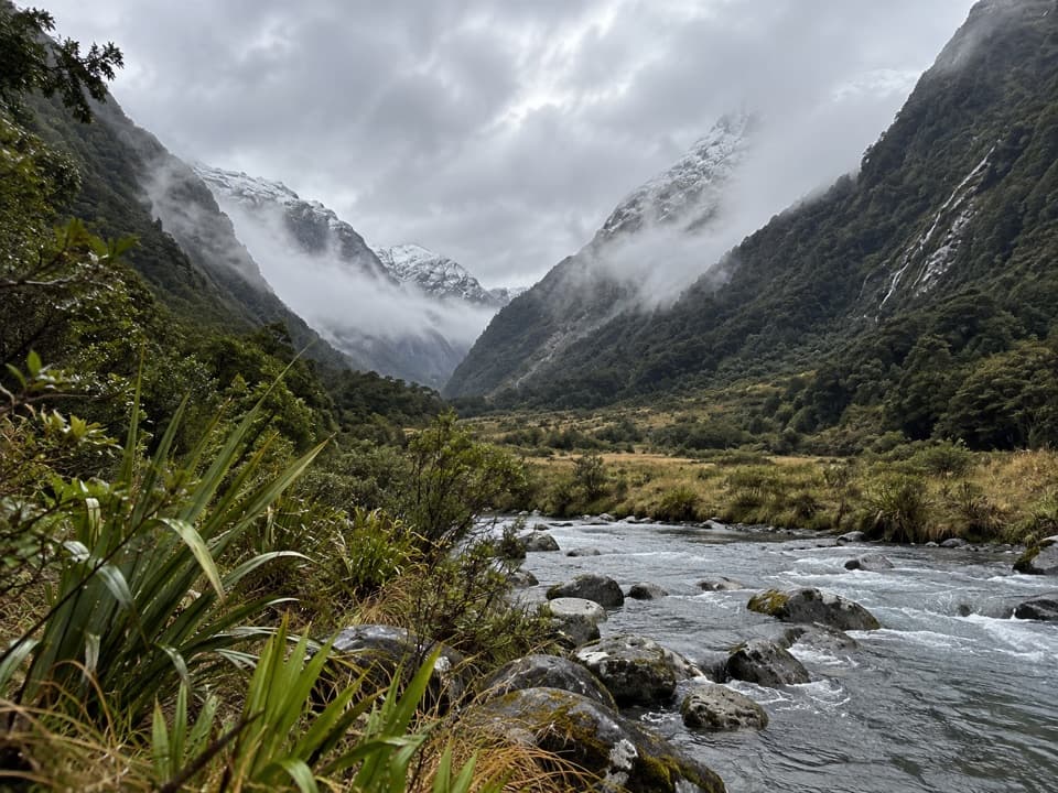
This is a remote valley route with no marked track across stretches of the flats, several river crossings, and simple avalanche terrain on the valley floor. Dogs are not allowed through either access route. At Forbes Flat, the braided river and forested valley walls make the defining view; a low foreground of grass and water shows how broad the valley is.

Wildlife

Wildlife in Queenstown-Lakes District

All Queenstown-Lakes District wildlife maps

Sighting maps show where each species has been reported across Queenstown-Lakes District. Wildlife moves, so no sighting is guaranteed.

Parkwolf’s Queenstown-Lakes District ranking

Top-rated trails in Queenstown-Lakes District

All 155 trails
  1. 1Routeburn TrackChallenging · 33.1 km
  2. 2Roys Peak TrackChallenging · 16 km
  3. 3Ben Lomond TrackChallenging · 14 km
  4. 4Rob Roy TrackModerate · 10 km
  5. 5Isthmus Peak TrackChallenging · 16 km
  6. 6Routeburn Falls TrackChallenging · 19.6 km

Take Parkwolf to Queenstown-Lakes District.

The audio tour guide for the drive, plus offline maps, trails, and wildlife heatmaps for when the signal drops.

4.7 from 8,600+ ratings

Download Parkwolf on the App StoreGet Parkwolf on Google Play