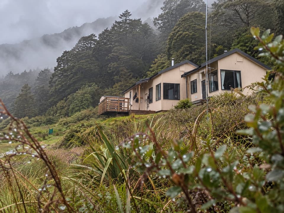
North Branch Wilkin Valley Track in Queenstown-Lakes District, New Zealand

Queenstown-Lakes District, New Zealand, OT

North Branch Wilkin Valley Track

A full day from the hut to three alpine lakes.

Length
16km
Time
7hr
Elev. change
530m
Difficulty
Challenging
  • No dogs
  • High point 1,135 m
Parkwolf audio tour298 stories across Queenstown-Lakes District’s roads

Overview

About North Branch Wilkin Valley Track

Why go

  • Three distinct alpine lakes on one route
  • A genuine backcountry lake outing above the valley

Heads up

  • A remote hut approach comes before the hike
  • River crossings and avalanche terrain need careful planning

Map & elevation

The route

Loading the Queenstown-Lakes District map
Full map
Elevation605–1,135 m
TrailheadTop Forks Hut-44.27448, 168.89094
Keep this map with you offline in the Parkwolf app

Plan your hike

Before you go

Parking

No road access or car park at Top Forks Hut. The approach from Kerin Forks Hut is 15 km and 6–8 hours on foot; plan the overnight logistics and return before setting out. Jet-boat or air transport in the valley must be arranged with providers in advance.

Safety

Several unbridged crossings include South Branch at the hut, a side stream, the Lucidus outlet and North Branch twice. Rivers can become impassable after rain. Boulder hopping is slippery when wet and the last 200 m to Castalia is loose rock. Beyond Lake Diana is complex avalanche terrain; check avalanche conditions for May–November trips.

3 active Queenstown-Lakes District alerts

  • CautionRob Roy Track: stop at lower lookout during avalanche seasonFrom May to November, end your Rob Roy Track hike at the lower lookout: DOC strongly recommends this because the upper section crosses active avalanche paths.Official details
  • ClosureSkippers Bridge closed to all usersSkippers Bridge is closed to all vehicles, cyclists and pedestrians; stay off the bridge and obey closure signs and barriers.Official details
See all 3 alerts
A park ranger sits on a dash-mounted phone, talking, as Parkwolf’s Tour Guide plays “Army Cutworm Moths: A Grizzly Bear Buffet” on Grand Loop Road below Dunraven Pass in Yellowstone
Parkwolf Tour GuideThe highest, rockiest slopes around here are a summer buffet for grizzly bears.

Queenstown-Lakes District Tour Guide

Your drive to North Branch Wilkin Valley Track, narrated.

Parkwolf is a GPS audio tour guide for Queenstown-Lakes District, New Zealand. As you drive, it chimes in with what’s ahead: hidden gems, upcoming stops, history, geology, and wildlife, right through your car’s speakers.

See the Queenstown-Lakes District audio tour
  • 298 audio storiesacross Queenstown-Lakes District’s roads, triggered by GPS as you drive
  • Wildlife heatmapsfor Kea, Kākā, Kererū, and 13 more
  • Works offlinemaps, 155 trails, 129 places, and audio download before you lose signal
  • CarPlay readysimple controls built for the drive
★★★★★
“Fantastic app with many points of information… It’s great to just turn on while you’re driving and it gives you an audio tour of the national Park. We love it!!!!”
JMJamesApp Store review
Download Parkwolf on the App StoreGet Parkwolf on Google Play

4.7 from 8,600+ ratings

Trail guide

Hiking North Branch Wilkin Valley Track

A full day above Top Forks HutThis is a rough out-and-back from Top Forks Hut to Lake Diana, Lake Lucidus and the outlet of…

This is a rough out-and-back from Top Forks Hut to Lake Diana, Lake Lucidus and the outlet of Lake Castalia. The Castalia leg is listed as 8 km and 3–4 hours, so plan on about 16 km (9.9 miles) and 6–8 hours return. The route climbs roughly 530 m from the hut to Castalia. It is a hard day even if you are already staying at Top Forks; for a shorter outing, turn back at Diana or Lucidus.

The hut comes firstTop Forks Hut is deep in the valley, not a road-end trailhead.

Top Forks Hut is deep in the valley, not a road-end trailhead. The walk in from Kerin Forks Hut is 15 km and 6–8 hours, so sort out the overnight plan and return logistics before setting out. Jet-boat and air transport in the valley need to be arranged ahead. There is no road parking at the start, and no dogs are allowed in Mount Aspiring National Park.

Up to Diana and LucidusThe route starts by crossing South Branch in front of the hut.

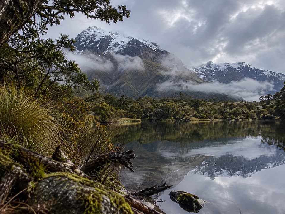
The route starts by crossing South Branch in front of the hut. Much of the first stretch is boulder hopping, with a small side-stream ford that can be awkward; the rocks are slippery when wet. The track then climbs through forest up the spur between the stream and North Branch, reaching Disappearing Tarn. Lake Diana is about five minutes farther on, tucked among subalpine plants. From there, Lake Lucidus is about 20 minutes across grassland. It is a moraine lake, and the change from forest to open alpine ground is a good reason to keep going if you have the time.

On to Lake CastaliaThe branch to Castalia leaves just beyond a boardwalk near Lucidus.

The branch to Castalia leaves just beyond a boardwalk near Lucidus. It crosses the lake outlet and North Branch, climbs through alpine vegetation, then crosses North Branch again to reach a snow-grass terrace and the lake outlet. The last 200 m is loose rock, so slow down there. Lake Diana's sheltered shore gives the clearest reflection view; include a little shoreline and the ridge above it to show the setting.

Crossings and avalanche terrainThere are several unbridged crossings: South Branch at the hut, a side stream, the Lucidus…

There are several unbridged crossings: South Branch at the hut, a side stream, the Lucidus outlet, and North Branch twice. The rivers can become impassable after rain, and you need to be ready to turn back rather than force a crossing. Beyond Lake Diana the route enters complex avalanche terrain; from May through November, check avalanche conditions before going.

Wildlife

Wildlife in Queenstown-Lakes District

All Queenstown-Lakes District wildlife maps

Sighting maps show where each species has been reported across Queenstown-Lakes District. Wildlife moves, so no sighting is guaranteed.

Parkwolf’s Queenstown-Lakes District ranking

Top-rated trails in Queenstown-Lakes District

All 155 trails
  1. 1Routeburn TrackChallenging · 33.1 km
  2. 2Roys Peak TrackChallenging · 16 km
  3. 3Ben Lomond TrackChallenging · 14 km
  4. 4Rob Roy TrackModerate · 10 km
  5. 5Isthmus Peak TrackChallenging · 16 km
  6. 6Routeburn Falls TrackChallenging · 19.6 km

Take Parkwolf to Queenstown-Lakes District.

The audio tour guide for the drive, plus offline maps, trails, and wildlife heatmaps for when the signal drops.

4.7 from 8,600+ ratings

Download Parkwolf on the App StoreGet Parkwolf on Google Play