Crucible Lake Track in Queenstown-Lakes District, New Zealand

Queenstown-Lakes District, New Zealand, OT

Crucible Lake Track

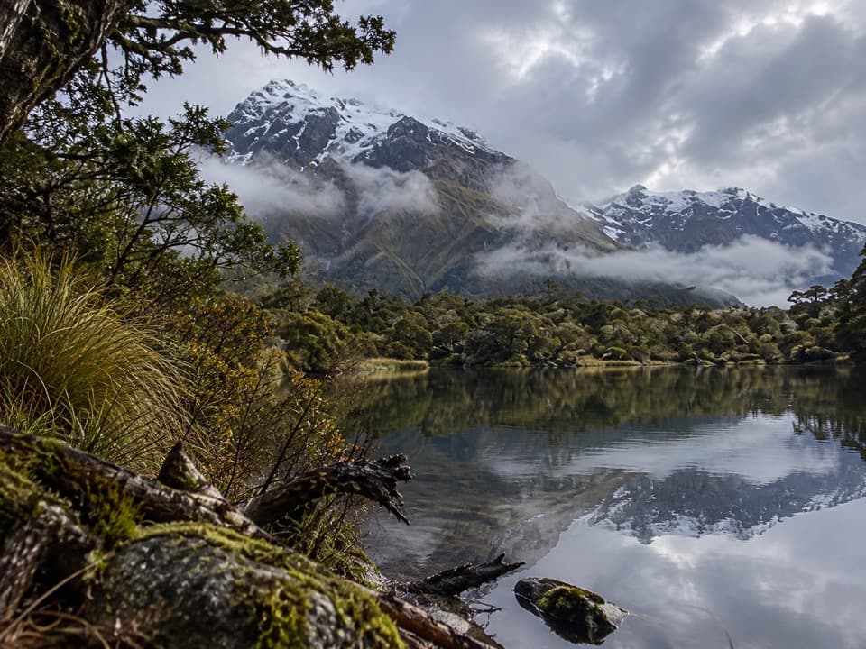
A remote lake beneath Mount Alba, reached across three alpine streams.

Photo: Huku15, CC0 1.0, via Wikimedia Commons

Length
14km
Time
7hr
Elev. change
563m
Difficulty
Challenging
  • No dogs
  • High point 1,174 m
  • #23 of 155 in Queenstown-Lakes District
Parkwolf audio tour298 stories across Queenstown-Lakes District’s roads

Overview

About Crucible Lake Track

Why go

  • A lake in a dramatic moraine basin below Mount Alba
  • Rock wrens are often seen among the outlet boulders

Heads up

  • The remote trailhead needs advance transport or a multi-day approach
  • Three stream crossings and a steep alpine spur

Map & elevation

The route

Loading the Queenstown-Lakes District map
Full map
Elevation611–1,174 m
TrailheadSiberia Hut-44.20475, 169.06172
Keep this map with you offline in the Parkwolf app

Plan your hike

Before you go

Parking

Siberia Hut is the trailhead, with no road access or adjacent car park. Reach it by pre-arranged plane or helicopter, by jet boat to Kerin Forks and then on foot, or overland via the Gillespie Pass Circuit from the Blue Pools car park. Arrange transport in advance.

Safety

Gillespie, Siberia and Crucible streams can become impassable after rain. The route climbs a steep, rough spur and follows poles through the upper basin. Crucible Valley has complex avalanche terrain, with avalanche debris risk from May to November. Dogs are prohibited in the national park; camping is not allowed in Crucible Basin.

3 active Queenstown-Lakes District alerts

  • CautionRob Roy Track: stop at lower lookout during avalanche seasonFrom May to November, end your Rob Roy Track hike at the lower lookout: DOC strongly recommends this because the upper section crosses active avalanche paths.Official details
  • ClosureSkippers Bridge closed to all usersSkippers Bridge is closed to all vehicles, cyclists and pedestrians; stay off the bridge and obey closure signs and barriers.Official details
See all 3 alerts
A park ranger sits on a dash-mounted phone, talking, as Parkwolf’s Tour Guide plays “Army Cutworm Moths: A Grizzly Bear Buffet” on Grand Loop Road below Dunraven Pass in Yellowstone
Parkwolf Tour GuideThe highest, rockiest slopes around here are a summer buffet for grizzly bears.

Queenstown-Lakes District Tour Guide

Your drive to Crucible Lake Track, narrated.

Parkwolf is a GPS audio tour guide for Queenstown-Lakes District, New Zealand. As you drive, it chimes in with what’s ahead: hidden gems, upcoming stops, history, geology, and wildlife, right through your car’s speakers.

See the Queenstown-Lakes District audio tour
  • 298 audio storiesacross Queenstown-Lakes District’s roads, triggered by GPS as you drive
  • Wildlife heatmapsfor Kea, Kākā, Kererū, and 13 more
  • Works offlinemaps, 155 trails, 129 places, and audio download before you lose signal
  • CarPlay readysimple controls built for the drive
★★★★★
“Fantastic app with many points of information… It’s great to just turn on while you’re driving and it gives you an audio tour of the national Park. We love it!!!!”
JMJamesApp Store review
Download Parkwolf on the App StoreGet Parkwolf on Google Play

4.7 from 8,600+ ratings

Trail guide

Hiking Crucible Lake Track

A remote 14 km return walkCrucible Lake Track is a remote out-and-back from Siberia Hut to a high alpine lake below Mount…

Crucible Lake Track is a remote out-and-back from Siberia Hut to a high alpine lake below Mount Alba in Mount Aspiring National Park. Allow 6 to 8 hours for roughly 14 km return, about 7 km each way. The lake is around 540 m higher than the hut, after a long valley approach and a steep climb. This is a hard day for fit trampers comfortable crossing unbridged streams and following a marked backcountry route. The lake is the turnaround; you retrace the same line.

Getting to Siberia HutThere is no road-end car park at this trailhead.

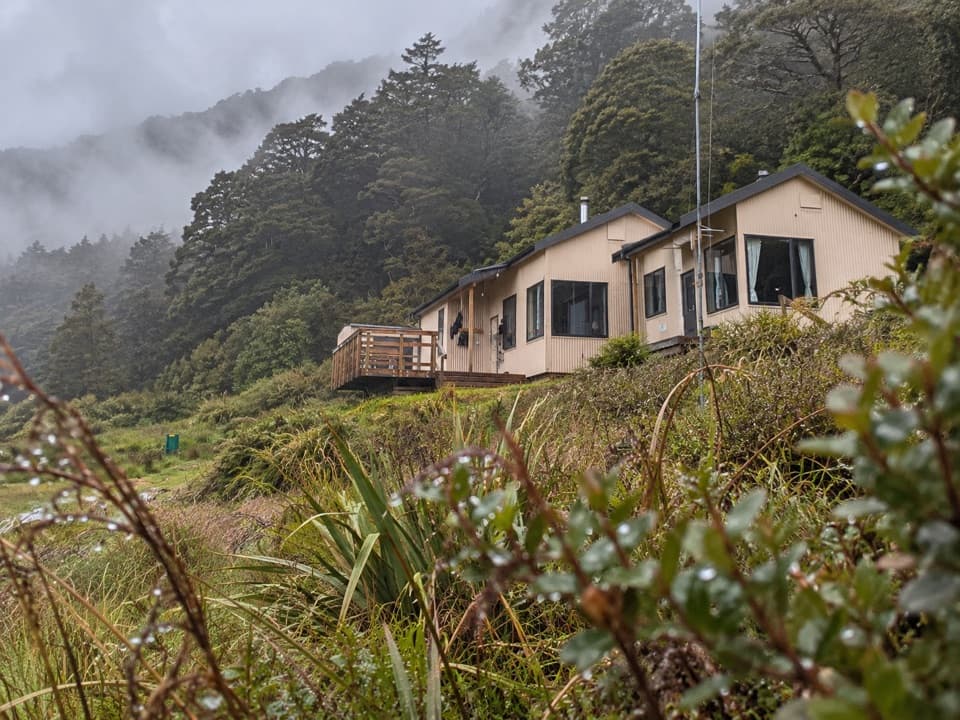
There is no road-end car park at this trailhead. Siberia Hut sits deep in the Wilkin Valley; people reach it by pre-arranged plane or helicopter, by jet boat to Kerin Forks and a walk, or on foot as part of the Gillespie Pass Circuit from the Blue Pools car park. Arrange transport well ahead. The 20-bunk hut has a toilet, mattresses and a multi-fuel stove, but no food service; bring everything you need and boil its untreated water before drinking. Overnight hut stays from December through April require a booking.

Across Siberia ValleyFrom the hut, follow open valley flats for about 2 km before crossing Gillespie and Siberia…

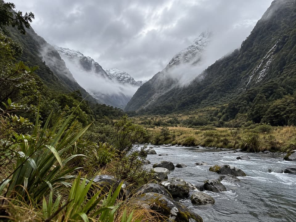
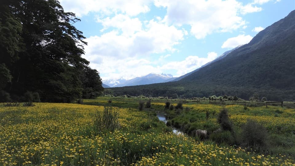
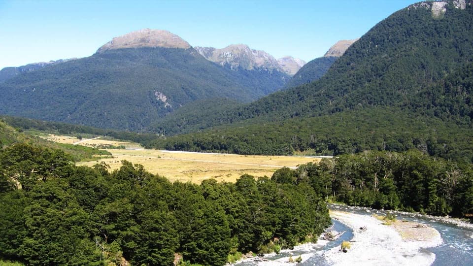
From the hut, follow open valley flats for about 2 km before crossing Gillespie and Siberia streams to their true right banks. The route then enters forest on the true left of Crucible Stream. The first stretch gives long views toward Mount Awful and Mount Dreadful and feels gentle beside the climb ahead. The stream crossings are a serious decision: they can become impassable after rain, so do not set out when the rivers are high.

Climb into Crucible BasinThe track climbs a narrow spur beside Crucible Stream, steeply over roots and rock; expect to…

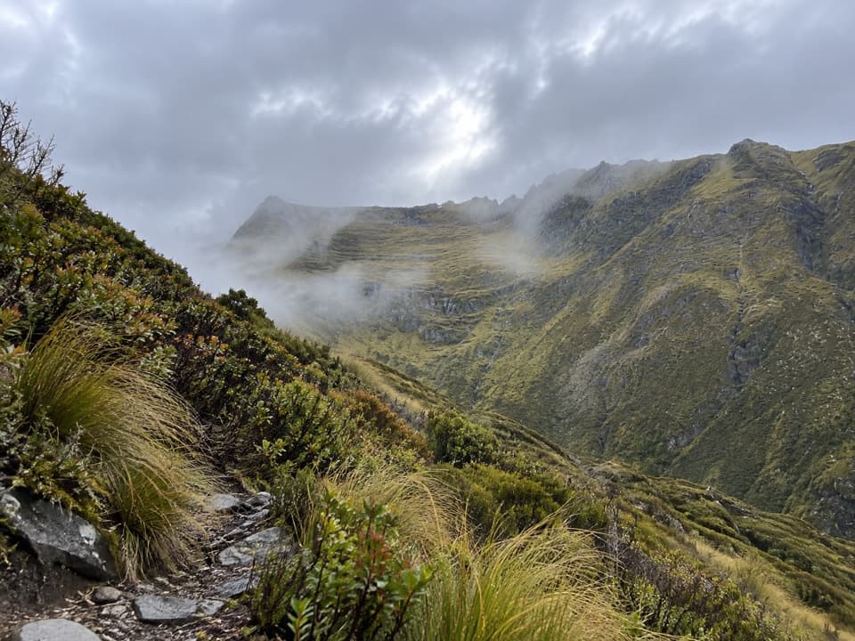
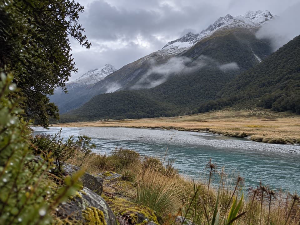
The track climbs a narrow spur beside Crucible Stream, steeply over roots and rock; expect to use your hands briefly in places. It sidles to another stream crossing, then emerges onto a snow-grass flat. Poles lead across the upper basin and up the rocky moraine to the lake. This is a rugged alpine route, not a built path. Stay on the marked line because the basin's alpine herb fields are fragile.

At the lakeCrucible Lake sits in a rocky basin beneath Mount Alba.

Crucible Lake sits in a rocky basin beneath Mount Alba. Check the outlet boulders for pīwauwau, the rock wren, which is often seen there. For a photo, frame the turquoise water with the moraine and enclosing cliffs; floating ice is sometimes present but varies. The wider Makarora Valley has a long Māori history: coastal Otago and Southland travellers came inland to hunt and fish, and the valley was known as Kaika Paekai, “place of abundant food.” Ice Age glaciers shaped the surrounding valleys.

Hazards and rulesGillespie, Siberia and Crucible streams can all become impassable after rain.

Gillespie, Siberia and Crucible streams can all become impassable after rain. Crucible Valley has complex avalanche terrain, and avalanche debris can cross the track between May and November; winter and spring parties need alpine and avalanche experience. Camping is not allowed in Crucible Basin, and dogs are prohibited in the national park.

Wildlife

Wildlife in Queenstown-Lakes District

All Queenstown-Lakes District wildlife maps

Sighting maps show where each species has been reported across Queenstown-Lakes District. Wildlife moves, so no sighting is guaranteed.

Parkwolf’s Queenstown-Lakes District ranking

Top-rated trails in Queenstown-Lakes District

All 155 trails
  1. 1Routeburn TrackChallenging · 33.1 km
  2. 2Roys Peak TrackChallenging · 16 km
  3. 3Ben Lomond TrackChallenging · 14 km
  4. 4Rob Roy TrackModerate · 10 km
  5. 5Isthmus Peak TrackChallenging · 16 km
  6. 6Routeburn Falls TrackChallenging · 19.6 km

Take Parkwolf to Queenstown-Lakes District.

The audio tour guide for the drive, plus offline maps, trails, and wildlife heatmaps for when the signal drops.

4.7 from 8,600+ ratings

Download Parkwolf on the App StoreGet Parkwolf on Google Play