Twin Sisters Trail in Rocky Mountain National Park

Rocky Mountain National Park, CO

Twin Sisters Trail

A steep climb with a summit view that earns every step.

Photo: Wikimedia Commons
Length
7.4mi
Time
4.5hr
Elev. change
2,385ft
Difficulty
Challenging
  • No dogs
  • High point 11,319 ft
  • #17 of 136 in Rocky Mountain

Hear the audio tour

Lily Lake: A Gentle Loop Below the Peaks

Overview

About Twin Sisters Trail

Why go

  • Big views of Longs Peak and the Continental Divide.
  • A short scramble gives the hike a proper summit finish.

Heads up

  • A long, sustained climb at high altitude with rough talus near the top.
Twin Sisters Trail is a 7.4-mile out-and-back from the public access near Lily Lake to the west summit and back. It climbs about 2,480 feet to 11,413 feet, so allow roughly four to five hours. The climb is steady, and the air gets thin well before the rocky summit. I’d pick this for a demanding half-day with open views of the Continental Divide, not for a casual walk or your first day at altitude. The last stretch to the west summit is a short scramble, but it’s much easier than the separate east summit.
Parkwolf’s verdictThe climb and the payoff

Map & elevation

The route

Loading the Rocky Mountain map
Full map
Elevation8,934–11,319 ft
TrailheadTwin Sisters Trailhead40.30641, -105.53707
Keep this map with you offline in the Parkwolf app

Plan your hike

Before you go

Parking

Limited parking at Twin Sisters Trailhead, reached by a gravel road east of Colorado 7 by Lily Lake. Additional parking is available at the Lily Lake Visitor Center; the access road closes to vehicles from about mid-October through Memorial Day weekend.

Safety

Steep sustained climbing to about 11,400 feet, exposed talus above treeline, and a short rocky summit scramble. Pets are prohibited on Rocky Mountain National Park trails, so they cannot accompany hikers on this full route.

3 active Rocky Mountain alerts

  • ClosureOld Fall River Road closed to vehiclesOld Fall River Road is closed to motor vehicles for the season.Official details
  • ClosureSun Valley burn-area access remains closedThe area and trail west of Sun Valley Trail remain closed, including the route used for angler access to the Colorado River, because of impacts from the 2020 East Troublesome and Cameron Peak Fires;…Official details
See all 3 alerts
A park ranger sits on a dash-mounted phone, talking, as Parkwolf’s Tour Guide plays “Army Cutworm Moths: A Grizzly Bear Buffet” on Grand Loop Road below Dunraven Pass in Yellowstone
Parkwolf Tour GuideThe highest, rockiest slopes around here are a summer buffet for grizzly bears.

Rocky Mountain Tour Guide

Your drive to Twin Sisters Trail, narrated.

Parkwolf is a GPS audio tour guide for Rocky Mountain National Park. As you drive, it chimes in with what’s ahead: hidden gems, upcoming stops, history, geology, and wildlife, right through your car’s speakers.

See the Rocky Mountain audio tour

Recorded for this trailhead

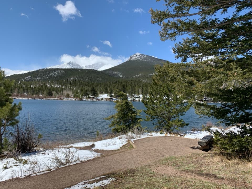
Lily Lake: A Gentle Loop Below the Peaks
0:00 / 0:30
“You're nearing Lily Lake, a good stop if you want a gentle walk with big mountain views.”

Plays as you drive up to this trailhead in the Parkwolf Rocky Mountain Tour Guide.

More stories near here in the app

  • The Tunnels Under the Bark
  • Longs Peak Trailhead: Lake or Summit
  • Seeds Sealed for Years
  • Bear Lake Road Park and Ride: Leave the Car Here
  • 79 audio storiesacross Rocky Mountain’s roads, triggered by GPS as you drive
  • Wildlife heatmapsfor Elk, Moose, Mountain Goat, and 13 more
  • Works offlinemaps, 136 trails, 88 places, and audio download before you lose signal
  • CarPlay readysimple controls built for the drive
★★★★★
“…No cell service for majority of the day but had continuous access to the app - the maps, the tour guide as you drive is amazing. Highly recommend purchasing the subscription.”
jkatnerApp Store review
Download Parkwolf on the App StoreGet Parkwolf on Google Play

4.7 from 8,600+ ratings

Trail guide

Hiking Twin Sisters Trail

Get to the actual trailFrom Colorado 7, turn east by the Lily Lake Visitor Center and follow the gravel access road…

From Colorado 7, turn east by the Lily Lake Visitor Center and follow the gravel access road about a quarter mile to the Twin Sisters Trailhead. Parking at the upper trailhead is limited; there’s additional parking at Lily Lake. From the lot, continue uphill along the road for about a tenth of a mile to the trail kiosk. The access road closes to vehicles from around mid-October through Memorial Day weekend, so check the park’s current road notice and plan for a longer approach if you can’t drive to the upper lot. This route crosses Rocky Mountain National Park trail, where pets are prohibited, so dogs can’t join the full hike.

A forest climb and a first viewThe trail climbs steadily through forest on stretches of large stone steps.

The trail climbs steadily through forest on stretches of large stone steps. At about a mile, a small west-facing overlook opens onto Longs Peak and Estes Cone. It’s a good place to catch your breath and get your first look at the high country ahead. The path crosses between park land and Roosevelt National Forest; keep following the signed trail as it moves between the two.

Crossing the flood scarAround 1.3 miles, the route crosses the broad landslide scar left by the September 2013 flood.

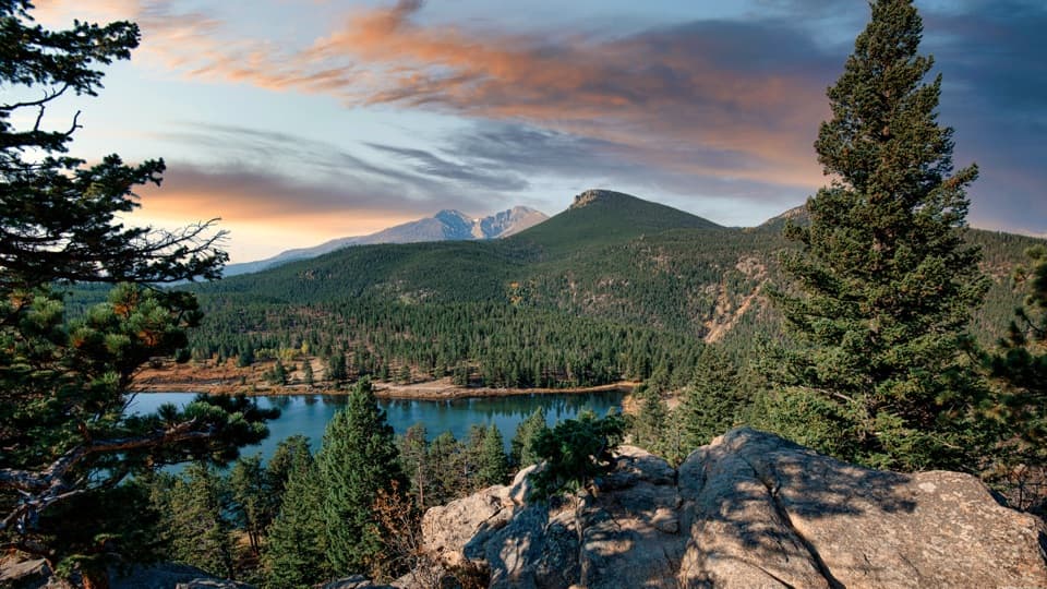
Around 1.3 miles, the route crosses the broad landslide scar left by the September 2013 flood. The slide tore through about 2,000 feet of trail and wiped out parts of three switchbacks. The path now follows a rebuilt line through the scar, and the open slope makes this section easy to pick out from below. The climb stays steep on the far side. As the trees thin, you start seeing Longs Peak, Mount Meeker, Powell Peak, Taylor Peak, Lily Mountain, and Estes Cone across the west.

Above treeline and at the saddleNear 2.9 miles, around 11,000 feet, the forest gives way to exposed talus and scree.

Near 2.9 miles, around 11,000 feet, the forest gives way to exposed talus and scree. The footing gets rougher and the climb feels harder in the thin air. At roughly 3.4 miles, you reach the saddle between the two summits, where a stone hut and radio tower make a clear landmark. Faint trails and cairns lead toward both peaks, so take a moment to pick the west summit route before scrambling upward.

Choose the west summitThe west summit, about 11,413 feet, is the easier and more popular finish.

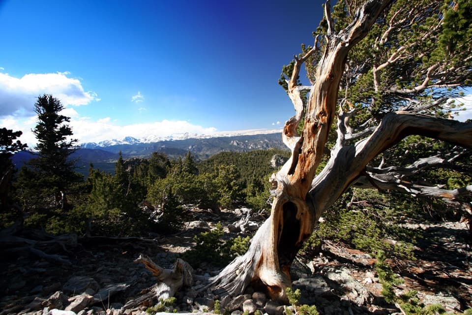
The west summit, about 11,413 feet, is the easier and more popular finish. From the saddle, head toward the stone hut, then turn left for a short scramble to the top. There’s no major cliff-edge exposure on this final pitch, but it is steep, rocky ground above treeline. The higher east summit, about 11,428 feet, is a separate, rougher scramble; skip it unless you’re comfortable finding your way over loose rock. From the west summit, the view takes in Longs Peak, Mount Meeker, Estes Cone, the Continental Divide, and Estes Park. At the treeline, frame the two peaks above the foreground talus; from the top, include Longs Peak to give the panorama some scale.

A trail with a long historyEarly Estes Park settlers called the mountain Lily Mountain.

Early Estes Park settlers called the mountain Lily Mountain. It was renamed Twin Sisters in 1907. The Forest Service built the first summit trail in 1914, and the Civilian Conservation Corps rebuilt it in 1936. The stone hut and radio tower still stand at the saddle, while an old fire lookout that once topped the west summit was removed in 1977.

Wildlife

Wildlife in Rocky Mountain

All Rocky Mountain wildlife maps

Sighting maps show where each species has been reported across Rocky Mountain. Wildlife moves, so no sighting is guaranteed.

Keep exploring

Near Twin Sisters Trail

See it all on the map

Trails that start nearby

Places near the trailhead

Parkwolf’s Rocky Mountain ranking

Top-rated trails in Rocky Mountain

All 136 trails
  1. 1Emerald Lake TrailModerate · 3.4 mi
  2. 2Sky Pond TrailChallenging · 9 mi
  3. 3Chasm Lake TrailChallenging · 8.4 mi
  4. 4Bear Lake LoopEasy · 0.6 mi
  5. 5Dream Lake TrailModerate · 2.2 mi
  6. 6Alberta Falls TrailEasy · 1.7 mi

Take Parkwolf to Rocky Mountain.

The audio tour guide for the drive, plus offline maps, trails, and wildlife heatmaps for when the signal drops.

4.7 from 8,600+ ratings

Download Parkwolf on the App StoreGet Parkwolf on Google Play