Estes Cone Trail from Longs Peak Trailhead in Rocky Mountain National Park

Rocky Mountain National Park, CO

Estes Cone Trail from Longs Peak Trailhead

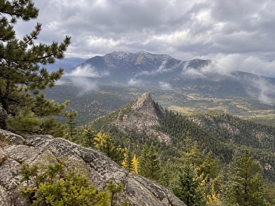
Mine ruins and a rocky summit make the long climb pay off.

Photo: Wikimedia Commons
Length
6.2mi
Time
5hr
Elev. change
1,499ft
Difficulty
Challenging
  • No dogs
  • High point 10,935 ft

Hear the audio tour

Longs Peak Trailhead: Lake or Summit

Overview

About Estes Cone Trail from Longs Peak Trailhead

Why go

  • Mine and homestead remains add a real history stop.
  • Longs Peak and Estes Valley views from the summit.

Heads up

  • The summit tread is steep, faint and scrambly.
  • Longs Peak Trailhead parking is limited in peak season.

Map & elevation

The route

Loading the Rocky Mountain map
Full map
Elevation9,436–10,935 ft
TrailheadLongs Peak Trailhead40.27214, -105.55668
Keep this map with you offline in the Parkwolf app

Plan your hike

Before you go

Parking

Park at Longs Peak Trailhead by the ranger station. From Colorado 7, turn onto Longs Peak Road and follow it to the end. The lot and roadside spaces are limited and often fill early in peak-season weekends. Restrooms are available; there is no water at the trailhead. A park entrance fee or pass applies.

Safety

The trail starts around 9,400 feet and reaches roughly 11,000 feet. The final half-mile is steep, rocky and faint in places; reaching the true summit requires scrambling beside a rock wall. Follow cairns and stop at the lower perch if the summit move is beyond your comfort. Afternoon thunderstorms are a recurring exposure hazard. Pets are prohibited on park trails; trained service animals are allowed.

3 active Rocky Mountain alerts

  • ClosureOld Fall River Road closed to vehiclesOld Fall River Road is closed to motor vehicles for the season.Official details
  • ClosureSun Valley burn-area access remains closedThe area and trail west of Sun Valley Trail remain closed, including the route used for angler access to the Colorado River, because of impacts from the 2020 East Troublesome and Cameron Peak Fires;…Official details
See all 3 alerts
A park ranger sits on a dash-mounted phone, talking, as Parkwolf’s Tour Guide plays “Army Cutworm Moths: A Grizzly Bear Buffet” on Grand Loop Road below Dunraven Pass in Yellowstone
Parkwolf Tour GuideThe highest, rockiest slopes around here are a summer buffet for grizzly bears.

Rocky Mountain Tour Guide

Your drive to Estes Cone Trail from Longs Peak Trailhead, narrated.

Parkwolf is a GPS audio tour guide for Rocky Mountain National Park. As you drive, it chimes in with what’s ahead: hidden gems, upcoming stops, history, geology, and wildlife, right through your car’s speakers.

See the Rocky Mountain audio tour

Recorded for this trailhead

Longs Peak Trailhead: Lake or Summit
0:00 / 0:34
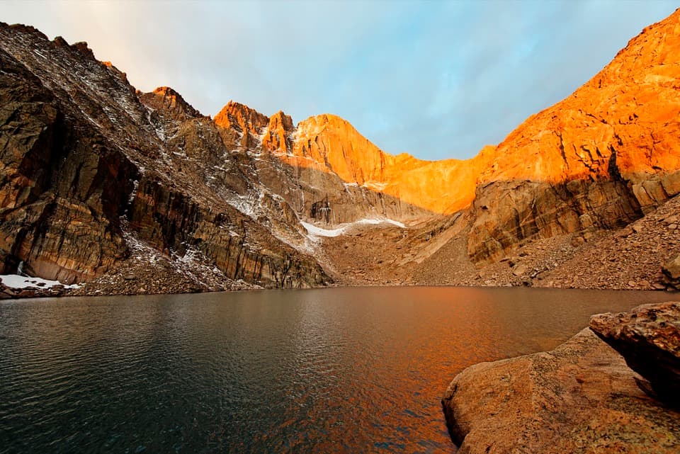
“You're approaching Longs Peak Trailhead, the start of some serious mountain outings. Chasm Lake is my pick if you want the view straight up Longs Peak's sheer east face, the Diamond, without attempting the summit.”

Plays as you drive up to this trailhead in the Parkwolf Rocky Mountain Tour Guide.

More stories near here in the app

  • The Tunnels Under the Bark
  • Lily Lake: A Gentle Loop Below the Peaks
  • Sandbeach Lake Trailhead and a Copeland Lake Picnic
  • Sprague Lake: An Easy Shoreline Stop
  • 79 audio storiesacross Rocky Mountain’s roads, triggered by GPS as you drive
  • Wildlife heatmapsfor Elk, Moose, Mountain Goat, and 13 more
  • Works offlinemaps, 136 trails, 88 places, and audio download before you lose signal
  • CarPlay readysimple controls built for the drive
★★★★★
“…No cell service for majority of the day but had continuous access to the app - the maps, the tour guide as you drive is amazing. Highly recommend purchasing the subscription.”
jkatnerApp Store review
Download Parkwolf on the App StoreGet Parkwolf on Google Play

4.7 from 8,600+ ratings

Trail guide

Hiking Estes Cone Trail from Longs Peak Trailhead

The climb and its payoffEstes Cone Trail from Longs Peak Trailhead is a 6.

Estes Cone Trail from Longs Peak Trailhead is a 6.2-mile out-and-back to a rocky summit, with about 1,800 feet of climbing from roughly 9,400 feet to 11,000. Plan on about five hours. The walk links East Longs Peak Trail, Eugenia Mine Trail, the Moore Park connector and Estes Cone Trail. The first part is forest hiking; the last half-mile gets steep and rocky, then a short scramble reaches the true top. It suits fit hikers who are comfortable at altitude and on faint, uneven tread. If you want an easy stroll, this isn't it.

Get the start rightThe trail begins at Longs Peak Trailhead by the ranger station, reached from Colorado 7 via…

The trail begins at Longs Peak Trailhead by the ranger station, reached from Colorado 7 via Longs Peak Road. The lot and roadside spaces are limited and can fill early on peak-season weekends, so arrive early and don't count on overflow. Restrooms are at the trailhead, but there is no water there or on the route. A park entrance fee or pass applies. Pets aren't allowed on park trails; trained service animals are permitted.

Through the forest to Eugenia MineThe route climbs steadily through lodgepole pine, spruce and fir.

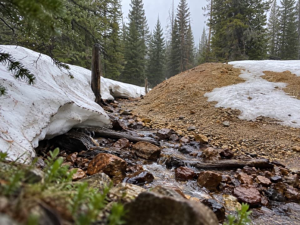
The route climbs steadily through lodgepole pine, spruce and fir. At about half a mile, turn right onto Eugenia Mine Trail. The grade eases as the path reaches a footbridge over Inn Brook; the historic mine site is about 1.4 miles from the start. Look for a crumbling log homestead, a rusting boiler by the creek and mine tailings upstream. The shaft is sealed, so stay out of the workings.

Moore Park and Storm PassFrom the mine, the trail drops toward Moore Park. At about 1.

From the mine, the trail drops toward Moore Park. At about 1.7 miles, pass the spur to Moore Park Backcountry Campsite; shortly after, ignore the branch toward private property and keep left on the Estes Cone route. The climb steepens as you head northwest. At Storm Pass, around 2.6 miles in, continue straight onto Estes Cone Trail. The right-hand route heads toward Lily Lake, a different approach; the left drops toward Bear Lake Road.

The last climbBeyond the pass, the forest thins to limber pines, roots and small boulders.

Beyond the pass, the forest thins to limber pines, roots and small boulders. The final two-thirds of a mile gains close to 800 feet. Parts of the tread are faint, so follow the cairns and pay attention at the rock. A lower perch gives you a good view without the final scramble; the true summit takes careful scrambling beside the rock wall. Stop at the perch if that move is outside your comfort zone. In summer, start early to reduce your time on the summit in the afternoon thunderstorm window.

What you see from the topThe summit opens in every direction: Longs Peak and Mount Meeker to the south, Hallett Peak and…

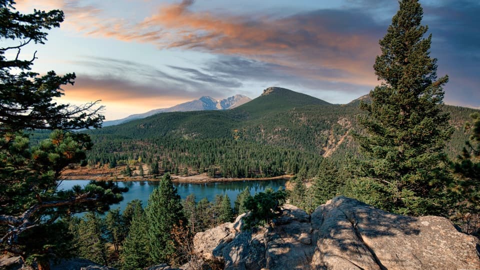
The summit opens in every direction: Longs Peak and Mount Meeker to the south, Hallett Peak and the Continental Divide beyond, the Mummy Range, and the Estes Valley to the north. For a useful photo, include a little of the summit rock in the foreground and frame Longs Peak rather than filling the shot with distant ridges.

A cone made by erosionEstes Cone looks volcanic, but its shape comes from erosion and its separation from the…

Estes Cone looks volcanic, but its shape comes from erosion and its separation from the surrounding mountains. The Eugenia Mine is a different kind of story: a short-lived copper-and-gold prospect. Local accounts describe a family homestead by the creek and a piano hauled in by wagon; the visible remains are the old structure, boiler and tailings, not an open mine.

Wildlife

Wildlife in Rocky Mountain

All Rocky Mountain wildlife maps

Sighting maps show where each species has been reported across Rocky Mountain. Wildlife moves, so no sighting is guaranteed.

Keep exploring

Near Estes Cone Trail from Longs Peak Trailhead

See it all on the map

Trails that start nearby

Places near the trailhead

Parkwolf’s Rocky Mountain ranking

Top-rated trails in Rocky Mountain

All 136 trails
  1. 1Emerald Lake TrailModerate · 3.4 mi
  2. 2Sky Pond TrailChallenging · 9 mi
  3. 3Chasm Lake TrailChallenging · 8.4 mi
  4. 4Bear Lake LoopEasy · 0.6 mi
  5. 5Dream Lake TrailModerate · 2.2 mi
  6. 6Alberta Falls TrailEasy · 1.7 mi

Take Parkwolf to Rocky Mountain.

The audio tour guide for the drive, plus offline maps, trails, and wildlife heatmaps for when the signal drops.

4.7 from 8,600+ ratings

Download Parkwolf on the App StoreGet Parkwolf on Google Play