Eldgjá

Vast volcanic canyon with an easy walk to Ófærufoss
Eldgjá, Vatnajökull National Park
InsideVatnajökull National Park

Overview

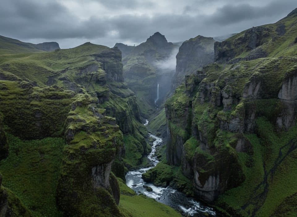
Eldgjá (Fire Canyon) is a colossal volcanic fissure and canyon in the Icelandic Highlands, within Vatnajökull National Park. Over a 40 km stretch, it reaches up to about 600 m wide and roughly 270 m deep—often called the world’s largest volcanic canyon. The landscape is raw and dramatic, carved by a monumental flood-basalt eruption around 939–942 CE that poured out roughly 18.6 km³ of lava across some 780 km². Eldgjá sits in Iceland’s Eastern Volcanic Zone, tied to the powerful Katla system, and you can read the story of its craters, faults, hornitos, and spatter ramparts right on the canyon floor.

What You’ll See

The star is Ófærufoss, a two-tier waterfall where the Nyrðri Ófæra river drops into the canyon near its center. From the gorge bottom you feel the scale—towering walls, black lava textures, and mossy highland color contrasts. From the rim and Gjátindur summit, the panorama stretches over Eldgjá and the Skaftá area.

Best Day Hikes

  • E1 Eldgjá–Ófærufoss: An easy walk (about 2 km one way) along the gorge floor to the waterfall—perfect first look at the canyon’s size.
  • E2 Gjátindur (943 m): From the car park via Ófærufoss up the east rim to the summit for knockout views. You can return the same way or descend a steep, more difficult path to the gorge bottom if you’re confident and conditions are good.
  • E3 Strangakvísl–Eldgjá: If you’d rather avoid a vehicle ford, park south of the Strangakvísl river and cross a hiking bridge, then follow the Nyrðri Ófæra into the canyon.

Getting There

This is a summer destination, typically June–September, when the highland F-roads open. A proper 4x4 is required. The most common approach is F208 from the south (from near Kirkjubæjarklaustur/Vík); expect generally easier driving up front, rougher highland track later, and usually one notable ford near the site. Approaching from Landmannalaugar via F208 involves more fords, while the F232–F233 corridor is the roughest option. To skip a ford entirely, use the E3 footbridge approach on foot. Rangers are quartered in the Eldgjá area during the day in season. There is no public transport to Eldgjá.

On-Site Facilities

There’s a car park and trailhead, but otherwise plan for no services: no food, fuel, or guaranteed toilets and running water. Bring everything you need and pack out all waste.

Safety Notes

Highland roads change with weather; water levels in fords can rise quickly. Drive only a suitable high-clearance 4x4, and don’t attempt river crossings beyond your skill. On trail, rim paths and any steep descents can be slick—stick to marked routes and heed ranger advice.

Best Time to Visit

Aim for the summer window (June–September) when F-roads are open. Pick stable weather if possible—both fords and rim paths are friendlier in fair conditions. If your goal is the Gjátindur panorama, allow a half-day and a clear forecast.

Pros

  • Ófærufoss waterfall via an easy 2 km trail from the car park
  • Rim-to-summit route to Gjátindur with sweeping canyon views

Cons

  • Summer-only 4x4 access with potential river fords
  • No on-site services; bring your own water and supplies

Tips

  • To avoid a vehicle ford at Strangakvísl, park south and use the footbridge.
  • Short on time? Walk E1 to Ófærufoss; for views, continue E2 up to Gjátindur.
  • Plan your visit for June–September when the highland F-roads typically open.
  • F208 south usually has one notable ford; drive a proper 4x4 and check conditions.
  • No services on-site—bring water, food, warm layers, and pack out all waste.
The Parkwolf tour guide sitting on a phone mounted in a car

Parkwolf Tour Guide

Like a tour guide in your car.

Save the places you found around Vatnajökull, then let Parkwolf guide the drive between them.Download Parkwolf on the App Store