Pros & cons
PROS
- Steam vents, mud pots, and sulfur-stained soils beside glacier ice
- Showcase of fire-and-ice geology with nearby hyaloclastite ridges
CONS
- Remote, seasonal highland access with no on-site services
- Real hazards from unstable ground and hydrothermal activity
Overview
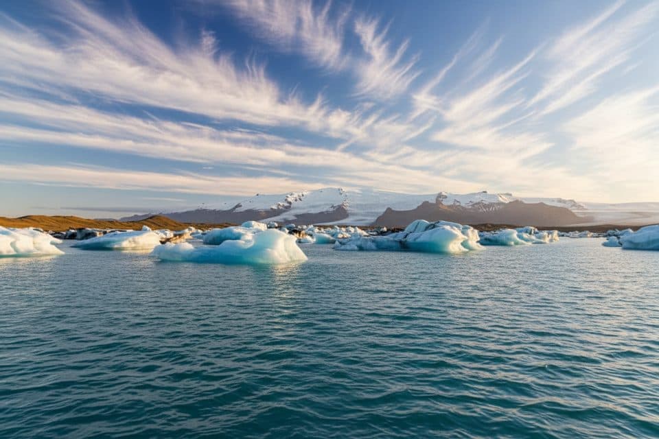
Hveradalur is the geothermal valley of the Kverkfjöll volcanic system on the northeast margin of the Vatnajökull ice cap. It’s where rift‑zone volcanism brushes right up against glacial ice—raw, steamy ground framed by crevassed ice and stark highlands. The area epitomizes the park’s fire‑and‑ice drama, with meltwater, subglacial activity, and outburst floods shaping the landscape.
What You’ll See
Expect fumaroles, steaming ground, sulfur deposits, and mud pots set among vividly altered soils. Around the valley you can pick out ice‑contact slopes and hyaloclastite ridges—glassy volcanic rubble built when hot basalt met ice or water. It’s a geology‑first destination; the scenery feels otherworldly and photogenic when conditions cooperate.
Geology & Hazards
Kverkfjöll has a long record of subglacial eruptions, and the 1929 activity specifically affected Hveradalur. Steam‑driven blasts (hydrothermal explosions) have also been documented in the wider Kverkfjöll field, underscoring that dangerous activity can occur without a lava eruption. Glacial margins here can shift quickly due to melt and jökulhlaups (glacial outburst floods). Treat the ground near vents as unstable and heed any closures or advisories.
Access & What to Expect
This is wilderness travel: rough, often seasonal highland tracks and minimal infrastructure. Plan to be fully self‑sufficient—there are typically no restrooms, food, fuel, or water at remote trailheads. The park’s interior access and conditions change fast; check the latest guidance from Vatnajökull National Park before setting out. In the Kverkfjöll area, hikes commonly start around the Sigurðarskáli hut, with routes that explore lava formations, moraines, and glacier views (e.g., toward Kverkjökull, Virkisfell, and Biskupsfell).
Best Time to Visit
Summer into early autumn generally offers the safest window for highland travel. Go on a stable‑weather day and aim for early or late daylight for softer photography light and better steam visibility. Crowds are rarely an issue—your main constraint is conditions. In shoulder seasons, expect colder temps, lingering snow, and rapidly changing footing.

Wildlife
Think sparse, high‑elevation volcanic desert at the ice margin. You’re here for the geothermal and glaciovolcanic landforms; any birdlife you encounter will be incidental in lower forelands.
Planning Tips
- Check current access, weather, and any hazard or closure notices before committing.
- Wear warm layers and waterproof boots; ground can be wet, soft, and sulfurous.
- Stay on established paths where present and give vent areas a wide berth.
- Consider a guided, multi‑day Kverkfjöll trip if you’re not experienced with Iceland’s highland travel.
- Carry all food, water, and emergency gear—there are no services on site.
Where it is
64.6611, -16.6654Tips for Hveradalur (Kverkfjöll)
- 01Verify highland road openings and park advisories the day before you go.
- 02Start from the Sigurðarskáli hut area for established routes in Kverkfjöll.
- 03Pack full provisions and extra layers; there are no services at trailheads.
- 04Keep distance from vents and fragile ground; hydrothermal blasts have occurred.
- 05Aim for early or late light to photograph steam plumes and colorful soils.
Near Hveradalur (Kverkfjöll)
All places →All trails →
1.3 mi awayKverkfjöllRaw fire-and-ice highland range of geothermal fields and glacier viewsTrailhead · Parking
6 mi awaySigurðarskáli HutRemote Kverkfjöll hut with bunks, camping, and glacier day hikesLodging · Campground
13.9 mi awayHoluhraunVast, fresh lava field from Iceland’s 2014–15 fissure eruptionTrailhead · Parking
24.3 mi awayAskja CalderaA remote caldera of crater lakes, lunar lava, and real adventureParking · Restroom
28.1 mi awayAskja Víti Crater TrailLunar walk to a warm crater beside Iceland’s deepest lakeEasy · 4 mi · 1.8 hr
39.3 mi awayHeinabergslón Lagoon TrailQuiet glacier-lagoon loop with big views and tricky river issuesModerate · 7.6 mi · 3 hr
40.9 mi awayHjallanes to Skálafellsjökull ViewpointQuiet loop to a real glacier view, with moraine and solitudeModerate · 5.2 mi · 3.5 hr
45.4 mi awaySjónarnípa Viewpoint Trail (S6)Basalt falls plus a cliff-top glacier overlook in one tidy loop.Moderate · 4.6 mi · 2.5 hr