Overview
About Laki Summit Viewpoint
Why stop
- A summit panorama makes the crater chain’s scale easy to grasp.
Heads up
- The highland drive and river crossings make this a major outing.
Map
Where it is

The highest, rockiest slopes around here are a summer buffet for grizzly bears.
Vatnajökull Tour Guide
Your drive to Laki Summit Viewpoint, narrated.
Parkwolf is a GPS audio tour guide for Vatnajökull National Park. As you drive, it chimes in with what’s ahead: hidden gems, upcoming stops, history, geology, and wildlife, right through your car’s speakers.
Recorded for this place
Laki Summit Viewpoint“You're nearing the starting point for Laki's summit walk, where a steep climb opens a view along the Lakagígar crater chain. Allow an hour to an hour and a half for the circuit, with loose rock on the climb and descent.”
Plays as you drive up to Laki Summit Viewpoint in the Parkwolf Vatnajökull Tour Guide.
More stories near here in the app
- The Phalarope Father
- When the Grass Became Poisonous
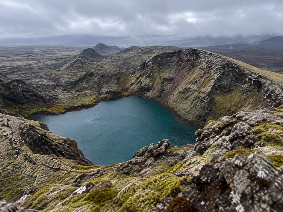
- Tjarnargígur: Crater Lake and Lava Channel
- A Plant Before It Falls
- 298 audio storiesacross Vatnajökull’s roads, triggered by GPS as you drive
- Wildlife heatmapsfor Grey Seal, Harbor Seal, Caribou, and 13 more
- Works offlinemaps, 92 trails, 75 places, and audio download before you lose signal
- CarPlay readysimple controls built for the drive
“Fantastic app with many points of information… It’s great to just turn on while you’re driving and it gives you an audio tour of the national Park. We love it!!!!”


Guide
More about Laki Summit Viewpoint
A summit above LakagígarLaki is an older volcanic mountain rising about 200 m above the surrounding lava country, with…
Laki is an older volcanic mountain rising about 200 m above the surrounding lava country, with a high outlook over the Lakagígar crater row. This pin is for the summit viewpoint; the ranger stop and picnic facilities are at the lower parking area.
Make time for the approachThe marked summit circuit starts beside the Laki parking lot.
The marked summit circuit starts beside the Laki parking lot. The park rates it challenging and allows about 1–1.5 hours. The drive is the bigger commitment: F206 and F207 are highland roads for four-wheel drive, with four unbridged river crossings. Road openings and crossing levels change with the season and weather, so check with rangers at Skaftárstofa before setting out. Visitors describe the rough drive as part of a substantial outing, not a quick roadside stop.
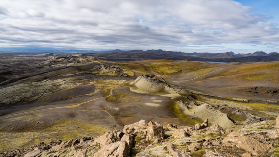
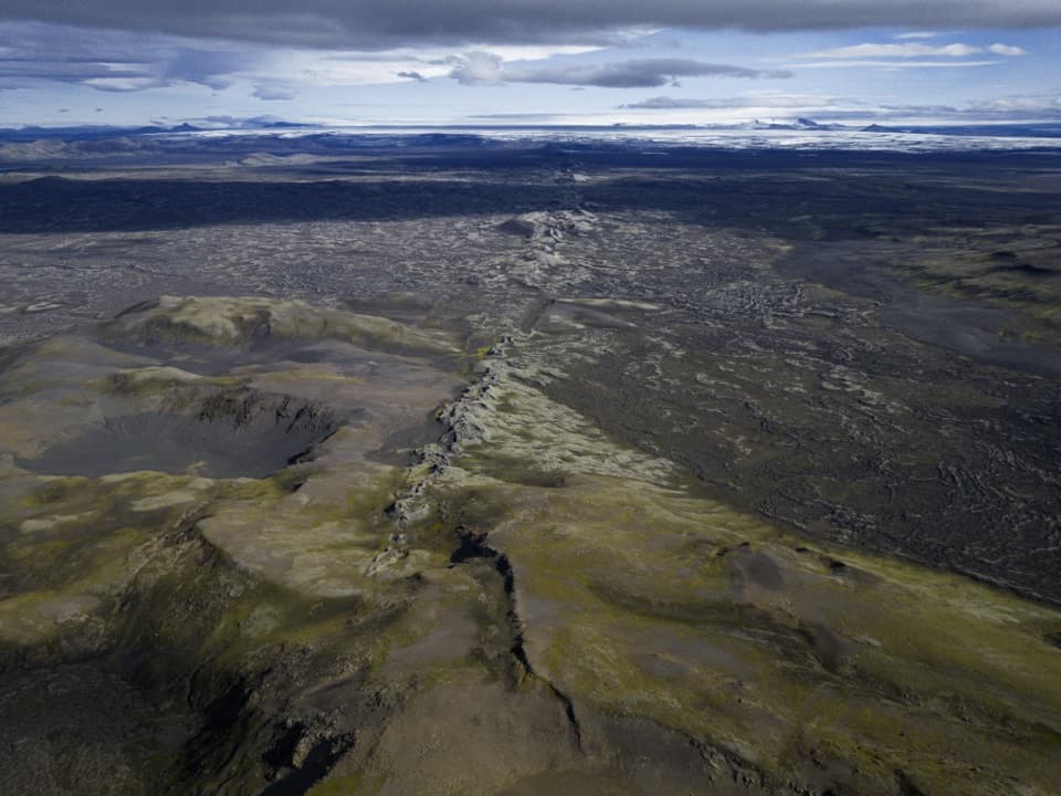
Look along the crater chainFrom the summit, the crater row and dark lava fields spread below you, with Vatnajökull to the…
From the summit, the crater row and dark lava fields spread below you, with Vatnajökull to the northeast. The best-known composition follows the line of craters toward the ice cap; the summit hike is needed for this view. Cloud can hide the distant glaciers, so allow for the possibility of a more local view. Stay on marked paths and off the moss.
The 1783–84 eruptionThe older mountain predates the eruption that made Lakagígar.
The older mountain predates the eruption that made Lakagígar. Starting on 8 June 1783 and ending on 7 February 1784, the fissure eruption opened a roughly 27 km complex of ten fissures on both sides of Laki. Lava flowed as far as 35 km from the vents within four days. Published estimates differ: one puts the total near 12 cubic kilometres, another at 14.7 ± 1.0 cubic kilometres.
A landscape changed by the eruptionSulfur gases spread an acid haze, and the aftermath is remembered in Iceland as Móðuharðindin,…
Sulfur gases spread an acid haze, and the aftermath is remembered in Iceland as Móðuharðindin, the “mist hardships.” The park estimates that about three-quarters of Iceland’s livestock died; famine and disease followed, killing roughly one in five Icelanders. It is a sobering part of the view: this quiet line of craters came from an eruption with consequences far beyond the lava field.
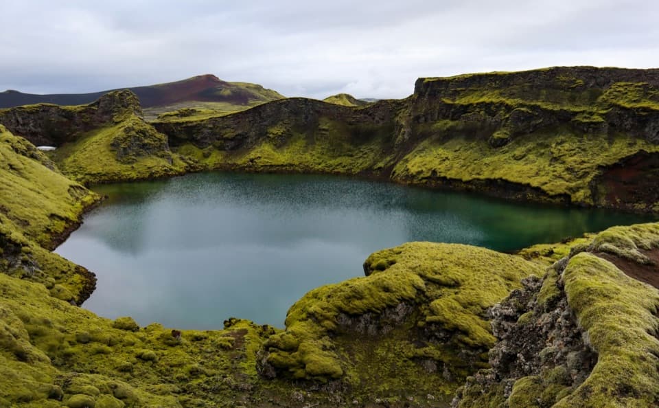
Moss on young lavaThe damp climate supports thick woolly moss and unusual lichen habitats on the young lava.
The damp climate supports thick woolly moss and unusual lichen habitats on the young lava. The moss is fragile; ash, flood deposits or fresh lava can bury it and give new plants a place to grow. Keep to marked trails so the green surface lasts for the next visitors.
Wildlife
Wildlife in Vatnajökull
 23 sightingsGrey SealMost seen around 5 AMSighting map
 260 sightingsHarbor SealMost seen around 11 AMSighting map
 184 sightingsCaribouMost seen around 7 PMSighting map
 62 sightingsArctic FoxMost seen around 8 PMSighting map
 169 sightingsWhooper SwanMost seen around 5 PMSighting map
 68 sightingsAtlantic PuffinMost seen around 7 PMSighting map
Sighting maps show where each species has been reported across Vatnajökull. Wildlife moves, so no sighting is guaranteed.