Overview
About Selfoss
Why stop
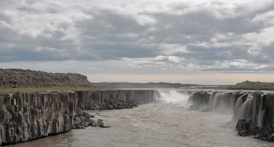
- A wide, shaped cascade gives the Dettifoss walk a distinct second waterfall.
Heads up
- Rocky, uneven footing and no wheelchair access.
Map
Where it is

The highest, rockiest slopes around here are a summer buffet for grizzly bears.
Vatnajökull Tour Guide
Your drive to Selfoss, narrated.
Parkwolf is a GPS audio tour guide for Vatnajökull National Park. As you drive, it chimes in with what’s ahead: hidden gems, upcoming stops, history, geology, and wildlife, right through your car’s speakers.
Recorded for this place
Dettifoss and Selfoss: West Bank“You're approaching the west-bank access for Dettifoss, a waterfall powerful enough to make nearby rock vibrate. There's a walk from the car park to the falls; you won't get the full view from the road.”
Plays as you drive up to Selfoss in the Parkwolf Vatnajökull Tour Guide.
More stories near here in the app
- Dettifoss and Selfoss: East Bank
- Two Fibres in One Fleece
- Snow as a Winter Blanket
- The Oystercatcher’s Shellfish Tool
- 298 audio storiesacross Vatnajökull’s roads, triggered by GPS as you drive
- Wildlife heatmapsfor Grey Seal, Harbor Seal, Caribou, and 13 more
- Works offlinemaps, 92 trails, 75 places, and audio download before you lose signal
- CarPlay readysimple controls built for the drive
“Fantastic app with many points of information… It’s great to just turn on while you’re driving and it gives you an audio tour of the national Park. We love it!!!!”


Guide
More about Selfoss
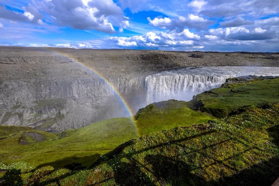
A lower, wider counterpoint to DettifossSelfoss is a 10-meter waterfall on the glacial Jökulsá á Fjöllum, just upstream of Dettifoss.
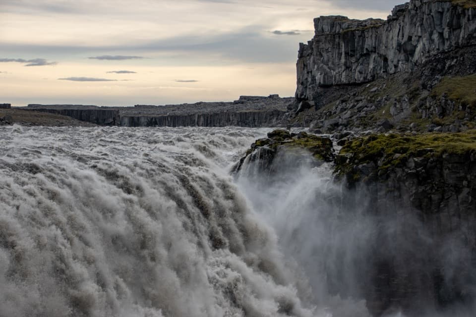
Selfoss is a 10-meter waterfall on the glacial Jökulsá á Fjöllum, just upstream of Dettifoss. It spreads into a broad, shaped cascade below the basalt gorge, a gentler counterpoint to Dettifoss’s force. I’d see both: the marked west-bank loop links them in 2.5 km, about an hour, and is rated easy.
Take the west-bank loopFrom the west Dettifoss car park, the route walks about 1 km to Dettifoss, then follows the…
From the west Dettifoss car park, the route walks about 1 km to Dettifoss, then follows the river south toward Selfoss and returns farther west to close the circuit. The path is natural and uneven; visitors report stony or muddy sections, and the waterfall is not wheelchair-accessible. “Easy” here doesn’t mean paved or step-free.
Choose a riverbankThere are marked approaches from both sides of the river.
There are marked approaches from both sides of the river. The west side uses paved Road 862, which has limited winter service. The east side uses gravel Road 864, which is seasonally closed after autumn snow and reopens when spring conditions allow. The west-side loop is the clearest option if you want to see both falls on one walk.
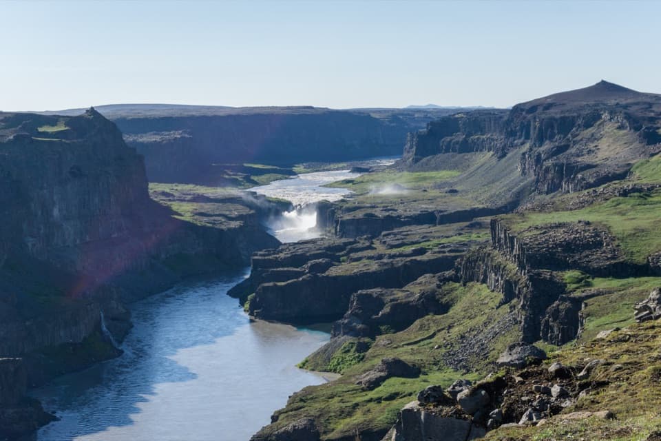
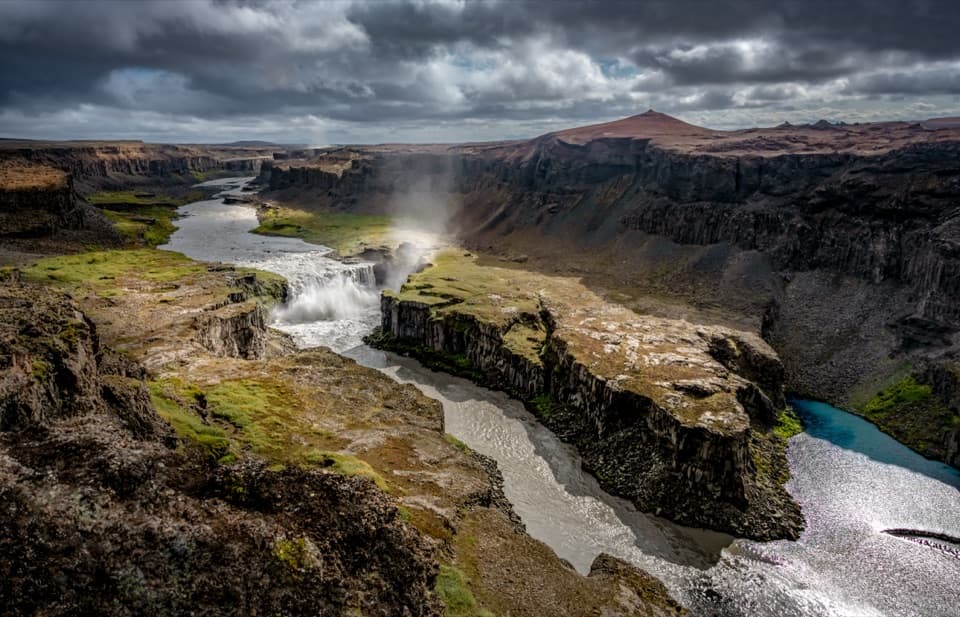
Read the canyonJökulsá á Fjöllum carries glacial water from Vatnajökull.
Jökulsá á Fjöllum carries glacial water from Vatnajökull. The wider gorge was shaped by the river and glacial outburst floods over recent millennia. Just north of Dettifoss, the park describes a roughly 500-meter stretch only about 100 meters wide, carved by Dettifoss.
A river too porous to damPeople once considered harnessing the river’s power in the canyon, but dropped the idea because…
People once considered harnessing the river’s power in the canyon, but dropped the idea because the lava formations are too porous to hold reservoir water. It’s a useful clue to the landscape here: basalt shapes the gorge, while water keeps cutting through it.
Frame the full curveThe falls’ broad front and basalt rim make the shape worth taking in from farther back along…
The falls’ broad front and basalt rim make the shape worth taking in from farther back along the established riverbank path. Visitors say standing too close can hide part of the cascade; include some of the canyon wall to show how the low waterfall sits in the larger landscape.
Wildlife
Wildlife in Vatnajökull
 23 sightingsGrey SealMost seen around 5 AMSighting map
 260 sightingsHarbor SealMost seen around 11 AMSighting map
 184 sightingsCaribouMost seen around 7 PMSighting map
 62 sightingsArctic FoxMost seen around 8 PMSighting map
 169 sightingsWhooper SwanMost seen around 5 PMSighting map
 68 sightingsAtlantic PuffinMost seen around 7 PMSighting map
Sighting maps show where each species has been reported across Vatnajökull. Wildlife moves, so no sighting is guaranteed.