Parking
Skálafell car park at the Hjallanes trailhead near Skálafell farm (Google Maps listing: 64.247404, -15.685374). Access from Route 1; close all gates after passing.
#10 of 16 trails in Vatnajökull
Vatnajökull National Park
Quiet loop to a real glacier view, with moraine and solitude
Overview
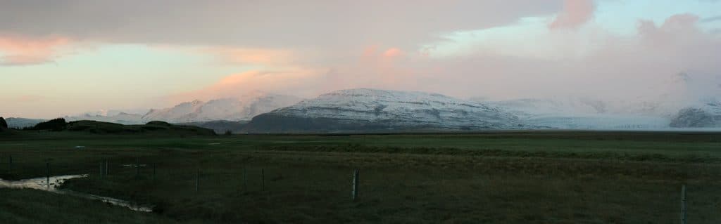
This is a quieter, scenery‑packed loop on the Skálafell side of Vatnajökull, delivering close, unfolding views of the Skálafellsjökull outlet glacier without stepping onto the ice. The loop is about 5.1 miles total (about 8.2 km; the park lists 8 km), taking most hikers 3–4 hours. Expect undulating terrain over moraine and heath, a few short steeper bits, and some shallow stream crossings. Officially labeled challenging, most hikers find it moderately challenging when dry.
If you want a real on‑foot glacier viewpoint without crowds or technical mountaineering, this loop is a gem. It’s not a manicured stroll—the terrain and weather keep you honest—but the solitude and front‑row glacier views punch well above the effort.
 Parkwolf’s verdictWorth It?
Map & elevation
Plan your hike

The highest, rockiest slopes around here are a summer buffet for grizzly bears.
Vatnajökull Tour Guide
Parkwolf is a GPS audio tour guide for Vatnajökull National Park. As you drive, it chimes in with what’s ahead: hidden gems, upcoming stops, history, geology, and wildlife, right through your car’s speakers.
Recorded for this trailhead
Hjallanes Trailhead and the Skálafellsjökull Glacier View“If you want to get out for a hike with some real solitude, the trailhead you're passing is for the Hjallanes loop.”
Plays as you drive up to this trailhead in the Parkwolf Vatnajökull Tour Guide.
More stories near here in the app
“Fantastic app with many points of information… It’s great to just turn on while you’re driving and it gives you an audio tour of the national Park. We love it!!!!”


Trail guide
The route wanders up the Hjallanes ridge with early looks into Kistugil gorge and interpretive signs that make sense of the glacier‑carved landscape. Higher up, you reach an old 1890s moraine crest with your first big look toward the glacier tongue. The middle section edges toward the lateral moraine with sweeping views over the ice, outwash flats, and a glacial lake. On the way back, a scenic stretch follows the Kolgríma river before the trail slips through low birch scrub to the farm.
Keep an eye out for summer wildflowers, late‑season berries, and birdlife; occasional reindeer wander through this area too. You’ll also pass information boards that help decode the geology and past glacier positions—worth a read.
Footing varies from firm path to loose, unconsolidated moraine, with muddy patches after rain. There are rock‑hop stream crossings and one brief, slightly exposed traverse squeezed between rock and river. Many hikers prefer going counterclockwise for a more dramatic reveal of the glacier, but clockwise works fine.
Start from the Skálafell farm car park by the Jón Eiríksson monument just off Route 1. The loop is signed and generally easy to follow, with a few new stairs/boardwalks near the start and end. Wear waterproof boots and bring layers—weather turns fast here. Trekking poles help on loose moraine and stream rocks. Cell service can be spotty near the glacier; download maps offline and let someone know your plan. Close any gates you pass and stay off glacier ice unless you’re with a certified guide.
Wildlife
 22 sightingsGrey SealMost seen around 5 AMSighting map
 258 sightingsHarbor SealMost seen around 11 AMSighting map
 184 sightingsCaribouMost seen around 7 PMSighting map
 62 sightingsArctic FoxMost seen around 8 PMSighting map
 168 sightingsWhooper SwanMost seen around 5 PMSighting map
 68 sightingsAtlantic PuffinMost seen around 7 PMSighting map
Sighting maps show where each species has been reported across Vatnajökull. Wildlife moves, so no sighting is guaranteed.
Keep exploring
Parkwolf’s Vatnajökull ranking
The audio tour guide for the drive, plus offline maps, trails, and wildlife heatmaps for when the signal drops.