Chitina in Wrangell-St. Elias National Park

Sight · Wrangell-St. Elias National Park

Chitina

Gateway town for tackling the McCarthy Road the right way

Photo: Wikimedia Commons
Type
Sight
Audio stories
2 nearby
  • Restrooms
  • Exhibit
  • Parking
  • Ranger station

Hear the audio tour

Chitina and the Start of the McCarthy Road

Overview

About Chitina

Chitina is the launch point for the McCarthy Road—your rugged, 60‑mile gravel gateway to the historic McCarthy–Kennecott area. It sits at the end of the Edgerton Highway and marks the transition from highway to true backroad adventure, following an old railroad grade toward the Kennecott copper mines.

Why stop

  • Gateway to the McCarthy Road and Kennecott district
  • Summer ranger station with trip-planning help and exhibits

Heads up

  • No gas stations; fuel up before you arrive
  • Very limited cell service and scarce services beyond town
Two reasons: information and last‑minute basics. The summer‑season Chitina Ranger Station helps you size up road conditions, shuttle/parking logistics at the end of the road, and what’s open in McCarthy/Kennecott. In town you’ll also find restrooms and informational waysides, plus a state wayside right at the start of the McCarthy Road with vault toilets and exhibits. A few restaurants and lodging options are seasonal, but do not count on fuel here.
Parkwolf’s verdictWhy Stop Here

Map

Where it is

Loading the Wrangell-St. Elias map
Full map
SightChitina61.51565, -144.44105
Keep this map with you offline in the Parkwolf app

Local know-how

Tips for visiting Chitina

  1. Fuel up in Glennallen, Copper Center, or Kenny Lake—there’s no gas in Chitina.

  2. Stop at the Chitina Ranger Station first for current McCarthy Road info.

  3. Carry a full-size spare, jack, and a tire kit; services are scarce past town.

  4. Download the McCarthy Road audio tour and offline maps before you lose signal.

  5. End-of-road parking is by the Kennicott River footbridge; plan to walk or shuttle.

Plan your stop

Before you go

Best time to visit

Summer is prime. Arrive earlier in the day to sort logistics at the ranger station before starting the drive. Weekdays are a touch quieter at popular pullouts. For photos, morning and late‑day light play nicely on the Copper River and the trestles; midday tends to be harsh. Mosquitoes can be intense from late June into July—pack repellent and headnets.

A park ranger sits on a dash-mounted phone, talking, as Parkwolf’s Tour Guide plays “Army Cutworm Moths: A Grizzly Bear Buffet” on Grand Loop Road below Dunraven Pass in Yellowstone
Parkwolf Tour GuideThe highest, rockiest slopes around here are a summer buffet for grizzly bears.

Wrangell-St. Elias Tour Guide

Your drive to Chitina, narrated.

Parkwolf is a GPS audio tour guide for Wrangell-St. Elias National Park. As you drive, it chimes in with what’s ahead: hidden gems, upcoming stops, history, geology, and wildlife, right through your car’s speakers.

See the Wrangell-St. Elias audio tour

Recorded for this place

Chitina and the Start of the McCarthy Road
Listen
“You're about to reach Chitina, which is the official starting point for the sixty-mile gravel McCarthy Road. Before heading down that road, the smartest stop you can make is the Chitina Ranger Station.”

Plays as you drive up to Chitina in the Parkwolf Wrangell-St. Elias Tour Guide.

More stories near here in the app

  • Chitina River Scenic Vista
  • Copper River's Famous Salmon
  • Bull Moose's Annual Antlers
  • 98 audio storiesacross Wrangell-St. Elias’s roads, triggered by GPS as you drive
  • Wildlife heatmapsfor Grizzly Bear, Moose, Humpback Whale, and 13 more
  • Works offlinemaps, 13 trails, 28 places, and audio download before you lose signal
  • CarPlay readysimple controls built for the drive
★★★★★
“Fantastic app with many points of information… It’s great to just turn on while you’re driving and it gives you an audio tour of the national Park. We love it!!!!”
JMJamesApp Store review
Download Parkwolf on the App StoreGet Parkwolf on Google Play

4.7 from 8,600+ ratings

Guide

More about Chitina

Services & EssentialsRestrooms and interpretive panels are available at the downtown wayside and at the state…
  • Restrooms and interpretive panels are available at the downtown wayside and at the state wayside at Mile 0 of the McCarthy Road.
  • The Chitina Ranger Station (a historic log cabin) operates in summer with exhibits and current info for the McCarthy/Kennecott side of the park.
  • Food and lodging can be available seasonally in Chitina; fuel is not—fill up in Glennallen, Copper Center, or Kenny Lake.
  • Expect very limited cell coverage.
The Road Ahead: What to ExpectThe McCarthy Road is unpaved, narrow, and often washboarded—plan on about 2–3 hours one way.

The McCarthy Road is unpaved, narrow, and often washboarded—plan on about 2–3 hours one way. Carry a good spare and jack; services between Chitina and McCarthy are nearly nonexistent. Notable stops with vault toilets and pullouts include Kuskulana Bridge (around Mile 17) and the Gilahina Trestle wayside (around Mile 29; there’s a short trail—don’t climb the trestle). There are additional signed pullouts and a second state wayside near the far end. At the road’s end, you’ll park by the Kennicott River footbridge; private vehicles don’t continue into McCarthy/Kennecott—walk or take a shuttle from there.

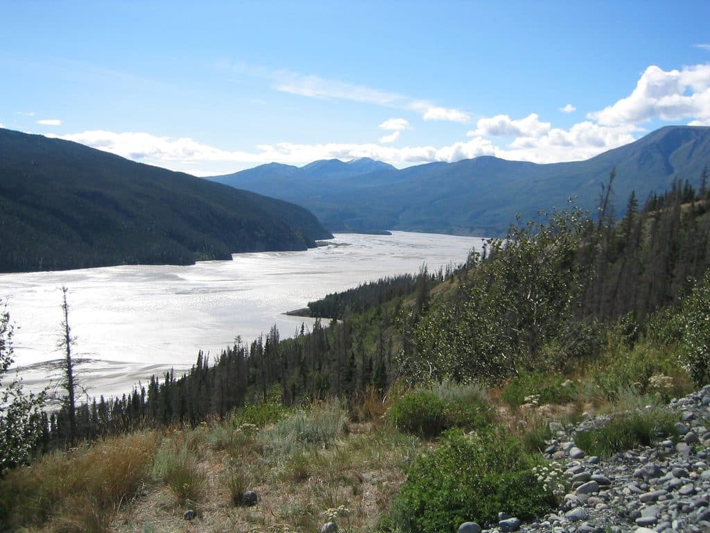
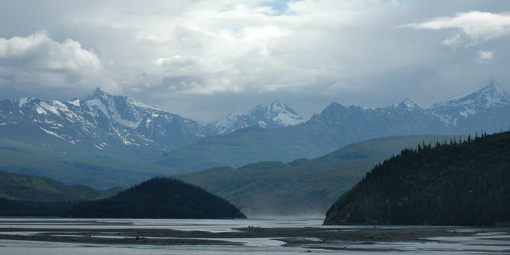
Scenery & WildlifeThis corridor threads big country—broad rivers, forested hillsides, and mountain views.

This corridor threads big country—broad rivers, forested hillsides, and mountain views. Lakes and river corridors in the Chitina/Copper River valleys can host moose, trumpeter swans, loons, and bald eagles. Late summer salmon runs attract bears and eagles—give wildlife a wide berth and never approach.

Tips for a Smooth StartDownload the McCarthy Road audio tour and a detailed map before you lose signal.
  • Download the McCarthy Road audio tour and a detailed map before you lose signal.
  • Drive slowly, stop at pullouts rather than shoulders, and never stop on bridges.
  • Let someone know your itinerary; carry food, water, and a tire repair kit.
Quick History ContextYou’re following the old railbed that once hauled copper ore from the Kennecott mines.

You’re following the old railbed that once hauled copper ore from the Kennecott mines. Today, the same corridor delivers you to one of Alaska’s most compelling historic districts—McCarthy and the Kennecott Mill Town.

Wildlife

Wildlife in Wrangell-St. Elias

All Wrangell-St. Elias wildlife maps

Sighting maps show where each species has been reported across Wrangell-St. Elias. Wildlife moves, so no sighting is guaranteed.

Parkwolf’s Wrangell-St. Elias ranking

Top sights in Wrangell-St. Elias

All 28 places
  1. 1Kennecott Mines National Historic LandmarkSight
  2. 2Root GlacierSight
  3. 3Bagley Ice FieldSight
  4. 4Kennicott GlacierSight
  5. 5Mount St. EliasSight
  6. 6Skolai PassSight

Take Parkwolf to Wrangell-St. Elias.

The audio tour guide for the drive, plus offline maps, trails, and wildlife heatmaps for when the signal drops.

4.7 from 8,600+ ratings

Download Parkwolf on the App StoreGet Parkwolf on Google Play